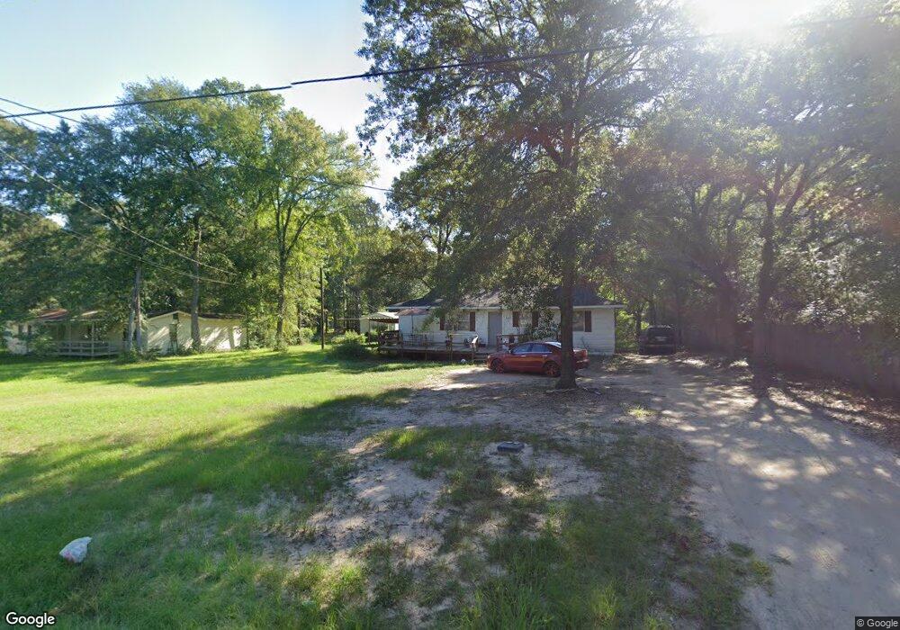
227 Stephenson Brown Rd Lufkin, TX 75904
Estimated Value: $111,891 - $202,000
2
Beds
1
Bath
864
Sq Ft
$165/Sq Ft
Est. Value
About This Home
This home is located at 227 Stephenson Brown Rd, Lufkin, TX 75904 and is currently estimated at $142,723, approximately $165 per square foot. 227 Stephenson Brown Rd is a home located in Angelina County with nearby schools including W.F. Peavy Primary School, W.H. Bonner Elementary School, and Hudson Middle School.
Ownership History
Date
Name
Owned For
Owner Type
Purchase Details
Closed on
Dec 10, 2005
Sold by
Robins Rebecca
Bought by
Jeffrey Kevin
Current Estimated Value
Home Financials for this Owner
Home Financials are based on the most recent Mortgage that was taken out on this home.
Original Mortgage
$24,480
Interest Rate
6.58%
Mortgage Type
Purchase Money Mortgage
Create a Home Valuation Report for This Property
The Home Valuation Report is an in-depth analysis detailing your home's value as well as a comparison with similar homes in the area
Home Values in the Area
Average Home Value in this Area
Purchase History
| Date | Buyer | Sale Price | Title Company |
|---|---|---|---|
| Jeffrey Kevin | $28,560 | None Available |
Source: Public Records
Mortgage History
| Date | Status | Borrower | Loan Amount |
|---|---|---|---|
| Previous Owner | Jeffrey Kevin | $24,480 |
Source: Public Records
Tax History Compared to Growth
Tax History
| Year | Tax Paid | Tax Assessment Tax Assessment Total Assessment is a certain percentage of the fair market value that is determined by local assessors to be the total taxable value of land and additions on the property. | Land | Improvement |
|---|---|---|---|---|
| 2025 | $1,410 | $94,990 | $12,190 | $82,800 |
| 2024 | $1,378 | $92,810 | $12,190 | $80,620 |
| 2023 | $1,357 | $92,490 | $12,190 | $80,300 |
| 2022 | $1,406 | $83,570 | $8,710 | $74,860 |
| 2021 | $1,406 | $76,680 | $8,710 | $67,970 |
| 2020 | $936 | $50,980 | $4,050 | $46,930 |
| 2019 | $940 | $49,500 | $3,930 | $45,570 |
| 2018 | $883 | $48,610 | $3,930 | $44,680 |
| 2017 | $883 | $45,970 | $3,150 | $42,820 |
| 2016 | $869 | $45,260 | $3,150 | $42,110 |
| 2015 | $832 | $37,880 | $3,150 | $34,730 |
| 2014 | $832 | $36,250 | $3,150 | $33,100 |
Source: Public Records
Map
Nearby Homes
- 105,115,116,195 Wilcox Dr
- Lot 2 Bethlehem Rd
- 183 Falcon Ave
- 260 Falcon Ave
- 3335 Bethlehem Rd
- 339 Liles Ln
- 3405 Bethlehem Rd
- 3202 Bethlehem Rd
- 1072 Stephenson Brown Rd
- TBD James Oates Rd
- 0000 Roy Christie Rd
- 895 Foster Rd
- 176 Lancewood Cir
- 885 Foster Rd
- 325 Evans Gann Rd
- 151 Plum Ridge
- 151 Lancewood Cir
- 179 Westfield Loop
- 185 Sandalwood St
- 4136 Bethlehem Rd
- 229 Stephenson Brown Rd
- 200 Stephenson Brown Rd
- 253 Stephenson Brown Rd
- 139 Stephenson Brown Rd
- 139 Stephenson Brown Rd
- 1553 S Fm 706
- 1553 S Fm 706
- 132 Stephenson Brown Rd
- 306 Stephenson Brown Rd
- 325 Stephenson Brown Rd
- 00 Farm To Market 706
- 1685 S Fm 706
- 1544 S Fm 706
- 1588 S Fm 706
- 114 Porter Rd
- 1568 S Fm 706
- 177 Tarver Hill Rd
- 1711 Bethlehem Rd
- 1495 S Fm 706
- 154 Porter Rd