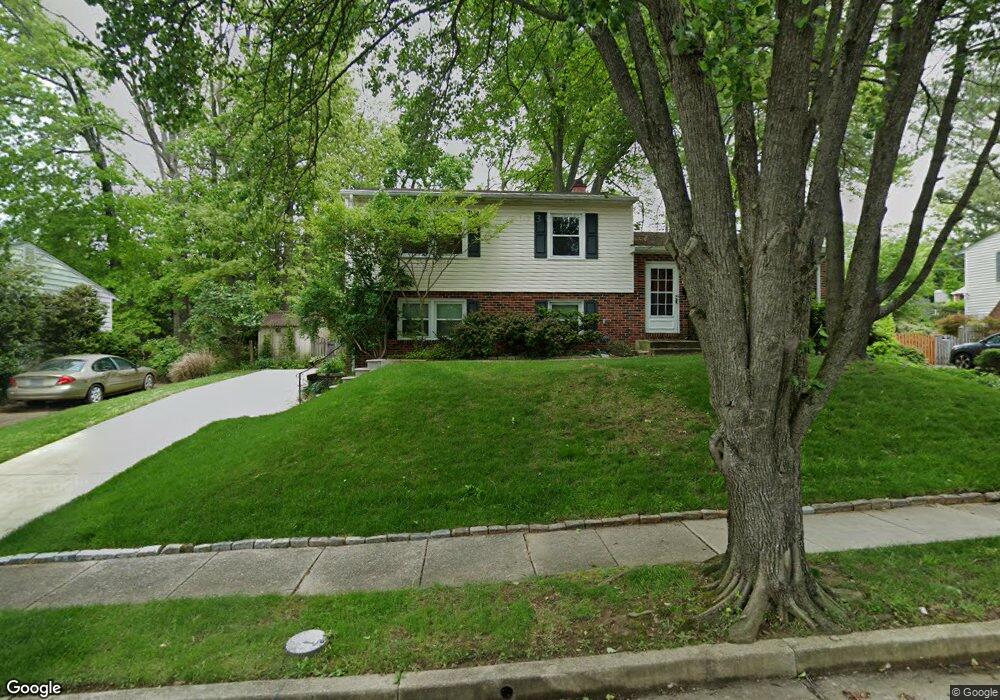
227 Stonewall Rd Catonsville, MD 21228
Estimated Value: $493,181 - $585,000
--
Bed
2
Baths
1,998
Sq Ft
$275/Sq Ft
Est. Value
About This Home
This home is located at 227 Stonewall Rd, Catonsville, MD 21228 and is currently estimated at $548,795, approximately $274 per square foot. 227 Stonewall Rd is a home located in Baltimore County with nearby schools including Westchester Elementary School, Catonsville Middle School, and Catonsville High School.
Ownership History
Date
Name
Owned For
Owner Type
Purchase Details
Closed on
Jul 27, 2023
Sold by
Kinling Susan Ann and Kinling Eric Robert
Bought by
Truffer Kelsey and Truffer Christopher Mark
Current Estimated Value
Home Financials for this Owner
Home Financials are based on the most recent Mortgage that was taken out on this home.
Original Mortgage
$455,993
Outstanding Balance
$441,588
Interest Rate
5%
Mortgage Type
New Conventional
Estimated Equity
$107,207
Purchase Details
Closed on
Sep 22, 1986
Sold by
Wattles Robert B
Bought by
Kinling Eric Robert and Kinling Susan Ann
Create a Home Valuation Report for This Property
The Home Valuation Report is an in-depth analysis detailing your home's value as well as a comparison with similar homes in the area
Home Values in the Area
Average Home Value in this Area
Purchase History
| Date | Buyer | Sale Price | Title Company |
|---|---|---|---|
| Truffer Kelsey | $410,000 | Lakeside Title | |
| Kinling Eric Robert | $104,000 | -- |
Source: Public Records
Mortgage History
| Date | Status | Borrower | Loan Amount |
|---|---|---|---|
| Open | Truffer Kelsey | $455,993 |
Source: Public Records
Tax History Compared to Growth
Tax History
| Year | Tax Paid | Tax Assessment Tax Assessment Total Assessment is a certain percentage of the fair market value that is determined by local assessors to be the total taxable value of land and additions on the property. | Land | Improvement |
|---|---|---|---|---|
| 2025 | $5,098 | $397,833 | -- | -- |
| 2024 | $5,098 | $382,500 | $106,200 | $276,300 |
| 2023 | $2,433 | $364,867 | $0 | $0 |
| 2022 | $4,706 | $347,233 | $0 | $0 |
| 2021 | $4,375 | $329,600 | $106,200 | $223,400 |
| 2020 | $4,375 | $325,100 | $0 | $0 |
| 2019 | $4,267 | $320,600 | $0 | $0 |
| 2018 | $4,176 | $316,100 | $95,700 | $220,400 |
| 2017 | $3,864 | $300,867 | $0 | $0 |
| 2016 | $3,147 | $285,633 | $0 | $0 |
| 2015 | $3,147 | $270,400 | $0 | $0 |
| 2014 | $3,147 | $270,400 | $0 | $0 |
Source: Public Records
Map
Nearby Homes
- 311 Radstock Rd
- 302 Wessling Cir
- 2310 Rockwell Ave
- 2305 Rockwell Ave
- 2110 Edmondson Ave
- 231 Gralan Rd
- 2621 Westchester Ave
- 720 Mary Jo Way
- 19 Clay Lodge Ln Unit 104
- 11 Clay Lodge Ln Unit 204
- 627 Meyers Dr
- 627 Meyers Dr Unit PARCEL 108
- 3 Rumford Dr Unit 202
- 2308 Quilting Bee Rd
- 8369 Governor Grayson Way
- 1100 Lisadale Cir Unit 1A
- 8 Seminole Ave
- 2100 Chantilla Rd
- 1300 Rice Ave
- 9794 Blue Ivy Way
- 229 Stonewall Rd
- 225 Stonewall Rd
- 218 Radstock Rd
- 216 Radstock Rd
- 220 Radstock Rd
- 301 Stonewall Rd
- 300 Radstock Rd
- 226 Stonewall Rd
- 224 Stonewall Rd
- 228 Stonewall Rd
- 303 Stonewall Rd
- 222 Stonewall Rd
- 300 Stonewall Rd
- 221 Stonewall Rd
- 302 Radstock Rd
- 217 Radstock Rd
- 222 Worthmont Rd
- 211 Radstock Rd
- 220 Stonewall Rd
- 215 Radstock Rd