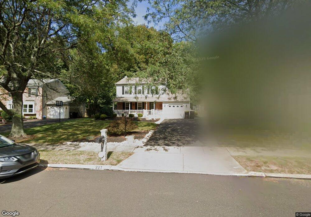
227 Twining Rd Unit 94 Lansdale, PA 19446
Estimated Value: $568,000 - $608,000
3
Beds
2
Baths
1,757
Sq Ft
$335/Sq Ft
Est. Value
About This Home
This home is located at 227 Twining Rd Unit 94, Lansdale, PA 19446 and is currently estimated at $588,535, approximately $334 per square foot. 227 Twining Rd Unit 94 is a home located in Montgomery County with nearby schools including Montgomery Elementary School, Pennbrook Middle School, and North Penn Senior High School.
Ownership History
Date
Name
Owned For
Owner Type
Purchase Details
Closed on
May 3, 2006
Sold by
Angelone Leandro N and Angelone Lisa M
Bought by
Angelone Leandro N and Angelone Lisa M
Current Estimated Value
Home Financials for this Owner
Home Financials are based on the most recent Mortgage that was taken out on this home.
Original Mortgage
$210,000
Outstanding Balance
$121,762
Interest Rate
6.42%
Estimated Equity
$466,773
Purchase Details
Closed on
Nov 3, 1995
Sold by
Urdanick Michael P
Bought by
Angelone Leandro N and Angelone Lisa M
Create a Home Valuation Report for This Property
The Home Valuation Report is an in-depth analysis detailing your home's value as well as a comparison with similar homes in the area
Home Values in the Area
Average Home Value in this Area
Purchase History
| Date | Buyer | Sale Price | Title Company |
|---|---|---|---|
| Angelone Leandro N | -- | None Available | |
| Angelone Leandro N | $163,500 | -- |
Source: Public Records
Mortgage History
| Date | Status | Borrower | Loan Amount |
|---|---|---|---|
| Open | Angelone Leandro N | $210,000 |
Source: Public Records
Tax History Compared to Growth
Tax History
| Year | Tax Paid | Tax Assessment Tax Assessment Total Assessment is a certain percentage of the fair market value that is determined by local assessors to be the total taxable value of land and additions on the property. | Land | Improvement |
|---|---|---|---|---|
| 2025 | $5,927 | $158,860 | -- | -- |
| 2024 | $5,927 | $158,860 | -- | -- |
| 2023 | $5,654 | $158,860 | $0 | $0 |
| 2022 | $5,455 | $158,860 | $0 | $0 |
| 2021 | $5,129 | $158,860 | $0 | $0 |
| 2020 | $4,994 | $158,860 | $0 | $0 |
| 2019 | $4,901 | $158,860 | $0 | $0 |
| 2018 | $848 | $158,860 | $0 | $0 |
| 2017 | $4,691 | $158,860 | $0 | $0 |
| 2016 | $4,629 | $158,860 | $0 | $0 |
| 2015 | $4,421 | $158,860 | $0 | $0 |
| 2014 | $4,421 | $158,860 | $0 | $0 |
Source: Public Records
Map
Nearby Homes
- 111 Hampton Cir
- 201 Beacon Ct
- 301 Essex Ct
- 103 August Ln
- 151 Canterbury Ln
- 403 Reagans Ln
- 263 Foxhedge Rd
- 261 Foxhedge Rd
- 259 Foxhedge Rd
- 708 Ascot Ct
- 456 Regans Ln
- 332 Foxtail Ln
- 437 Reagans Ln
- 458 Reagans Ln
- 442 Reagans Ln
- 435 Reagans Ln
- 431 Reagans Ln
- 428 Reagans Ln
- 21 Meadow Glen Rd
- 434 Reagans Ln
- 225 Twining Rd
- 229 Twining Rd
- 231 Twining Rd
- 223 Twining Rd
- 220 Twining Rd
- 221 Twining Rd
- 214 Twining Rd
- 233 Twining Rd
- 222 Twining Rd
- 219 Twining Rd
- 212 Twining Rd
- 103 Arrowhead Cir
- 235 Twining Rd
- 102 Arrowhead Cir
- 217 Twining Rd
- 230 Twining Rd
- 210 Twining Rd
- 237 Twining Rd
- 105 Arrowhead Cir
- 215 Twining Rd