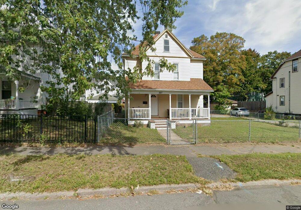
227 W Franklin St Holyoke, MA 01040
Estimated Value: $205,000 - $262,068
3
Beds
2
Baths
1,472
Sq Ft
$162/Sq Ft
Est. Value
About This Home
This home is located at 227 W Franklin St, Holyoke, MA 01040 and is currently estimated at $238,267, approximately $161 per square foot. 227 W Franklin St is a home located in Hampden County with nearby schools including Lt. Elmer J. McMahon Elementary School, H.B. Lawrence Elementary School, and Holyoke High School.
Ownership History
Date
Name
Owned For
Owner Type
Purchase Details
Closed on
Feb 22, 2016
Sold by
Vega Jannette and Pares Pedro A
Bought by
Vega Jannette
Current Estimated Value
Purchase Details
Closed on
Jun 25, 2001
Sold by
Federico Patricia A and Colton Brian J
Bought by
Pares Pedro A
Home Financials for this Owner
Home Financials are based on the most recent Mortgage that was taken out on this home.
Original Mortgage
$65,467
Interest Rate
7.09%
Mortgage Type
Purchase Money Mortgage
Create a Home Valuation Report for This Property
The Home Valuation Report is an in-depth analysis detailing your home's value as well as a comparison with similar homes in the area
Home Values in the Area
Average Home Value in this Area
Purchase History
| Date | Buyer | Sale Price | Title Company |
|---|---|---|---|
| Vega Jannette | -- | -- | |
| Pares Pedro A | $66,000 | -- |
Source: Public Records
Mortgage History
| Date | Status | Borrower | Loan Amount |
|---|---|---|---|
| Previous Owner | Pares Pedro A | $7,349 | |
| Previous Owner | Pares Pedro A | $65,467 | |
| Closed | Pares Pedro A | $2,500 |
Source: Public Records
Tax History Compared to Growth
Tax History
| Year | Tax Paid | Tax Assessment Tax Assessment Total Assessment is a certain percentage of the fair market value that is determined by local assessors to be the total taxable value of land and additions on the property. | Land | Improvement |
|---|---|---|---|---|
| 2025 | $3,321 | $190,200 | $41,700 | $148,500 |
| 2024 | $3,015 | $159,100 | $39,500 | $119,600 |
| 2023 | $2,887 | $153,900 | $39,500 | $114,400 |
| 2022 | $2,766 | $143,600 | $39,500 | $104,100 |
| 2021 | $2,590 | $134,400 | $35,900 | $98,500 |
| 2020 | $2,458 | $128,800 | $35,900 | $92,900 |
| 2019 | $2,274 | $117,900 | $30,200 | $87,700 |
| 2018 | $2,167 | $113,300 | $30,200 | $83,100 |
| 2017 | $2,172 | $113,300 | $30,200 | $83,100 |
| 2016 | $2,143 | $112,100 | $30,200 | $81,900 |
| 2015 | $2,134 | $112,100 | $30,200 | $81,900 |
Source: Public Records
Map
Nearby Homes
- 201 Locust St
- 301-303 Linden St
- 268-270 Sargeant St
- 329 Beech St
- 15 Chapman Ave
- 309 Walnut St
- 12 Saint James Ave
- 1678 Northampton St
- 1705-1707 Northampton St
- 3 Park View Terrace Unit 3
- 69 Gates St
- 1793 Northampton St
- 104 Saint James Ave
- 223 Elm St
- 1421 Dwight St
- 215 Elm St
- 78 Calumet Rd
- 0 High St
- 352 Maple St Unit R
- 146 Beech St
- 231 W Franklin St
- 223 W Franklin St
- 94 Sycamore St
- 213 Locust St
- 219 W Franklin St Unit 221
- 92 Sycamore St
- 226 W Franklin St
- 209 Locust St
- 230 W Franklin St
- 222 W Franklin St
- 88 Sycamore St
- 101 Sycamore St
- 218 W Franklin St
- 205 Locust St
- 95 Sycamore St
- 234 W Franklin St
- 118 Sycamore St
- 93 Sycamore St
- 215 W Franklin St
- 237 Locust St