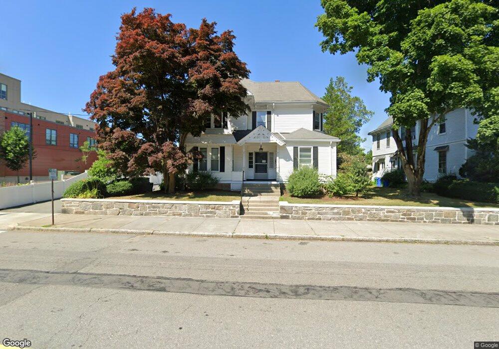
227 Walnut St Unit 3 Newtonville, MA 02460
Newtonville NeighborhoodEstimated Value: $1,638,000 - $1,968,000
3
Beds
2
Baths
1,700
Sq Ft
$1,047/Sq Ft
Est. Value
About This Home
This home is located at 227 Walnut St Unit 3, Newtonville, MA 02460 and is currently estimated at $1,779,812, approximately $1,046 per square foot. 227 Walnut St Unit 3 is a home located in Middlesex County with nearby schools including Horace Mann Elementary School, F.A. Day Middle School, and Newton North High School.
Ownership History
Date
Name
Owned For
Owner Type
Purchase Details
Closed on
Mar 30, 1987
Sold by
Faber Realty Tr
Bought by
P & K Realty Tr
Current Estimated Value
Home Financials for this Owner
Home Financials are based on the most recent Mortgage that was taken out on this home.
Original Mortgage
$282,800
Interest Rate
9.03%
Mortgage Type
Purchase Money Mortgage
Create a Home Valuation Report for This Property
The Home Valuation Report is an in-depth analysis detailing your home's value as well as a comparison with similar homes in the area
Home Values in the Area
Average Home Value in this Area
Purchase History
| Date | Buyer | Sale Price | Title Company |
|---|---|---|---|
| P & K Realty Tr | $353,500 | -- |
Source: Public Records
Mortgage History
| Date | Status | Borrower | Loan Amount |
|---|---|---|---|
| Open | P & K Realty Tr | $336,000 | |
| Closed | P & K Realty Tr | $282,800 |
Source: Public Records
Tax History Compared to Growth
Tax History
| Year | Tax Paid | Tax Assessment Tax Assessment Total Assessment is a certain percentage of the fair market value that is determined by local assessors to be the total taxable value of land and additions on the property. | Land | Improvement |
|---|---|---|---|---|
| 2025 | $12,339 | $1,259,100 | $703,900 | $555,200 |
| 2024 | $11,931 | $1,222,400 | $683,400 | $539,000 |
| 2023 | $11,542 | $1,133,800 | $545,900 | $587,900 |
| 2022 | $11,044 | $1,049,800 | $505,500 | $544,300 |
| 2021 | $10,363 | $963,100 | $463,800 | $499,300 |
| 2020 | $10,055 | $963,100 | $463,800 | $499,300 |
| 2019 | $9,406 | $900,100 | $433,500 | $466,600 |
| 2018 | $9,610 | $888,200 | $405,200 | $483,000 |
| 2017 | $9,062 | $814,900 | $371,700 | $443,200 |
| 2016 | $8,508 | $747,600 | $341,000 | $406,600 |
| 2015 | $8,112 | $698,700 | $318,700 | $380,000 |
Source: Public Records
Map
Nearby Homes
- 168 Walnut St
- 911 Washington St
- 935 Washington St Unit 8
- 935 Washington St (Rear Facing) Unit 11
- 32-34 Rossmere St
- 77 Court St Unit 205
- 957 Washington St Unit 1
- 43 Walker St
- 611 Watertown St Unit 14
- 22 Walnut Place Unit 1
- 354 Linwood Ave Unit 1
- 42-44 Judkins St
- 57 Walnut St
- 48 Harvard St Unit 1
- 10 Washington Park
- 10 Washington Park Unit 2
- 10 Washington Park Unit 1
- 321 Albemarle Rd
- 300 Cabot St
- 123-125 Mount Vernon St
- 227 Walnut St
- 227 Walnut St
- 227 Walnut St Unit 1
- 221 Walnut St
- 221 Walnut St Unit 2
- 241 Walnut St
- 239 Walnut St Unit 1A
- 239 Walnut St
- 14 Foster St Unit 16
- 6 Walnut Terrace
- 209 Walnut St
- 20 Foster St
- 20 Foster St Unit 2
- 230 Walnut St Unit 28
- 230 Walnut St Unit 31B
- 230 Walnut St Unit 27
- 230 Walnut St Unit 24
- 230 Walnut St Unit 40
- 230 Walnut St Unit 1
- 230 Walnut St Unit 4B