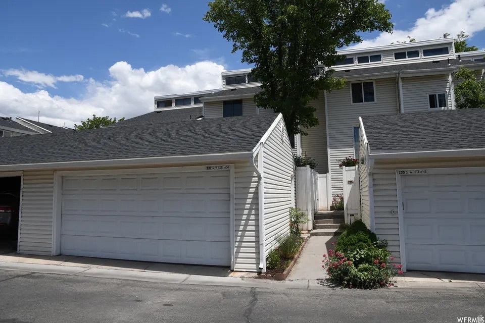

227 West Ln Provo, UT 84601
Lakeview NeighborhoodEstimated payment $2,554/month
Highlights
- Popular Property
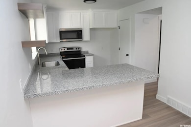
- Updated Kitchen
- Mountain View
- In Ground Pool
- Fruit Trees
- Secluded Lot
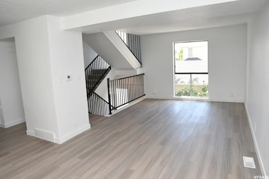
About This Home
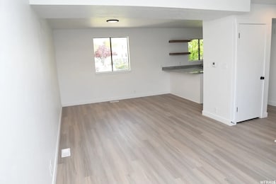
Updated townhouse featuring a rentable basement apartment/ADU with separate entrance, conveniently located in the center of Provo city, close to freeway access, schools, and parks. Vaulted ceilings and plenty of natural light throughout, making it a comfortable and cozy home.
Listing Agent
Chorkei (KK) Davis
Presidio Real Estate (South Valley) License #11108824 Listed on: 12/08/2025
Townhouse Details
Home Type
- Townhome
Est. Annual Taxes
- $1,511
Year Built
- Built in 1975
Lot Details
- 2,178 Sq Ft Lot
- Property is Fully Fenced
- Landscaped
- Fruit Trees
HOA Fees
- $225 Monthly HOA Fees
Parking
- 2 Car Garage
- 1 Open Parking Space
Interior Spaces
- 2,139 Sq Ft Home
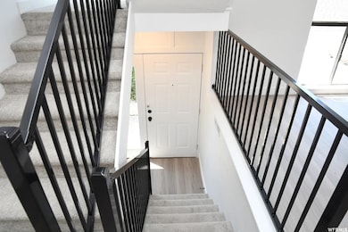
- 3-Story Property
- Vaulted Ceiling
- Shades
- Blinds
- French Doors
- Carpet
- Mountain Views
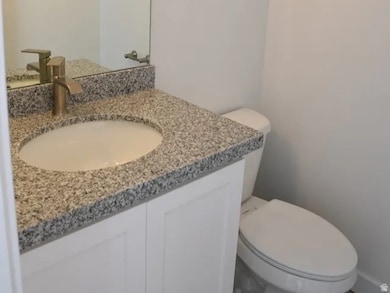
Kitchen
- Updated Kitchen
- Free-Standing Range
- Granite Countertops
- Disposal
Bedrooms and Bathrooms
- 4 Bedrooms
Basement
- Basement Fills Entire Space Under The House
- Exterior Basement Entry
Outdoor Features
- In Ground Pool
- Porch
Additional Homes
- Accessory Dwelling Unit (ADU)
Schools
- Sunset View Elementary School
- Dixon Middle School
- Provo High School
Utilities
- Forced Air Heating and Cooling System
- Natural Gas Connected
- Sewer Paid
Listing and Financial Details
- Assessor Parcel Number 55-011-0007
Community Details
Overview
- Association fees include cable TV, insurance, sewer, trash, water
- Pmi Utah Association
- Westbridge Subdivision
Recreation
- Community Pool
- Snow Removal
Map
Home Values in the Area
Average Home Value in this Area
Tax History
| Year | Tax Paid | Tax Assessment Tax Assessment Total Assessment is a certain percentage of the fair market value that is determined by local assessors to be the total taxable value of land and additions on the property. | Land | Improvement |
|---|---|---|---|---|
| 2025 | $2,064 | $200,585 | $53,600 | $311,100 |
| 2024 | $2,064 | $203,170 | $0 | $0 |
| 2023 | $1,963 | $190,465 | $0 | $0 |
| 2022 | $1,510 | $147,785 | $0 | $0 |
| 2021 | $1,184 | $202,000 | $30,300 | $171,700 |
| 2020 | $1,263 | $202,000 | $26,300 | $175,700 |
| 2019 | $1,214 | $202,000 | $26,300 | $175,700 |
| 2018 | $1,093 | $184,500 | $24,000 | $160,500 |
| 2017 | $951 | $88,220 | $0 | $0 |
| 2016 | $896 | $77,440 | $0 | $0 |
| 2015 | $771 | $67,320 | $0 | $0 |
| 2014 | $652 | $59,345 | $0 | $0 |
Property History
| Date | Event | Price | List to Sale | Price per Sq Ft |
|---|---|---|---|---|
| 12/08/2025 12/08/25 | For Sale | $420,000 | -- | $196 / Sq Ft |
Purchase History
| Date | Type | Sale Price | Title Company |
|---|---|---|---|
| Warranty Deed | -- | Prospect Title | |
| Special Warranty Deed | -- | Gt Title Services | |
| Warranty Deed | -- | Gt Title Services |
Mortgage History
| Date | Status | Loan Amount | Loan Type |
|---|---|---|---|
| Open | $201,000 | New Conventional |
Source: UtahRealEstate.com
MLS Number: 2126065
APN: 55-011-0007
Disclaimer: Certain information contained herein is derived from information provided by parties other than Homes.com. All information provided is deemed reliable, but is not guaranteed to be accurate and should be independently verified.
![]() IDX information is provided exclusively for consumers’ personal, non-commercial use, that it may not be used for any purpose other than to identify prospective properties consumers may be interested in purchasing, and that the data is deemed reliable but is not guaranteed accurate by the MLS. Licensor is only providing the MLS Content and not other sources of data provided in the Product.
IDX information is provided exclusively for consumers’ personal, non-commercial use, that it may not be used for any purpose other than to identify prospective properties consumers may be interested in purchasing, and that the data is deemed reliable but is not guaranteed accurate by the MLS. Licensor is only providing the MLS Content and not other sources of data provided in the Product.
Based on information from the Wasatch Front Regional Multiple Listing Service, Inc.. All data, including all measurements and calculations of area, is obtained from various sources and has not been, and will not be, verified by broker or the MLS. All information should be independently reviewed and verified for accuracy. Properties may or may not be listed by the office/agent presenting the information.
- 154 N 2560 W
- 398 N 2380 W
- 201 N Geneva Rd Unit 3
- 2727 W 220 N
- 2216 W 480 N
- 2316 W 510 N
- 582 N 2310 W
- 386 S 2390 W
- 255 N 1600 W Unit 148
- 255 N 1600 W Unit 52
- 255 N 1600 W Unit 84
- 255 N 1600 W Unit 108
- 1744 W 150 N
- 1828 W 170 S
- 312 S 1920 W
- 273 S 1860 W
- 147 S 1680 W
- 927 Independence Ave
- 249 West Ln Unit 10
- 2075 W 1080 N
- 3056 W 1010 N
- 1287 Reese Dr
- 1214 W 500 N
- 915 N 500 W Unit 24
- 1003 W 500 S
- 1344 N 3500 W
- 810 N 600 W Unit Basement Apartment
- 750 S 650 W
- 556 W 800 N Unit Spacious Condo in Provo
- 1245 Riverside Ave Unit 37
- 1710 Hickory Ln
- 480 N Freedom Blvd
- 538 N Freedom Blvd
- 423 W 1640 S Unit ID1249907P
- 1851 S Columbia Ln
- 61 W 400 S
- 77 W 500 S
- 255 S University Ave
- 63 E Center St
- 502 W 1720 N Unit 502 west 1720 north