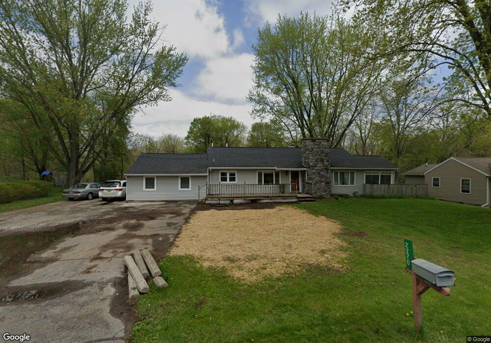
2270 Curtis Rd Adrian, MI 49221
Estimated Value: $251,138 - $316,000
3
Beds
3
Baths
1,792
Sq Ft
$153/Sq Ft
Est. Value
About This Home
This home is located at 2270 Curtis Rd, Adrian, MI 49221 and is currently estimated at $273,535, approximately $152 per square foot. 2270 Curtis Rd is a home located in Lenawee County with nearby schools including Adrian High School, St. Joseph Academy, and St. Joseph's Academy.
Ownership History
Date
Name
Owned For
Owner Type
Purchase Details
Closed on
Mar 16, 2010
Sold by
Saunders Shaun
Bought by
Saunders Shaun and Saunders Tiffany A
Current Estimated Value
Home Financials for this Owner
Home Financials are based on the most recent Mortgage that was taken out on this home.
Original Mortgage
$107,400
Outstanding Balance
$34,126
Interest Rate
4.96%
Mortgage Type
New Conventional
Estimated Equity
$239,409
Purchase Details
Closed on
Jan 31, 2002
Bought by
Saunders Shaun and Saunders Tiffany A
Create a Home Valuation Report for This Property
The Home Valuation Report is an in-depth analysis detailing your home's value as well as a comparison with similar homes in the area
Home Values in the Area
Average Home Value in this Area
Purchase History
| Date | Buyer | Sale Price | Title Company |
|---|---|---|---|
| Saunders Shaun | -- | None Available | |
| Saunders Shaun | $140,000 | -- |
Source: Public Records
Mortgage History
| Date | Status | Borrower | Loan Amount |
|---|---|---|---|
| Open | Saunders Shaun | $107,400 |
Source: Public Records
Tax History
| Year | Tax Paid | Tax Assessment Tax Assessment Total Assessment is a certain percentage of the fair market value that is determined by local assessors to be the total taxable value of land and additions on the property. | Land | Improvement |
|---|---|---|---|---|
| 2025 | $2,420 | $125,500 | $0 | $0 |
| 2024 | $15 | $125,000 | $0 | $0 |
| 2022 | $1,377 | $99,400 | $0 | $0 |
| 2021 | $2,212 | $87,800 | $0 | $0 |
| 2020 | $2,416 | $80,800 | $0 | $0 |
| 2019 | $207,120 | $73,700 | $0 | $0 |
| 2018 | $2,137 | $73,697 | $0 | $0 |
| 2017 | $2,059 | $71,257 | $0 | $0 |
| 2016 | $2,044 | $68,861 | $0 | $0 |
| 2014 | -- | $69,522 | $0 | $0 |
Source: Public Records
Map
Nearby Homes
- 2550 Bent Oak Ave
- 2658 Spielman Heights Dr
- 2697 Spielman Rd
- 3264 N Adrian Hwy
- 4587 N Adrian Hwy
- 1012 Saw Mill Ct
- 1014 Saw Mill Ct
- 1016 Saw Mill Ct
- 1001 Saw Mill Ct
- 1003 Saw Mill Ct
- 1005 Saw Mill Ct
- 1018 Saw Mill Ct
- 1007 Saw Mill Ct
- 371 Riverside Ave
- 453 Riverside Ave
- 547 Riverside Ave
- 710 Lakeshire Trail Unit 201E
- 1826 Oak Leaf Dr
- 770 Lakeshire Trail Unit 201 West
- 310 E Siena Heights Dr
- 2266 Curtis Rd
- 2252 Curtis Rd
- 2287 Curtis Rd
- 2327 Curtis Rd
- 2352 Curtis Rd
- 2357 Curtis Rd
- 2376 Curtis Rd
- 2383 Curtis Rd
- 2397 Curtis Rd
- 2413 Curtis Rd
- 2745 Bent Oak Ave
- 2420 Curtis Rd
- 2420 Curtis Rd Unit CURTIS
- 2419 Curtis Rd
- 2425 Curtis Rd
- 2428 Curtis Rd
- 2172 Curtis Rd
- 2434 Curtis Rd
- 2435 Curtis Rd
- 2445 Curtis Rd