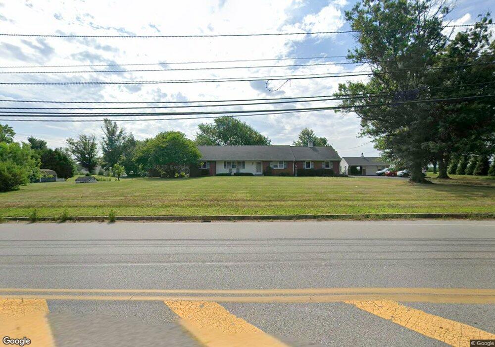
2270 S Valley Forge Rd Lansdale, PA 19446
Estimated Value: $670,000 - $736,000
4
Beds
3
Baths
3,034
Sq Ft
$232/Sq Ft
Est. Value
About This Home
This home is located at 2270 S Valley Forge Rd, Lansdale, PA 19446 and is currently estimated at $704,144, approximately $232 per square foot. 2270 S Valley Forge Rd is a home located in Montgomery County with nearby schools including Worcester Elementary School, Skyview Upper Elementary School, and Arcola Intermediate School.
Ownership History
Date
Name
Owned For
Owner Type
Purchase Details
Closed on
Apr 21, 2020
Sold by
Bonekemper Charlene G
Bought by
Carr John and Carr Leah
Current Estimated Value
Home Financials for this Owner
Home Financials are based on the most recent Mortgage that was taken out on this home.
Original Mortgage
$264,800
Outstanding Balance
$235,022
Interest Rate
3.5%
Mortgage Type
New Conventional
Estimated Equity
$469,122
Purchase Details
Closed on
Aug 25, 1983
Bought by
Bonekemper Arthur K and Bonekemper Charlene G
Create a Home Valuation Report for This Property
The Home Valuation Report is an in-depth analysis detailing your home's value as well as a comparison with similar homes in the area
Home Values in the Area
Average Home Value in this Area
Purchase History
| Date | Buyer | Sale Price | Title Company |
|---|---|---|---|
| Carr John | $331,000 | First American Title | |
| Bonekemper Arthur K | $125,000 | -- |
Source: Public Records
Mortgage History
| Date | Status | Borrower | Loan Amount |
|---|---|---|---|
| Open | Carr John | $264,800 |
Source: Public Records
Tax History Compared to Growth
Tax History
| Year | Tax Paid | Tax Assessment Tax Assessment Total Assessment is a certain percentage of the fair market value that is determined by local assessors to be the total taxable value of land and additions on the property. | Land | Improvement |
|---|---|---|---|---|
| 2025 | $7,846 | $207,130 | $66,130 | $141,000 |
| 2024 | $7,846 | $207,130 | $66,130 | $141,000 |
| 2023 | $7,525 | $207,130 | $66,130 | $141,000 |
| 2022 | $7,380 | $207,130 | $66,130 | $141,000 |
| 2021 | $7,234 | $207,130 | $66,130 | $141,000 |
| 2020 | $7,100 | $207,130 | $66,130 | $141,000 |
| 2019 | $7,030 | $207,130 | $66,130 | $141,000 |
| 2018 | $807 | $207,130 | $66,130 | $141,000 |
| 2017 | $6,761 | $207,130 | $66,130 | $141,000 |
| 2016 | $6,679 | $207,130 | $66,130 | $141,000 |
| 2015 | $6,442 | $207,130 | $66,130 | $141,000 |
| 2014 | $6,442 | $207,130 | $66,130 | $141,000 |
Source: Public Records
Map
Nearby Homes
- 1939 Penngrove Terrace
- 2806 Morris Rd
- 937 General Nash Dr
- 2203 Weber Rd
- 1825 Flintlock Cir
- 210 Berwick Place Unit 20E
- 4 Anglesey
- 1653 Bridle Path Dr
- 1625 Clearbrook Rd
- 1116 Dogwood Ct
- 803 Poplar Ct
- 2725 Skippack Pike
- 1401 Oak Cir
- 641 Jones Ave
- 643 Jones Ave
- 1811 Hollow Rd
- 645 Jones Ave
- 984 Independence Ln Unit 13
- 3180 Zacharias Rd
- 1716 Landis Rd
- 2264 S Valley Forge Rd
- 3000 Stuart Way
- 2950 Morris Rd
- 3001 Stuart Way
- 3002 Stuart Way
- 3041 Pawlings Ford Rd
- 3037 Pawlings Ford Rd
- 2040 Ryans Run
- 2042 Ryans Run
- 2038 Ryans Run
- 3039 Pawlings Ford Rd
- 2044 Ryans Run
- 2046 Ryans Run
- 3005 Stuart Way
- 3035 Pawlings Ford Rd
- 2039 Ryans Run
- 3008 Morris Rd
- 2037 Ryans Run
- 2035 Ryans Run
- 1978 Penngrove Terrace