Estimated Value: $293,000 - $425,046
3
Beds
2
Baths
768
Sq Ft
$466/Sq Ft
Est. Value
About This Home
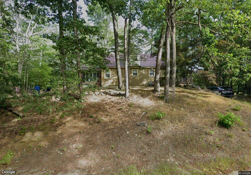
This home is located at 2271 Acton Ridge Rd, Acton, ME 04001 and is currently estimated at $358,012, approximately $466 per square foot. 2271 Acton Ridge Rd is a home located in York County with nearby schools including Acton Elementary School.
Ownership History
Date
Name
Owned For
Owner Type
Purchase Details
Closed on
Jul 8, 2005
Sold by
Potvin Lucien R
Bought by
Macpherson Wendy G
Current Estimated Value
Home Financials for this Owner
Home Financials are based on the most recent Mortgage that was taken out on this home.
Original Mortgage
$106,550
Outstanding Balance
$55,091
Interest Rate
5.71%
Mortgage Type
Commercial
Estimated Equity
$302,921
Create a Home Valuation Report for This Property
The Home Valuation Report is an in-depth analysis detailing your home's value as well as a comparison with similar homes in the area
Home Values in the Area
Average Home Value in this Area
Purchase History
| Date | Buyer | Sale Price | Title Company |
|---|---|---|---|
| Macpherson Wendy G | $159,900 | -- |
Source: Public Records
Mortgage History
| Date | Status | Borrower | Loan Amount |
|---|---|---|---|
| Open | Macpherson Wendy G | $106,550 | |
| Closed | Macpherson Wendy G | $8,066 |
Source: Public Records
Tax History Compared to Growth
Tax History
| Year | Tax Paid | Tax Assessment Tax Assessment Total Assessment is a certain percentage of the fair market value that is determined by local assessors to be the total taxable value of land and additions on the property. | Land | Improvement |
|---|---|---|---|---|
| 2024 | $1,579 | $223,330 | $101,280 | $122,050 |
| 2023 | $1,440 | $223,330 | $101,280 | $122,050 |
| 2022 | $1,524 | $127,560 | $48,096 | $79,464 |
| 2021 | $1,524 | $127,560 | $48,096 | $79,464 |
| 2020 | $3,210 | $127,560 | $48,096 | $79,464 |
| 2019 | $1,537 | $127,560 | $48,096 | $79,464 |
| 2018 | $1,537 | $127,560 | $48,096 | $79,464 |
| 2017 | $3,112 | $127,560 | $48,096 | $79,464 |
| 2016 | $1,435 | $127,560 | $48,096 | $79,464 |
| 2015 | $1,473 | $127,560 | $48,096 | $79,464 |
| 2014 | $1,416 | $127,560 | $48,096 | $79,464 |
Source: Public Records
Map
Nearby Homes
- 57 Green Bay Rd
- 253 Asbury Ln
- 204 Acton Ridge Rd Unit 204
- 1618 Acton Ridge Rd
- 0 Island Dr
- TBD Mann Rd
- 367 Shady Nook Rd
- Lot #021 Abbott Rd
- 0 Whitehouse Rd
- 284 Abbott Rd
- 347 Anderson Cove Rd
- 112 Gile Rd
- Parcel #1 Sanborn Rd
- 271 Red Gate Ln
- 163 Buzzell Rd
- 97 Daniel Dr
- 510 Balch Mill Rd
- 0 Monique Dr Unit 5047887
- 322 Concord Ln
- 281 Gile Rd
- 7 Lakewood Dr
- 30 Lakewood Dr
- 14 Lakewood Dr
- 4 Lakewood Dr
- 40 Lakewood Dr
- 2307 Acton Ridge Rd
- 68 Lakewood Dr
- 2309 Acton Ridge Rd
- 74 Lakewood Dr
- 23 E H Davis Dr
- 43 Eh Davis Rd
- 50 E H Davis Dr
- 2 Beachview Terrace
- 31 Eh Davis Rd
- 23 Eh Davis Rd
- 2176 Acton Ridge Rd
- 26 Beachview Terra Terrace
- 26 Beachview Terrace
- Lot 35 Beachview Terrace
- 58 Eh Davis Rd