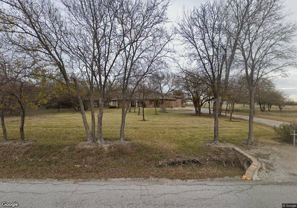
2271 County Road 4522 Justin, TX 76247
Estimated Value: $442,000 - $1,031,000
--
Bed
1
Bath
2,429
Sq Ft
$280/Sq Ft
Est. Value
About This Home
This home is located at 2271 County Road 4522, Justin, TX 76247 and is currently estimated at $680,342, approximately $280 per square foot. 2271 County Road 4522 is a home with nearby schools including Decatur High School.
Ownership History
Date
Name
Owned For
Owner Type
Purchase Details
Closed on
Feb 11, 2013
Sold by
Ramos Michael and Ramos Diane
Bought by
Gray Dearl and Gray Joyce
Current Estimated Value
Purchase Details
Closed on
Feb 1, 2013
Sold by
Compass Bank
Bought by
Gray Dearl and Gray Joyce
Purchase Details
Closed on
Dec 7, 2010
Sold by
Wise Co Properties Lp
Bought by
Gray Dearl and Gray Joyce
Purchase Details
Closed on
Jun 8, 2005
Sold by
Rote Kyle
Bought by
Gray Dearl and Gray Joyce
Purchase Details
Closed on
Mar 23, 2005
Sold by
Nakiomi Inc
Bought by
Gray Dearl and Gray Joyce
Purchase Details
Closed on
Jun 11, 1986
Bought by
Gray Dearl and Gray Joyce
Create a Home Valuation Report for This Property
The Home Valuation Report is an in-depth analysis detailing your home's value as well as a comparison with similar homes in the area
Home Values in the Area
Average Home Value in this Area
Purchase History
| Date | Buyer | Sale Price | Title Company |
|---|---|---|---|
| Gray Dearl | -- | -- | |
| Gray Dearl | -- | None Available | |
| Gray Dearl | -- | -- | |
| Gray Dearl | -- | -- | |
| Gray Dearl | -- | -- | |
| Gray Dearl | -- | -- |
Source: Public Records
Tax History Compared to Growth
Tax History
| Year | Tax Paid | Tax Assessment Tax Assessment Total Assessment is a certain percentage of the fair market value that is determined by local assessors to be the total taxable value of land and additions on the property. | Land | Improvement |
|---|---|---|---|---|
| 2025 | $2,792 | $560,845 | $114,000 | $446,845 |
| 2024 | $2,792 | $516,960 | $0 | $0 |
| 2023 | $5,678 | $469,964 | $0 | $0 |
| 2022 | $6,556 | $427,240 | $0 | $0 |
| 2021 | $6,226 | $388,400 | $60,640 | $327,760 |
| 2020 | $5,855 | $362,930 | $53,040 | $309,890 |
| 2019 | $6,105 | $355,270 | $53,040 | $302,230 |
| 2018 | $6,079 | $342,490 | $43,460 | $299,030 |
| 2017 | $5,557 | $313,060 | $33,880 | $279,180 |
| 2016 | $3,729 | $309,260 | $30,080 | $279,180 |
| 2015 | -- | $139,110 | $24,830 | $114,280 |
| 2014 | -- | $19,380 | $19,380 | $0 |
Source: Public Records
Map
Nearby Homes
- 6270 High Mesa Dr
- 5926 High Mesa Dr
- 1746 County Road 4522
- 1421 County Road 4530
- 5345 Moncrief Rd
- 160 Quail Run Ct
- n/a N A
- 1495 County Road 4530
- 709 County Road 4530
- 705 County Road 4530
- 112 Emma Ct
- 117 Emma Ct
- 2600 Judge Ln
- 729 Kincannon Ln
- TBD County Road 4511
- 13508 Deussen Rd
- 16509 Japanese Maple Dr
- 16817 Purpurea Rd
- 2801 Half Moon Way
- 928 Alberta Spruce Rd
- 2289 County Road 4522
- 514 Claremont Dr
- 2616 Roaming Trail
- 1030 Moss Grove Trail
- 1027 Moss Grove Trail
- 1009 Moss Grove Trail
- 2508 Roaming Trail
- 1025 Moss Grove Trail
- 1037 Moss Grove Trail
- 1036 Moss Grove Trail
- 9304 Bluestem Ln
- 205 Onyx Dr
- 403 Eaton Dr
- 405 Eaton Dr
- 307 Laruel Dr
- 309 Laruel Dr
- 1035 Moss Grove Trail
- 1021 Moss Grove Trail
- 509 Claremont Dr
- 407 Eaton Dr