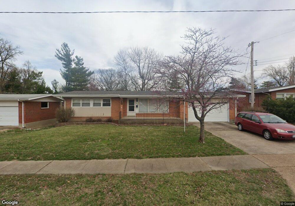
2272 Kenosho Ave Saint Louis, MO 63114
Estimated Value: $186,000 - $208,000
3
Beds
2
Baths
1,092
Sq Ft
$180/Sq Ft
Est. Value
About This Home
This home is located at 2272 Kenosho Ave, Saint Louis, MO 63114 and is currently estimated at $196,741, approximately $180 per square foot. 2272 Kenosho Ave is a home located in St. Louis County with nearby schools including Wyland Elementary School, Ritenour Middle School, and Ritenour Senior High School.
Ownership History
Date
Name
Owned For
Owner Type
Purchase Details
Closed on
Sep 12, 2018
Sold by
Ruby Joseph H
Bought by
Ruby Joseph H and Joseph H Ruby Jr Revocable Trust
Current Estimated Value
Purchase Details
Closed on
May 22, 2002
Sold by
Mulick Gordon L and Mulick Elaine A
Bought by
Ruby Elizabeth Joan and Ruby Joseph H
Purchase Details
Closed on
Sep 27, 2000
Sold by
Mulick Gordon L and Mulick Elaine A
Bought by
Fletcher Joyce E and Silvey Kelle E
Create a Home Valuation Report for This Property
The Home Valuation Report is an in-depth analysis detailing your home's value as well as a comparison with similar homes in the area
Home Values in the Area
Average Home Value in this Area
Purchase History
| Date | Buyer | Sale Price | Title Company |
|---|---|---|---|
| Ruby Joseph H | -- | None Available | |
| Ruby Elizabeth Joan | $100,000 | -- | |
| Fletcher Joyce E | -- | -- |
Source: Public Records
Tax History Compared to Growth
Tax History
| Year | Tax Paid | Tax Assessment Tax Assessment Total Assessment is a certain percentage of the fair market value that is determined by local assessors to be the total taxable value of land and additions on the property. | Land | Improvement |
|---|---|---|---|---|
| 2025 | $2,752 | $37,400 | $6,160 | $31,240 |
| 2024 | $2,752 | $32,230 | $3,290 | $28,940 |
| 2023 | $2,691 | $32,230 | $3,290 | $28,940 |
| 2022 | $2,527 | $26,540 | $2,870 | $23,670 |
| 2021 | $2,526 | $26,540 | $2,870 | $23,670 |
| 2020 | $2,466 | $23,900 | $4,030 | $19,870 |
| 2019 | $2,442 | $23,900 | $4,030 | $19,870 |
| 2018 | $2,138 | $18,810 | $2,890 | $15,920 |
| 2017 | $2,039 | $18,810 | $2,890 | $15,920 |
| 2016 | $1,796 | $16,860 | $2,890 | $13,970 |
| 2015 | $1,837 | $16,860 | $2,890 | $13,970 |
| 2014 | $1,914 | $17,880 | $2,760 | $15,120 |
Source: Public Records
Map
Nearby Homes
- 29 W Sherwood Dr
- 2325 Goodale Ave
- 2424 Gothland Ave
- 2475 Hartland Ave
- 1947 Brown Rd
- 8822 Olden Ave
- 1910 Leondale Ave
- 2327 Gaebler Ave
- 2414 Gilrose Ave
- 8431 Midland Blvd
- 2223 Burns Ave
- 8476 Lackland Rd
- 2435 Ackerman Ave
- 8637 Olden Ave
- 8920 Burton Ave
- 8425 Ann Ave
- 9417 Romaine Ave
- 9430 Ridge Ave
- 9515 Cote Brilliante Ave
- 9446 Miriam Ave
- 2268 Kenosho Ave
- 47 W Sherwood Dr
- 2289 Kenosho Ave
- 2300 Kenosho Ave
- 2262 Kenosho Ave
- 53 W Sherwood Dr
- 2285 Kenosho Ave
- 41 W Sherwood Dr
- 8890 Oneida Ln
- 2304 Kenosho Ave
- 2256 Kenosho Ave
- 2301 Kenosho Ave
- 2281 Kenosho Ave
- 59 W Sherwood Dr
- 8887 Oneida Ln
- 8894 Oneida Ln
- 35 W Sherwood Dr
- 2308 Kenosho Ave
- 2252 Kenosho Ave
- 2255 Kenosho Ave