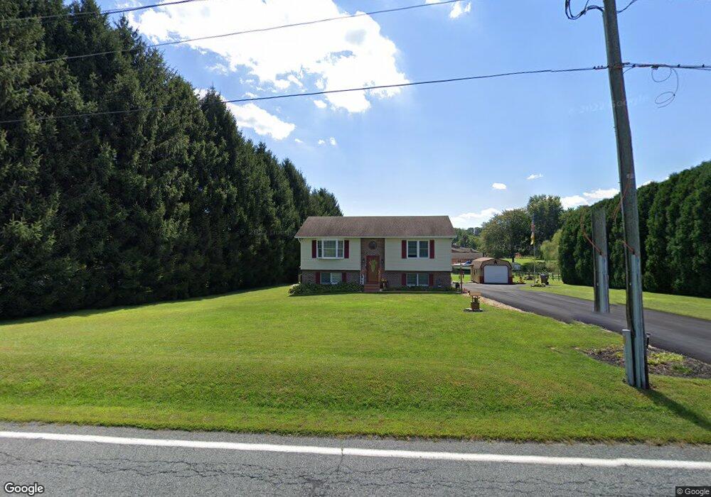
2272 Liberty Grove Rd Colora, MD 21917
Estimated Value: $238,000 - $345,000
--
Bed
1
Bath
944
Sq Ft
$312/Sq Ft
Est. Value
About This Home
This home is located at 2272 Liberty Grove Rd, Colora, MD 21917 and is currently estimated at $294,502, approximately $311 per square foot. 2272 Liberty Grove Rd is a home located in Cecil County with nearby schools including Rising Sun Elementary School, Rising Sun Middle School, and Rising Sun High School.
Ownership History
Date
Name
Owned For
Owner Type
Purchase Details
Closed on
Jan 17, 1992
Sold by
Riley Jeffrey W and Riley Jackqueline
Bought by
Hale Jerry Layne and Brenda Ann
Current Estimated Value
Home Financials for this Owner
Home Financials are based on the most recent Mortgage that was taken out on this home.
Original Mortgage
$93,150
Interest Rate
8.45%
Purchase Details
Closed on
Dec 12, 1986
Sold by
Harrington Hale
Bought by
Riley Jeffrey W
Home Financials for this Owner
Home Financials are based on the most recent Mortgage that was taken out on this home.
Original Mortgage
$12,900
Interest Rate
9.35%
Create a Home Valuation Report for This Property
The Home Valuation Report is an in-depth analysis detailing your home's value as well as a comparison with similar homes in the area
Home Values in the Area
Average Home Value in this Area
Purchase History
| Date | Buyer | Sale Price | Title Company |
|---|---|---|---|
| Hale Jerry Layne | $92,000 | -- | |
| Riley Jeffrey W | $14,900 | -- |
Source: Public Records
Mortgage History
| Date | Status | Borrower | Loan Amount |
|---|---|---|---|
| Closed | Hale Jerry Layne | $93,150 | |
| Previous Owner | Riley Jeffrey W | $12,900 |
Source: Public Records
Tax History Compared to Growth
Tax History
| Year | Tax Paid | Tax Assessment Tax Assessment Total Assessment is a certain percentage of the fair market value that is determined by local assessors to be the total taxable value of land and additions on the property. | Land | Improvement |
|---|---|---|---|---|
| 2025 | $2,215 | $198,700 | $80,500 | $118,200 |
| 2024 | $1,782 | $190,767 | $0 | $0 |
| 2023 | $1,370 | $182,833 | $0 | $0 |
| 2022 | $2,030 | $174,900 | $80,500 | $94,400 |
| 2021 | $1,989 | $174,267 | $0 | $0 |
| 2020 | $2,063 | $173,633 | $0 | $0 |
| 2019 | $2,055 | $173,000 | $80,500 | $92,500 |
| 2018 | $2,026 | $170,467 | $0 | $0 |
| 2017 | $1,997 | $167,933 | $0 | $0 |
| 2016 | $1,884 | $165,400 | $0 | $0 |
| 2015 | $1,884 | $165,400 | $0 | $0 |
| 2014 | $1,782 | $165,400 | $0 | $0 |
Source: Public Records
Map
Nearby Homes
- 0 Colora Rd
- 12 Thruway Dr
- 127 Barnes Corner Rd
- 1741 Liberty Grove Rd
- 192 Barnes Corner Rd
- 21 Country Ln
- 1668 Colora Rd
- 1964 Conowingo Rd
- 1718 Jacob Tome Memorial Hwy
- TBD Pine Needle Ct
- 152 Hopewell Rd
- Sussex Plan at Liberty Grove
- Danville II Plan at Liberty Grove
- Brandywine Plan at Liberty Grove
- Rehoboth Plan at Liberty Grove
- Jefferson Plan at Liberty Grove
- Frankford Plan at Liberty Grove
- Roosevelt Plan at Liberty Grove
- Nottingham Plan at Liberty Grove
- Salem Plan at Liberty Grove
- 2286 Liberty Grove Rd
- 2262 Liberty Grove Rd
- 321 Liddell Rd
- 337 Liddell Rd
- TBD Liberty Grove Rd
- 2258 Liberty Grove Rd
- 2234 Liberty Grove Rd
- 305 Liddell Rd
- 2325 Liberty Grove Rd
- 11 Piccadilly Ct
- 291 Liddell Rd
- Sterling Nesbitt Ct
- 2250 Liberty Grove Rd
- 25 Piccadilly Ct
- 39 Sterling Nesbitt Ct
- 12 Sweet Potato Ln
- 33 Piccadilly Ct
- 31 Sterling Nesbitt Ct
- 24 Piccadilly Ct
- 30 Sweet Potato Ln