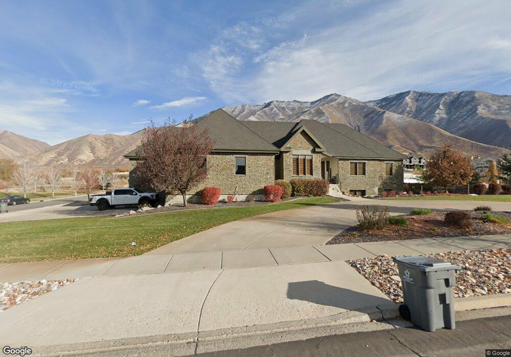
2273 S Lookout Ridge Dr Mapleton, UT 84664
Estimated Value: $1,381,000 - $1,559,767
6
Beds
6
Baths
5,561
Sq Ft
$264/Sq Ft
Est. Value
About This Home
This home is located at 2273 S Lookout Ridge Dr, Mapleton, UT 84664 and is currently estimated at $1,470,384, approximately $264 per square foot. 2273 S Lookout Ridge Dr is a home located in Utah County with nearby schools including Maple Ridge Elementary, Mapleton Junior High School, and Maple Mountain High School.
Ownership History
Date
Name
Owned For
Owner Type
Purchase Details
Closed on
Jan 7, 2011
Sold by
Younica Edward G
Bought by
Dye Corey J and Dye Nadine K
Current Estimated Value
Home Financials for this Owner
Home Financials are based on the most recent Mortgage that was taken out on this home.
Original Mortgage
$279,000
Interest Rate
3.25%
Mortgage Type
Adjustable Rate Mortgage/ARM
Purchase Details
Closed on
Sep 20, 2010
Sold by
Younica Edward G and Younica Allaire H
Bought by
Younica Edward G
Purchase Details
Closed on
Jan 15, 2008
Sold by
Younica Edward G and Younica Allaire
Bought by
Younica Edward G and Younica Allaire H
Home Financials for this Owner
Home Financials are based on the most recent Mortgage that was taken out on this home.
Original Mortgage
$910,000
Interest Rate
5.5%
Mortgage Type
New Conventional
Create a Home Valuation Report for This Property
The Home Valuation Report is an in-depth analysis detailing your home's value as well as a comparison with similar homes in the area
Home Values in the Area
Average Home Value in this Area
Purchase History
| Date | Buyer | Sale Price | Title Company |
|---|---|---|---|
| Dye Corey J | -- | Backman | |
| Younica Edward G | -- | None Available | |
| Younica Edward G | -- | First American |
Source: Public Records
Mortgage History
| Date | Status | Borrower | Loan Amount |
|---|---|---|---|
| Previous Owner | Dye Corey J | $279,000 | |
| Previous Owner | Younica Edward G | $910,000 |
Source: Public Records
Tax History
| Year | Tax Paid | Tax Assessment Tax Assessment Total Assessment is a certain percentage of the fair market value that is determined by local assessors to be the total taxable value of land and additions on the property. | Land | Improvement |
|---|---|---|---|---|
| 2025 | $6,544 | $729,635 | -- | -- |
| 2024 | $6,544 | $641,105 | $0 | $0 |
| 2023 | $6,486 | $639,400 | $0 | $0 |
| 2022 | $7,124 | $1,259,500 | $543,200 | $716,300 |
| 2021 | $5,971 | $891,100 | $340,100 | $551,000 |
| 2020 | $5,869 | $847,400 | $317,600 | $529,800 |
| 2019 | $5,185 | $764,000 | $267,600 | $496,400 |
| 2018 | $5,327 | $747,600 | $267,100 | $480,500 |
| 2017 | $4,912 | $366,650 | $0 | $0 |
| 2016 | $4,328 | $321,130 | $0 | $0 |
| 2015 | $4,294 | $316,730 | $0 | $0 |
| 2014 | $3,701 | $268,105 | $0 | $0 |
Source: Public Records
Map
Nearby Homes
- 525 N 1550 W Unit COLUMB
- 525 N 1550 W Unit WINDSO
- 525 N 1550 W Unit HILDAL
- 3713 S White Ash Dr
- 525 N 1550 W Unit BALLAR
- 525 N 1550 W Unit CALDWE
- 525 N 1550 W Unit DREXEL
- 525 N 1550 W Unit MORGAN
- 525 N 1550 W Unit WAKEFI
- 525 N 1550 W Unit ARDEN
- 3958 S Sage Wood Ave Unit CHAMBE
- 1060 W 2620 S
- 4695 S 690 W Unit U204
- 675 W 4500 S Unit P303
- 2057 E Maple Hills Ln
- 675 W 4500 S Unit P101
- 4695 S 690 W Unit U102
- 550 N 2000 E
- 675 W 4500 S Unit P203
- 675 W 4500 S Unit P301
- 684 W Lookout Point Dr
- 657 W Lookout Point Dr
- 2302 S Lookout Ridge Dr Unit 31
- 684 W Lookout Point Dr
- 1538 Viewpoint Ridge Ave
- 1526 Viewpoint Ridge Ave
- 2347 S Lookout Ridge Dr
- 2347 S Lookout Ridge Dr
- 2352 S Lookout Ridge Dr
- 2253 Brush Canyon Dr Unit 22
- 2297 Brush Canyon Dr Unit 21
- 2308 Brush Canyon Dr Unit 12
- 672 W Triple Crown Dr Unit 29
- 2157 Brush Canyon Dr Unit 24
- 2277 S Brush Canyon Dr Unit 24
- 2277 S Brush Canyon Dr
- 652 W Triple Crown Dr
- 742 W Triple Crown Dr Unit 33
- 525 N 1550 W
- 525 N 1550 W Unit 1
Your Personal Tour Guide
Ask me questions while you tour the home.