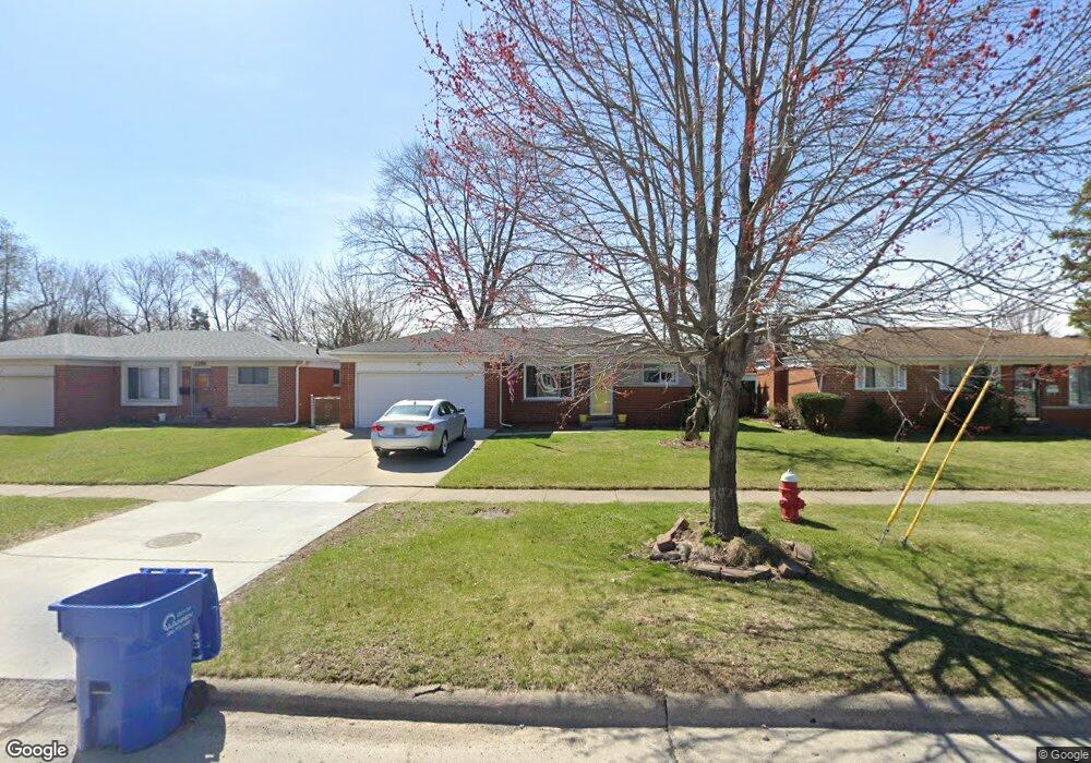
2274 Common Rd Warren, MI 48092
Northwest Warren NeighborhoodEstimated Value: $256,635 - $284,000
3
Beds
2
Baths
1,389
Sq Ft
$199/Sq Ft
Est. Value
About This Home
This home is located at 2274 Common Rd, Warren, MI 48092 and is currently estimated at $276,409, approximately $198 per square foot. 2274 Common Rd is a home located in Macomb County with nearby schools including Lean Elementary School, Beer Middle School, and Warren Mott High School.
Ownership History
Date
Name
Owned For
Owner Type
Purchase Details
Closed on
Jul 15, 2021
Sold by
Tocco Renee S
Bought by
Tocco Renee S and Tocco Anthony Joseph
Current Estimated Value
Home Financials for this Owner
Home Financials are based on the most recent Mortgage that was taken out on this home.
Original Mortgage
$117,000
Outstanding Balance
$88,102
Interest Rate
2.1%
Mortgage Type
New Conventional
Estimated Equity
$188,307
Purchase Details
Closed on
Feb 13, 2004
Sold by
Roncelli Thomas L and Roncelli Helen M
Bought by
Tocco Renee S
Home Financials for this Owner
Home Financials are based on the most recent Mortgage that was taken out on this home.
Original Mortgage
$176,604
Interest Rate
5.77%
Mortgage Type
FHA
Purchase Details
Closed on
Aug 18, 2003
Sold by
Malinski Michael E and Malinski Alma M
Bought by
Roncelli Thomas L and Roncelli Helen M
Create a Home Valuation Report for This Property
The Home Valuation Report is an in-depth analysis detailing your home's value as well as a comparison with similar homes in the area
Home Values in the Area
Average Home Value in this Area
Purchase History
| Date | Buyer | Sale Price | Title Company |
|---|---|---|---|
| Tocco Renee S | -- | Accommodation | |
| Tocco Renee S | $178,000 | Title One Inc | |
| Roncelli Thomas L | $130,600 | Metropolitan Title Company |
Source: Public Records
Mortgage History
| Date | Status | Borrower | Loan Amount |
|---|---|---|---|
| Open | Tocco Renee S | $117,000 | |
| Closed | Tocco Renee S | $176,604 |
Source: Public Records
Tax History
| Year | Tax Paid | Tax Assessment Tax Assessment Total Assessment is a certain percentage of the fair market value that is determined by local assessors to be the total taxable value of land and additions on the property. | Land | Improvement |
|---|---|---|---|---|
| 2025 | $3,259 | $118,950 | $0 | $0 |
| 2024 | $32 | $113,540 | $0 | $0 |
| 2023 | $3,022 | $100,180 | $0 | $0 |
| 2022 | $2,920 | $87,510 | $0 | $0 |
| 2021 | $2,971 | $82,800 | $0 | $0 |
| 2020 | $2,865 | $78,300 | $0 | $0 |
| 2019 | $2,763 | $71,010 | $0 | $0 |
| 2018 | $2,806 | $71,300 | $0 | $0 |
| 2017 | $2,771 | $65,280 | $10,270 | $55,010 |
| 2016 | $2,767 | $65,280 | $0 | $0 |
| 2015 | -- | $58,040 | $0 | $0 |
| 2012 | -- | $48,190 | $0 | $0 |
Source: Public Records
Map
Nearby Homes
- 2052 Roman Ct
- 1714 Moulin Ave
- 1957 Nicholas Ct
- 1705 Moulin Ave
- 1687 Fontaine Ave
- 29713 Mackenzie Cir W
- 30121 Woodhouse Dr
- 1405 Dulong Ave
- 29273 Tessmer Ct Unit 87
- 1812 E Thirteen Mile Rd
- 1886 E 13 Mile Rd
- 30885 Lee Frank Ln
- 30802 Dell Ln
- 2408 Otter St
- 28423 James Dr
- 30469 Winthrop Dr
- 2415 Otter St
- 29147 Milton Ave
- 31227 Dequindre Rd
- 28314 James Dr
- 2286 Common Rd
- 2238 Common Rd
- 2300 Common Rd
- 2222 Common Rd
- 2275 Walter Ave
- 2287 Walter Ave
- 2299 Walter Ave
- 2312 Common Rd
- 29814 Merrick Ave
- 2311 Walter Ave
- 2243 Common Rd
- 2324 Common Rd
- 30021 Paul Ct
- 30010 Paul Ct
- 2205 Common Rd
- 2323 Walter Ave
- 29837 Merrick Ave
- 29823 Merrick Ave
- 30011 Merrick Ave
- 29751 Westbrook Ave
Your Personal Tour Guide
Ask me questions while you tour the home.