
Seller's Agent in 2025
Scott Weaver
CCR Realtors
(937) 321-4740
3 in this area
84 Total Sales
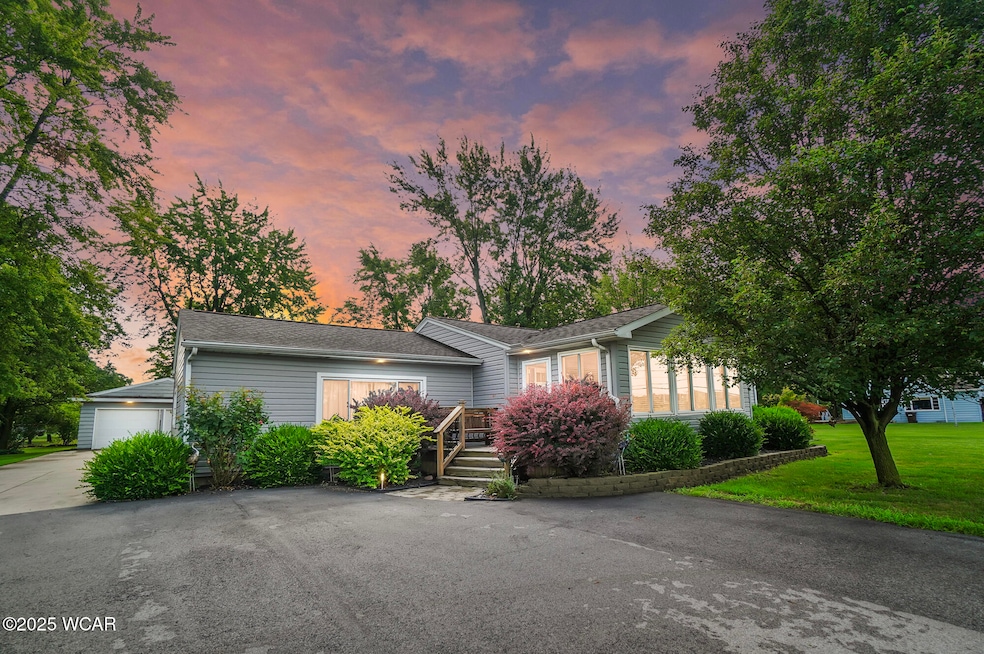
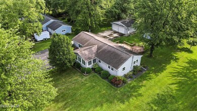
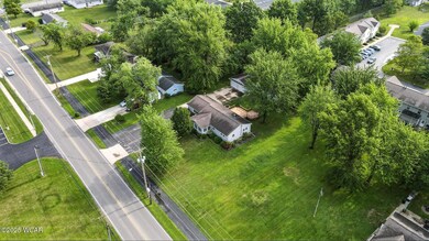
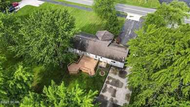
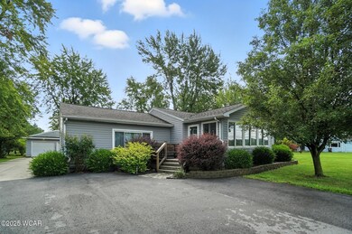
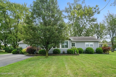
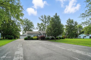
Welcome to your dream ranch retreat in the coveted Elida School District. This beautifully updated 3-bed, 2-bath home spans 1,554 finished square feet on the main level—plus a finished lower level—offering abundant space to live, work, and play.
Step into a bright, open living area where vaulted ceilings and LED accent lighting draw your eye to a striking whitewashed stone fireplace with a gas insert. Gleaming hardwood floors flow seamlessly underfoot as you make your way to the chef's kitchen, complete with custom cabinetry, granite countertops, a generous center island, and a built-in pantry.
Downstairs, discover a versatile entertaining haven. A second kitchen and expansive recreation room invite movie nights, game days, or gatherings with family and friends.
Outside, entertain on the oversized deck overlooking a lush backyard. A detached two-car garage and newer storage shed provide ample room for tools, toys, and projects.
Don't miss your chance to call this impeccably maintained ranch home yours. Schedule your private showing with your favorite local Realtor today and experience modern comfort and style at 2274 N Cole St!
Welcome home!
Rooms are virtually staged.
| Date | Type | Sale Price | Title Company |
|---|---|---|---|
| Deed | $260,000 | None Listed On Document | |
| Quit Claim Deed | -- | None Listed On Document | |
| Deed | $60,000 | -- | |
| Deed | -- | -- |
| Date | Status | Loan Amount | Loan Type |
|---|---|---|---|
| Open | $247,000 | New Conventional | |
| Previous Owner | $45,000 | New Conventional |
| Date | Event | Price | List to Sale | Price per Sq Ft |
|---|---|---|---|---|
| 08/29/2025 08/29/25 | Sold | $260,000 | -1.9% | $167 / Sq Ft |
| 07/31/2025 07/31/25 | Pending | -- | -- | -- |
| 07/30/2025 07/30/25 | For Sale | $265,000 | -- | $171 / Sq Ft |
| Year | Tax Paid | Tax Assessment Tax Assessment Total Assessment is a certain percentage of the fair market value that is determined by local assessors to be the total taxable value of land and additions on the property. | Land | Improvement |
|---|---|---|---|---|
| 2024 | $1,957 | $48,870 | $9,490 | $39,380 |
| 2023 | $1,761 | $39,730 | $7,700 | $32,030 |
| 2022 | $1,792 | $39,730 | $7,700 | $32,030 |
| 2021 | $1,802 | $39,730 | $7,700 | $32,030 |
| 2020 | $1,670 | $34,590 | $7,250 | $27,340 |
| 2019 | $1,670 | $34,590 | $7,250 | $27,340 |
| 2018 | $1,633 | $34,590 | $7,250 | $27,340 |
| 2017 | $1,593 | $34,590 | $7,250 | $27,340 |
| 2016 | $1,591 | $34,590 | $7,250 | $27,340 |
| 2015 | $1,599 | $34,590 | $7,250 | $27,340 |
| 2014 | $1,421 | $29,620 | $7,250 | $22,370 |
| 2013 | $1,378 | $29,620 | $7,250 | $22,370 |
Seller's Agent in 2025
Scott Weaver
CCR Realtors
(937) 321-4740
3 in this area
84 Total Sales
C
Buyer's Agent in 2025
Caley Schafer
Cowan, Realtors
(419) 236-5014
1 in this area
18 Total Sales
Source: West Central Association of REALTORS® (OH)
MLS Number: 307821
APN: 36-24-07-04-009.000
Ask me questions while you tour the home.