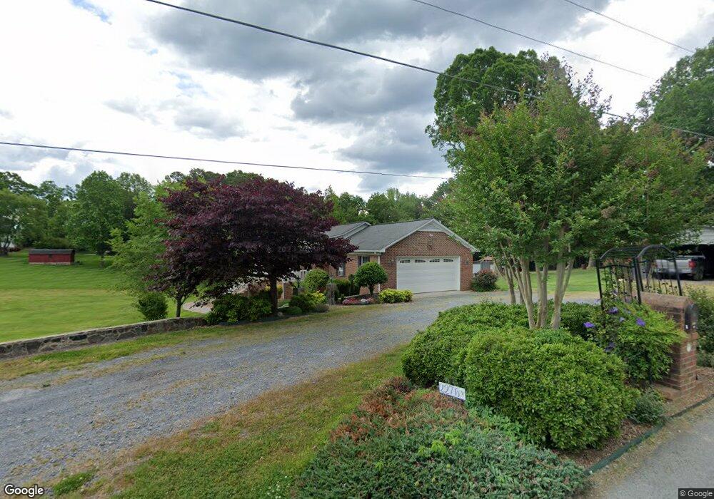
2276 Davidson Rd Asheboro, NC 27205
Estimated Value: $334,548 - $635,000
--
Bed
2
Baths
1,350
Sq Ft
$344/Sq Ft
Est. Value
About This Home
This home is located at 2276 Davidson Rd, Asheboro, NC 27205 and is currently estimated at $463,887, approximately $343 per square foot. 2276 Davidson Rd is a home located in Randolph County with nearby schools including Charles W. McCrary Elementary School, North Asheboro Middle School, and Asheboro High School.
Ownership History
Date
Name
Owned For
Owner Type
Purchase Details
Closed on
May 1, 2012
Sold by
Davidson Stephen J and Davidson Beth S
Bought by
Edwards Jay R and Edwards Susan D
Current Estimated Value
Purchase Details
Closed on
Oct 3, 2011
Sold by
Branson Thomas Hurley and Branson Carrie Moon
Bought by
Edwards Jay R and Edwards Susan D
Home Financials for this Owner
Home Financials are based on the most recent Mortgage that was taken out on this home.
Original Mortgage
$176,000
Interest Rate
4.24%
Mortgage Type
New Conventional
Create a Home Valuation Report for This Property
The Home Valuation Report is an in-depth analysis detailing your home's value as well as a comparison with similar homes in the area
Home Values in the Area
Average Home Value in this Area
Purchase History
| Date | Buyer | Sale Price | Title Company |
|---|---|---|---|
| Edwards Jay R | $5,000 | None Available | |
| Edwards Jay R | $220,000 | None Available |
Source: Public Records
Mortgage History
| Date | Status | Borrower | Loan Amount |
|---|---|---|---|
| Previous Owner | Edwards Jay R | $176,000 |
Source: Public Records
Tax History Compared to Growth
Tax History
| Year | Tax Paid | Tax Assessment Tax Assessment Total Assessment is a certain percentage of the fair market value that is determined by local assessors to be the total taxable value of land and additions on the property. | Land | Improvement |
|---|---|---|---|---|
| 2025 | $2,410 | $310,180 | $43,670 | $266,510 |
| 2024 | $2,379 | $310,180 | $43,670 | $266,510 |
| 2023 | $2,379 | $310,180 | $43,670 | $266,510 |
| 2022 | $2,079 | $223,790 | $31,300 | $192,490 |
| 2021 | $2,079 | $223,790 | $31,300 | $192,490 |
| 2020 | $2,034 | $223,790 | $31,300 | $192,490 |
| 2019 | $2,034 | $223,790 | $31,300 | $192,490 |
| 2018 | $1,969 | $210,810 | $31,300 | $179,510 |
| 2016 | $1,948 | $210,806 | $31,300 | $179,506 |
| 2015 | $1,936 | $210,806 | $31,300 | $179,506 |
| 2014 | -- | $210,806 | $31,300 | $179,506 |
Source: Public Records
Map
Nearby Homes
- 2589 Northmont Lake Dr
- 2004 Northmont Dr
- 2193 Berkley Ln
- 1086 Wilson Dr
- 1475 Fawn Dr
- 1821 Back Creek Ct
- 1847 Saddlewood Ct
- 223 Mclaurin Dr
- 1142 Westover Terrace
- 1025 Neely Dr
- 0 English St
- 1374 W Lake Dr
- 1011 Westmont Dr
- 1582 Westmont Dr
- 1807 Newell St
- 1822 Newell St
- 405 Saunders Dr
- 0 Highwood Dr
- 1273 Cedar Creek Dr
- 2087 Old Lexington Rd
- 2242 Davidson Rd
- 2523 Northmont Dr
- 2257 Davidson Rd
- 2507 Northmont Dr
- 2279 Davidson Rd
- 2551 Northmont Dr
- 2258 Davidson Rd
- 2497 Northmont Dr
- 2204 Davidson Rd
- 2243 Davidson Rd
- 2100 Davidson Rd
- 2093 Davidson Rd
- 2088 Davidson Rd
- 2439 Northmont Dr
- 2285 Country Ln
- 1529 Spero Rd
- 2429 Northmont Dr
- 2192 Davidson Rd
- 2329 Country Ln
- 2560 Northmont Lake Dr