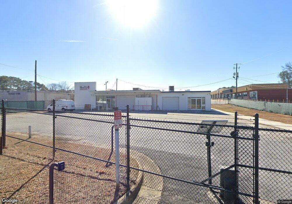
2277 Brannen Rd SE Atlanta, GA 30316
Gresham Park NeighborhoodEstimated Value: $403,394
--
Bed
--
Bath
2,624
Sq Ft
$154/Sq Ft
Est. Value
About This Home
This home is located at 2277 Brannen Rd SE, Atlanta, GA 30316 and is currently estimated at $403,394, approximately $153 per square foot. 2277 Brannen Rd SE is a home located in DeKalb County with nearby schools including Barack H. Obama Elementary Magnet School of Technology, McNair Middle School, and McNair High School.
Ownership History
Date
Name
Owned For
Owner Type
Purchase Details
Closed on
Feb 23, 2021
Sold by
Shell Roosevelt
Bought by
Sargenelli Holdings Llc
Current Estimated Value
Home Financials for this Owner
Home Financials are based on the most recent Mortgage that was taken out on this home.
Original Mortgage
$220,575
Outstanding Balance
$126,824
Interest Rate
2.7%
Mortgage Type
Commercial
Estimated Equity
$276,570
Create a Home Valuation Report for This Property
The Home Valuation Report is an in-depth analysis detailing your home's value as well as a comparison with similar homes in the area
Home Values in the Area
Average Home Value in this Area
Purchase History
| Date | Buyer | Sale Price | Title Company |
|---|---|---|---|
| Sargenelli Holdings Llc | $321,750 | -- |
Source: Public Records
Mortgage History
| Date | Status | Borrower | Loan Amount |
|---|---|---|---|
| Open | Sargenelli Holdings Llc | $220,575 | |
| Closed | Sargenelli Holdings Llc | $176,460 |
Source: Public Records
Tax History Compared to Growth
Tax History
| Year | Tax Paid | Tax Assessment Tax Assessment Total Assessment is a certain percentage of the fair market value that is determined by local assessors to be the total taxable value of land and additions on the property. | Land | Improvement |
|---|---|---|---|---|
| 2024 | $5,475 | $146,320 | $98,760 | $47,560 |
| 2023 | $5,475 | $113,400 | $65,840 | $47,560 |
| 2022 | $5,232 | $113,400 | $65,840 | $47,560 |
| 2021 | $1,784 | $34,840 | $21,920 | $12,920 |
| 2020 | $1,784 | $34,840 | $21,920 | $12,920 |
| 2019 | $1,784 | $34,840 | $21,920 | $12,920 |
| 2018 | $1,797 | $34,840 | $21,920 | $12,920 |
| 2017 | $1,831 | $34,840 | $21,920 | $12,920 |
| 2016 | $1,794 | $34,840 | $21,920 | $12,920 |
| 2014 | $1,832 | $34,840 | $21,920 | $12,920 |
Source: Public Records
Map
Nearby Homes
- 2249 Brannen Rd SE
- 2252 Brannen Rd SE
- 2236 Brannen Rd SE
- 2212 Brannen Rd SE
- 2028 Cook Rd
- 2019 W Flat Shoals Terrace
- 1927 Vicki Ln SE
- 1955 Vicki Ln SE
- 2424 Flat Shoals Rd
- 2041 W Flat Shoals Terrace
- 1625 Flintwood Dr SE
- 1808 Arkose Dr SE
- 1620 Flintwood Dr SE
- 2587 Flat Shoals Rd
- 2099 Rexford Dr
- 1662 Flintwood Dr SE
- 2658 Rollingwood Ln SE
- 2105 Rexford Dr
- 2887 Rockcliff Rd SE
- 2277 Brannen Rd SE Unit 3
- 2519 Gresham Road South E
- 2804 Gresham Rd SE
- 2256 Brannen Rd SE
- 2511 Welland Ave SE
- 2519 Welland Ave SE
- 2525 Welland Ave SE
- 2245 Brannen Rd SE Unit 2245
- 2245 Brannen Rd SE
- 0 Welland Ave SE Unit 7544016
- 0 Welland Ave SE Unit 8105741
- 0 Welland Ave SE Unit 7301837
- 2531 Welland Ave SE
- 2526 Gresham Rd SE
- 2541 Gresham Rd SE
- 2248 Brannen Rd SE
- 2241 Brannen Rd SE
- 2522 Boulder Rd SE
- 2244 Brannen Rd SE
- 2526 Boulder Rd SE