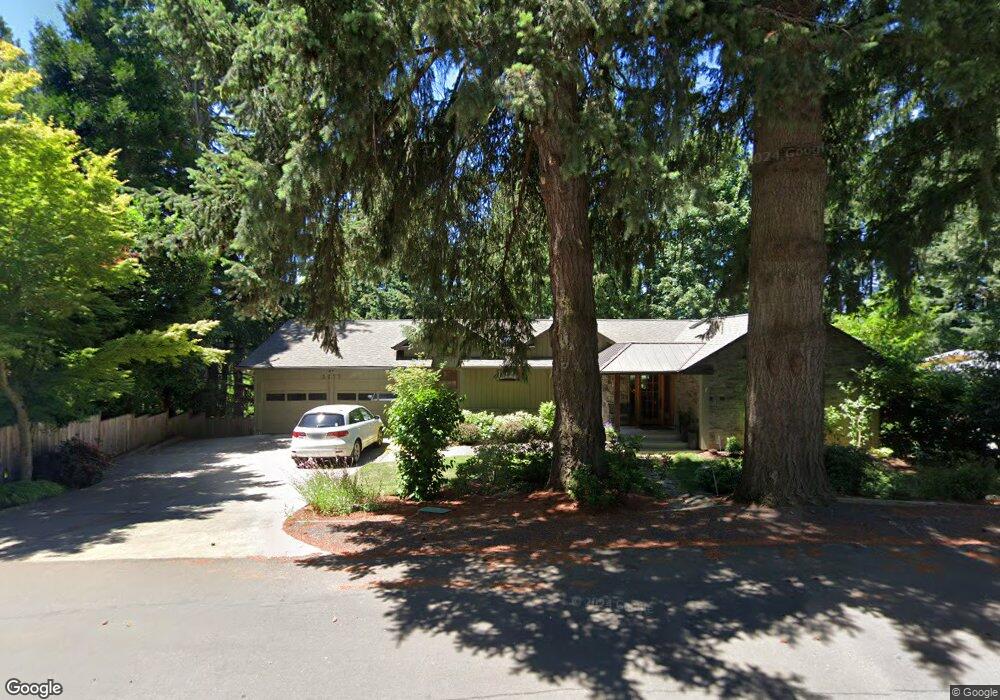
2277 Fernwood Cir Lake Oswego, OR 97034
Palisades NeighborhoodEstimated Value: $1,319,000 - $1,566,000
4
Beds
3
Baths
5,270
Sq Ft
$277/Sq Ft
Est. Value
About This Home
This home is located at 2277 Fernwood Cir, Lake Oswego, OR 97034 and is currently estimated at $1,461,501, approximately $277 per square foot. 2277 Fernwood Cir is a home located in Clackamas County with nearby schools including Westridge Elementary School, Lakeridge Middle School, and Lakeridge High School.
Ownership History
Date
Name
Owned For
Owner Type
Purchase Details
Closed on
Jul 25, 2023
Sold by
Maynes Stewart G
Bought by
Stewart G Maynes 2006 Trust and Marcia B Maynes 2006 Trust
Current Estimated Value
Purchase Details
Closed on
Jun 17, 1996
Sold by
Friar Thomas A and Friar Kitta F
Bought by
Maynes Stewart G and Maynes Marcia B
Home Financials for this Owner
Home Financials are based on the most recent Mortgage that was taken out on this home.
Original Mortgage
$170,800
Interest Rate
8.01%
Mortgage Type
Balloon
Create a Home Valuation Report for This Property
The Home Valuation Report is an in-depth analysis detailing your home's value as well as a comparison with similar homes in the area
Home Values in the Area
Average Home Value in this Area
Purchase History
| Date | Buyer | Sale Price | Title Company |
|---|---|---|---|
| Stewart G Maynes 2006 Trust | -- | None Listed On Document | |
| Maynes Stewart G | $213,500 | Ticor Title Insurance |
Source: Public Records
Mortgage History
| Date | Status | Borrower | Loan Amount |
|---|---|---|---|
| Previous Owner | Maynes Stewart G | $170,800 |
Source: Public Records
Tax History Compared to Growth
Tax History
| Year | Tax Paid | Tax Assessment Tax Assessment Total Assessment is a certain percentage of the fair market value that is determined by local assessors to be the total taxable value of land and additions on the property. | Land | Improvement |
|---|---|---|---|---|
| 2025 | $10,432 | $543,209 | -- | -- |
| 2024 | $10,154 | $527,388 | -- | -- |
| 2023 | $10,154 | $512,028 | $0 | $0 |
| 2022 | $9,563 | $497,115 | $0 | $0 |
| 2021 | $8,833 | $482,636 | $0 | $0 |
| 2020 | $8,611 | $468,579 | $0 | $0 |
| 2019 | $8,399 | $454,932 | $0 | $0 |
| 2018 | $7,987 | $441,682 | $0 | $0 |
| 2017 | $7,707 | $428,817 | $0 | $0 |
| 2016 | $7,016 | $416,327 | $0 | $0 |
| 2015 | $6,779 | $404,201 | $0 | $0 |
| 2014 | $6,691 | $392,428 | $0 | $0 |
Source: Public Records
Map
Nearby Homes
- 2627 Park Rd
- 2255 Glen Haven Rd
- 16878 Canyon Dr
- 1951 Greentree Rd
- 17360 Alpine Way
- 2306 Mayors Ln
- 0 S Shore Blvd
- 1931 Park Forest Ct
- 17901 Hillside Dr
- 17035 Westview Dr
- 1847 Woodland Terrace
- 17677 Westview Dr
- 17958 Saint Clair Dr
- 17447 Blue Heron Rd
- 17210 Cedar Rd
- 1467 Greentree Cir
- 16636 Maple Cir
- 1410 Woodland Terrace
- 2240 Summit Ct
- 17367 Canal Cir
- 2331 Dellwood Dr
- 2375 Dellwood Dr
- 2235 Fernwood Cir
- 2250 Fernwood Cir
- 2280 Fernwood Cir
- 17274 Canyon Dr
- 17278 Canyon Dr
- 2234 Fernwood Cir
- 17270 Canyon Dr
- 2330 Dellwood Dr
- 2300 Fernwood Cir
- 2405 Dellwood Dr
- 2432 Park Rd
- 2215 Fernwood Cir
- 2340 Park Rd
- 2420 Park Rd
- 2380 Dellwood Dr
- 2220 Fernwood Cir
- 2305 Fernwood Cir
- 2420 Fernwood Cir