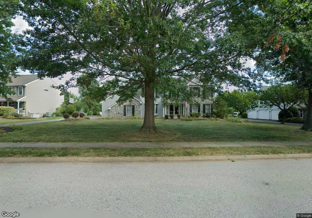
2277 Locust Dr Lansdale, PA 19446
Estimated Value: $743,442 - $828,000
4
Beds
3
Baths
2,772
Sq Ft
$289/Sq Ft
Est. Value
About This Home
This home is located at 2277 Locust Dr, Lansdale, PA 19446 and is currently estimated at $800,611, approximately $288 per square foot. 2277 Locust Dr is a home located in Montgomery County with nearby schools including Worcester Elementary School, Skyview Upper Elementary School, and Arcola Intermediate School.
Ownership History
Date
Name
Owned For
Owner Type
Purchase Details
Closed on
Feb 29, 2008
Sold by
Glass Adriane J and Glass William A
Bought by
Glass Adriane J
Current Estimated Value
Create a Home Valuation Report for This Property
The Home Valuation Report is an in-depth analysis detailing your home's value as well as a comparison with similar homes in the area
Home Values in the Area
Average Home Value in this Area
Purchase History
| Date | Buyer | Sale Price | Title Company |
|---|---|---|---|
| Glass Adriane J | -- | None Available |
Source: Public Records
Tax History Compared to Growth
Tax History
| Year | Tax Paid | Tax Assessment Tax Assessment Total Assessment is a certain percentage of the fair market value that is determined by local assessors to be the total taxable value of land and additions on the property. | Land | Improvement |
|---|---|---|---|---|
| 2025 | $9,200 | $242,880 | $85,910 | $156,970 |
| 2024 | $9,200 | $242,880 | $85,910 | $156,970 |
| 2023 | $8,824 | $242,880 | $85,910 | $156,970 |
| 2022 | $8,653 | $242,880 | $85,910 | $156,970 |
| 2021 | $8,483 | $242,880 | $85,910 | $156,970 |
| 2020 | $8,325 | $242,880 | $85,910 | $156,970 |
| 2019 | $8,244 | $242,880 | $85,910 | $156,970 |
| 2018 | $947 | $242,880 | $85,910 | $156,970 |
| 2017 | $7,927 | $242,880 | $85,910 | $156,970 |
| 2016 | $7,832 | $242,880 | $85,910 | $156,970 |
| 2015 | $7,554 | $242,880 | $85,910 | $156,970 |
| 2014 | $7,554 | $242,880 | $85,910 | $156,970 |
Source: Public Records
Map
Nearby Homes
- 3053 Sunny Ayre Dr
- 1939 Penngrove Terrace
- 2806 Morris Rd
- 2203 Weber Rd
- 937 General Nash Dr
- 1825 Flintlock Cir
- 1019 Anders Rd
- 825 Morris Rd
- 980 Jacks Ln
- 1811 Hollow Rd
- 1653 Bridle Path Dr
- 210 Berwick Place Unit 20E
- 4 Anglesey
- 3180 Zacharias Rd
- 128 Wellington Terrace
- 1625 Clearbrook Rd
- 1716 Landis Rd
- 742 Tranquility Ln
- 2725 Skippack Pike
- 803 Poplar Ct
- 2279 Locust Dr
- 2275 Locust Dr
- 2244 Ayreshire Dr
- 2281 Locust Dr
- 2273 Locust Dr
- 2246 Ayreshire Dr
- 3049 Conrad Way
- 2242 Ayreshire Dr
- 2280 Locust Dr
- 3021 Pawlings Ford Rd
- 3050 Conrad Way
- 2283 Locust Dr
- 2278 Locust Dr
- 2271 Locust Dr
- 2248 Ayreshire Dr
- 2240 Ayreshire Dr
- 3023 Pawlings Ford Rd
- 2269 Locust Dr
- 2238 Ayreshire Dr
- 2284 Locust Dr