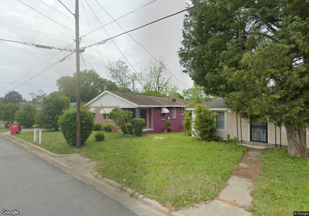
2277 Lowe St Macon, GA 31206
Estimated Value: $80,613 - $146,000
Studio
1
Bath
1,539
Sq Ft
$67/Sq Ft
Est. Value
About This Home
This home is located at 2277 Lowe St, Macon, GA 31206 and is currently estimated at $103,153, approximately $67 per square foot. 2277 Lowe St is a home located in Bibb County with nearby schools including Hartley Elementary School, Southwest High School, and Cirrus Charter Academy.
Ownership History
Date
Name
Owned For
Owner Type
Purchase Details
Closed on
Apr 28, 2005
Sold by
Reid Carl Rufus
Bought by
Lamar Jeannette M
Current Estimated Value
Home Financials for this Owner
Home Financials are based on the most recent Mortgage that was taken out on this home.
Original Mortgage
$25,000
Outstanding Balance
$12,984
Interest Rate
5.98%
Mortgage Type
Unknown
Estimated Equity
$90,169
Purchase Details
Closed on
Mar 14, 2005
Home Financials for this Owner
Home Financials are based on the most recent Mortgage that was taken out on this home.
Original Mortgage
$25,000
Outstanding Balance
$12,984
Interest Rate
5.98%
Mortgage Type
Unknown
Estimated Equity
$90,169
Create a Home Valuation Report for This Property
The Home Valuation Report is an in-depth analysis detailing your home's value as well as a comparison with similar homes in the area
Purchase History
| Date | Buyer | Sale Price | Title Company |
|---|---|---|---|
| Lamar Jeannette M | $55,000 | None Available | |
| -- | -- | -- |
Source: Public Records
Mortgage History
| Date | Status | Borrower | Loan Amount |
|---|---|---|---|
| Open | Lamar Jeannette M | $25,000 |
Source: Public Records
Tax History
| Year | Tax Paid | Tax Assessment Tax Assessment Total Assessment is a certain percentage of the fair market value that is determined by local assessors to be the total taxable value of land and additions on the property. | Land | Improvement |
|---|---|---|---|---|
| 2025 | $609 | $24,772 | $2,400 | $22,372 |
| 2024 | $629 | $24,772 | $2,400 | $22,372 |
| 2023 | $734 | $24,772 | $2,400 | $22,372 |
| 2022 | $605 | $17,476 | $4,128 | $13,348 |
| 2021 | $664 | $17,476 | $4,128 | $13,348 |
| 2020 | $678 | $17,476 | $4,128 | $13,348 |
| 2019 | $901 | $23,008 | $4,128 | $18,880 |
| 2018 | $1,559 | $23,008 | $4,128 | $18,880 |
| 2017 | $886 | $23,642 | $4,128 | $19,514 |
| 2016 | $818 | $23,642 | $4,128 | $19,514 |
| 2015 | $1,158 | $23,642 | $4,128 | $19,514 |
| 2014 | $444 | $23,642 | $4,128 | $19,514 |
Source: Public Records
Map
Nearby Homes
- 1545 Anthony Rd
- 1323 Crawford St
- 2125 Cedar Ave
- 210 Moseley Ave
- 670 Poppy Ave
- 742 Grayson Ave
- 730 Grayson Ave
- 2106 Mason St
- 660 Lilly Ave
- 815 Edwards Ave
- 2445 Adams Ave
- 576 Pansy Ave
- 1144 Carroll St
- 2420 Adams Ave
- 800 Patton Ave
- 2164 Monroe Ave
- 1121 Carroll St
- 284 Grosso Ave
- 736 Key St
- 458 Daffodil St
- 2313 Lowe St
- 2285 Lowe St
- 2325 Lowe St
- 2273 Lowe St
- 2270 Anthony Terrace
- 2260 Anthony Terrace
- 2335 Lowe St
- 2302 Anthony Terrace
- 2252 Anthony Terrace
- 1490 Dent St
- 2286 Lowe St
- 2249 Lowe St
- 2310 Anthony Terrace
- 2242 Anthony Terrace
- 2345 Lowe St
- 2274 Lowe St
- 2340 Lowe St
- 2320 Anthony Terrace
- 2234 Anthony Terrace
- 2251 Lowe St
Your Personal Tour Guide
Ask me questions while you tour the home.