Estimated Value: $560,000 - $712,018
5
Beds
3
Baths
2,035
Sq Ft
$323/Sq Ft
Est. Value
About This Home
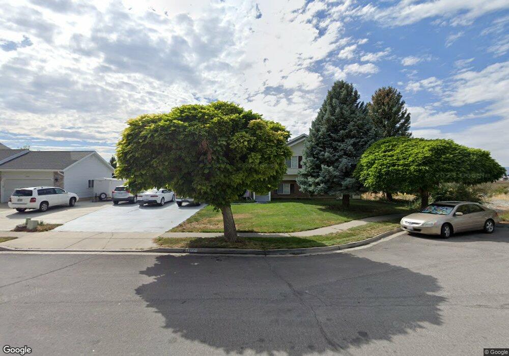
This home is located at 2277 N 850 E, Lehi, UT 84043 and is currently estimated at $657,255, approximately $322 per square foot. 2277 N 850 E is a home located in Utah County with nearby schools including Freedom Elementary School, Lehi Junior High School, and Skyridge High School.
Ownership History
Date
Name
Owned For
Owner Type
Purchase Details
Closed on
Jun 24, 2013
Sold by
Hughes Cal and Hughes Carol
Bought by
Henry Heath M and Henry Angela G
Current Estimated Value
Home Financials for this Owner
Home Financials are based on the most recent Mortgage that was taken out on this home.
Original Mortgage
$220,000
Outstanding Balance
$156,426
Interest Rate
3.48%
Mortgage Type
VA
Estimated Equity
$500,830
Purchase Details
Closed on
Dec 21, 2012
Sold by
Mccoy Mike and Mccoy Karen S
Bought by
Hughes Cal and Hughes Carol
Purchase Details
Closed on
Mar 4, 1998
Sold by
Mortensen Jay Rhett and Mortensen Lisa J
Bought by
Mccoy Mike and Mccoy Karen S
Home Financials for this Owner
Home Financials are based on the most recent Mortgage that was taken out on this home.
Original Mortgage
$149,000
Interest Rate
6.99%
Create a Home Valuation Report for This Property
The Home Valuation Report is an in-depth analysis detailing your home's value as well as a comparison with similar homes in the area
Home Values in the Area
Average Home Value in this Area
Purchase History
| Date | Buyer | Sale Price | Title Company |
|---|---|---|---|
| Henry Heath M | -- | United Title Services | |
| Hughes Cal | -- | United Title Serves | |
| Mccoy Mike | -- | -- |
Source: Public Records
Mortgage History
| Date | Status | Borrower | Loan Amount |
|---|---|---|---|
| Open | Henry Heath M | $220,000 | |
| Previous Owner | Mccoy Mike | $149,000 |
Source: Public Records
Tax History
| Year | Tax Paid | Tax Assessment Tax Assessment Total Assessment is a certain percentage of the fair market value that is determined by local assessors to be the total taxable value of land and additions on the property. | Land | Improvement |
|---|---|---|---|---|
| 2025 | $2,966 | $375,320 | -- | -- |
| 2024 | $2,912 | $347,050 | $0 | $0 |
| 2023 | $1,025 | $369,985 | $0 | $0 |
| 2022 | $2,266 | $421,135 | $0 | $0 |
| 2021 | $1,795 | $584,900 | $128,700 | $456,200 |
| 2020 | $1,622 | $545,600 | $119,200 | $426,400 |
| 2019 | $2,561 | $490,000 | $119,200 | $370,800 |
| 2018 | $298 | $290,600 | $114,100 | $176,500 |
| 2017 | $340 | $149,710 | $0 | $0 |
| 2016 | $101 | $135,685 | $0 | $0 |
| 2015 | $46 | $129,965 | $0 | $0 |
| 2014 | $1,397 | $117,645 | $0 | $0 |
Source: Public Records
Map
Nearby Homes
- 4233 N 325 E Unit 1415
- 975 E 2850 N
- 10365 N 6960 W
- 878 E 3050 N
- 1370 N Cedar Hollow Blvd
- 2139 N Banbury Ct
- 6756 W 10050 N
- 1272 N Cedar Hollow Blvd
- 3239 N 620 E
- 9967 N 6670 W
- 532 E 3270 N
- 3368 N 700 E
- 578 E 3375 N
- 356 W 1850 N Unit 6
- 1602 E Center Pointe Dr
- 1610 E Center Pointe Dr
- 1618 E Center Pointe Dr
- 1329 N 100 E Unit 21
- 497 W 2200 N
- 398 W 2660 N
Your Personal Tour Guide
Ask me questions while you tour the home.