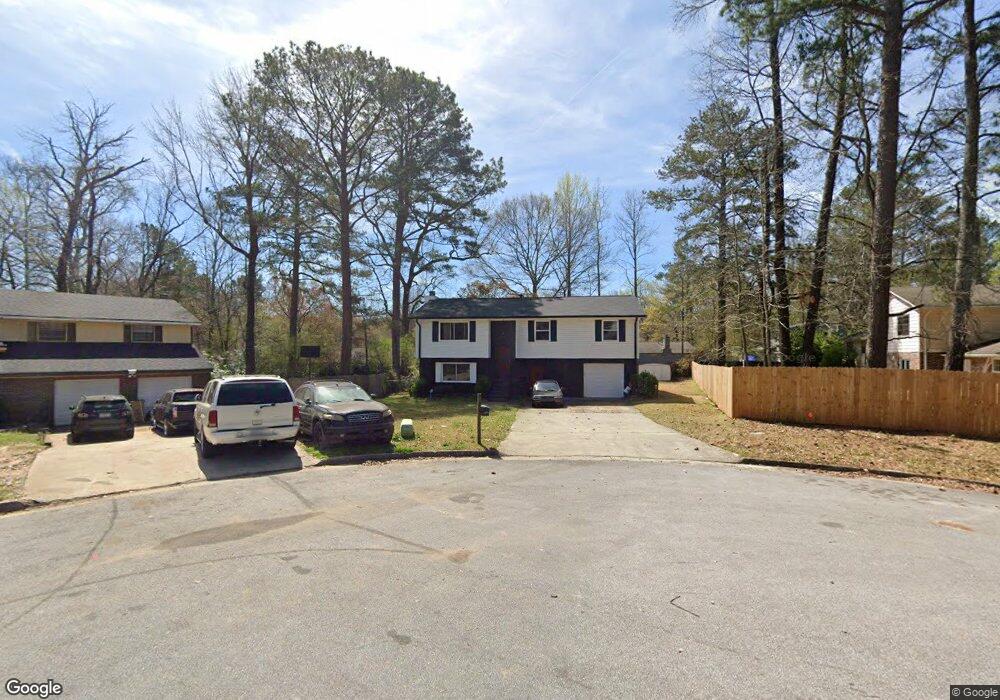
2277 Olin Ct Morrow, GA 30260
Estimated Value: $180,000 - $210,000
3
Beds
2
Baths
1,704
Sq Ft
$116/Sq Ft
Est. Value
About This Home
This home is located at 2277 Olin Ct, Morrow, GA 30260 and is currently estimated at $197,440, approximately $115 per square foot. 2277 Olin Ct is a home located in Clayton County with nearby schools including William M. Mcgarrah Elementary School, Morrow Middle School, and Morrow High School.
Ownership History
Date
Name
Owned For
Owner Type
Purchase Details
Closed on
Jul 2, 2021
Sold by
Stallings Eric
Bought by
Hubbard Ronald G
Current Estimated Value
Home Financials for this Owner
Home Financials are based on the most recent Mortgage that was taken out on this home.
Original Mortgage
$135,500
Outstanding Balance
$122,143
Interest Rate
2.9%
Mortgage Type
FHA
Estimated Equity
$75,297
Purchase Details
Closed on
Jun 25, 2001
Sold by
Ngo Thua B and Ngo Duc C
Bought by
Stallings Eric
Home Financials for this Owner
Home Financials are based on the most recent Mortgage that was taken out on this home.
Original Mortgage
$115,151
Interest Rate
7.16%
Mortgage Type
FHA
Create a Home Valuation Report for This Property
The Home Valuation Report is an in-depth analysis detailing your home's value as well as a comparison with similar homes in the area
Home Values in the Area
Average Home Value in this Area
Purchase History
| Date | Buyer | Sale Price | Title Company |
|---|---|---|---|
| Hubbard Ronald G | $138,000 | -- | |
| Stallings Eric | $117,000 | -- |
Source: Public Records
Mortgage History
| Date | Status | Borrower | Loan Amount |
|---|---|---|---|
| Open | Hubbard Ronald G | $135,500 | |
| Previous Owner | Stallings Eric | $115,151 |
Source: Public Records
Tax History
| Year | Tax Paid | Tax Assessment Tax Assessment Total Assessment is a certain percentage of the fair market value that is determined by local assessors to be the total taxable value of land and additions on the property. | Land | Improvement |
|---|---|---|---|---|
| 2025 | $2,701 | $80,520 | $8,000 | $72,520 |
| 2024 | $2,764 | $80,840 | $8,000 | $72,840 |
| 2023 | $2,686 | $74,400 | $8,000 | $66,400 |
| 2022 | $2,100 | $63,520 | $8,000 | $55,520 |
| 2021 | $1,844 | $46,680 | $8,000 | $38,680 |
| 2020 | $1,765 | $44,125 | $8,000 | $36,125 |
| 2019 | $1,613 | $39,724 | $6,400 | $33,324 |
| 2018 | $1,516 | $37,338 | $6,400 | $30,938 |
| 2017 | $886 | $31,786 | $6,400 | $25,386 |
| 2016 | $853 | $30,955 | $6,400 | $24,555 |
| 2015 | $531 | $0 | $0 | $0 |
| 2014 | $638 | $26,021 | $6,400 | $19,621 |
Source: Public Records
Map
Nearby Homes
- 6566 Melandre Dr
- 6633 Cameron Rd
- 6560 Maddox Rd
- 6463 Maddox Rd
- 6495 Revena Dr
- 6413 Maddox Rd
- 2117 Amish Ct
- 6359 Lanier Rd
- 2617 Terrace Pkwy
- 2613 Stratford Ln Unit 3
- 6584 Sleepy Hollow Ln
- 2575 Stratford Ln
- 0 Adamson Pkwy
- 6663 Peacock Blvd
- 6532 Debbie Sue Ln
- 2497 Celina Ct
- 6541 Debbie Sue Ln
- 2455 Lake Harbin Rd
- 2681 Heritage Ln
- 2688 Heritage Ln
- 2281 Olin Ct
- 2271 Olin Ct
- 6622 Demere Dr Unit 3
- 6694 Cameron Rd
- 6690 Cameron Rd
- 6702 Cameron Rd
- 2280 Olin Ct
- 6682 Cameron Rd
- 6682 Cameron Rd
- 6629 Fleming Rd
- 6621 Fleming Rd
- 6588 Demere Dr Unit 21
- 6588 Demere Dr Unit 3
- 2276 Olin Ct
- 6637 Fleming Rd
- 6613 Demere Dr Unit 3
- 6613 Fleming Rd
- 6621 Demere Dr
- 6695 Cameron Rd
- 6597 Demere Dr
Your Personal Tour Guide
Ask me questions while you tour the home.