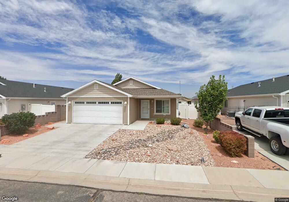
2278 475 S Parowan, UT 84761
Estimated Value: $240,441 - $379,000
--
Bed
1
Bath
--
Sq Ft
3,920
Sq Ft Lot
About This Home
This home is located at 2278 475 S, Parowan, UT 84761 and is currently estimated at $333,610. 2278 475 S is a home located in Iron County with nearby schools including Parowan School, Parowan High School, and Cedar City High School.
Ownership History
Date
Name
Owned For
Owner Type
Purchase Details
Closed on
Jun 17, 2019
Sold by
Ted M Steffernsen Construction Inc
Bought by
Graff Larry and Graff Kathy
Current Estimated Value
Home Financials for this Owner
Home Financials are based on the most recent Mortgage that was taken out on this home.
Original Mortgage
$101,400
Outstanding Balance
$89,155
Interest Rate
4.1%
Mortgage Type
New Conventional
Estimated Equity
$244,455
Purchase Details
Closed on
Sep 28, 2018
Sold by
Steffensen Investment Lc
Bought by
Ted M Steffensen Construction Inc
Create a Home Valuation Report for This Property
The Home Valuation Report is an in-depth analysis detailing your home's value as well as a comparison with similar homes in the area
Home Values in the Area
Average Home Value in this Area
Purchase History
| Date | Buyer | Sale Price | Title Company |
|---|---|---|---|
| Graff Larry | -- | Security Escrow & Title Ins | |
| Ted M Steffensen Construction Inc | -- | Security Escrow & Title Insu |
Source: Public Records
Mortgage History
| Date | Status | Borrower | Loan Amount |
|---|---|---|---|
| Open | Graff Larry | $101,400 |
Source: Public Records
Tax History Compared to Growth
Tax History
| Year | Tax Paid | Tax Assessment Tax Assessment Total Assessment is a certain percentage of the fair market value that is determined by local assessors to be the total taxable value of land and additions on the property. | Land | Improvement |
|---|---|---|---|---|
| 2025 | $1,075 | $133,364 | $9,075 | $124,289 |
| 2023 | $1,078 | $168,135 | $9,075 | $159,060 |
| 2022 | $1,348 | $140,800 | $8,250 | $132,550 |
| 2021 | $1,019 | $106,440 | $8,250 | $98,190 |
| 2020 | $1,225 | $113,020 | $8,250 | $104,770 |
| 2019 | $208 | $18,305 | $8,250 | $10,055 |
| 2018 | $174 | $15,000 | $15,000 | $0 |
| 2017 | $77 | $6,500 | $6,500 | $0 |
| 2016 | $82 | $6,500 | $6,500 | $0 |
| 2015 | $60 | $4,500 | $0 | $0 |
| 2014 | $150 | $10,775 | $0 | $0 |
Source: Public Records
Map
Nearby Homes
- 2246 W 450 S
- 2239 W 475 S
- 2228 W 450 S
- 6 Acres Commercial Land
- 267 S 2400 W
- 0 Pine Canyon Dr Unit 25-260421
- 20.75 Acres S of Parowan Along I-15
- 680 S Heritage Hills Dr
- 701 S Heritage Hills Dr
- 403 & 404 Kari
- 1435 W 200 S Unit 315
- 1521 W 950 S
- 0 Sunflower Ln
- 0 W Old Highway 91 Unit 24-253616
- 0 W Old Highway 91 Unit 108031
- 1112 W 275 S
- 1144 375 South St
- 257 S 1175 W
- 0 Lot 3 Summit Valley Ranchos Unit 110908
- 0 2 35 Ac- Summit Valley Ranchos Unit 113469