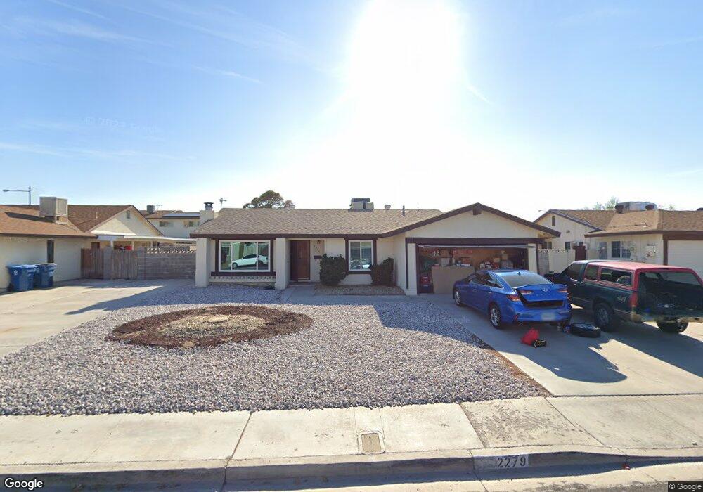
2279 Roan Ave Las Vegas, NV 89119
University District NeighborhoodEstimated Value: $366,082 - $413,000
3
Beds
2
Baths
1,320
Sq Ft
$292/Sq Ft
Est. Value
About This Home
This home is located at 2279 Roan Ave, Las Vegas, NV 89119 and is currently estimated at $385,521, approximately $292 per square foot. 2279 Roan Ave is a home located in Clark County with nearby schools including Jack Dailey Elementary School, Gene Ward Elementary School, and Helen C. Cannon Junior High School.
Ownership History
Date
Name
Owned For
Owner Type
Purchase Details
Closed on
Aug 9, 2018
Sold by
Bliss Marcella Ann and Flesher Marcella A
Bought by
Hodgson Patricia M
Current Estimated Value
Home Financials for this Owner
Home Financials are based on the most recent Mortgage that was taken out on this home.
Original Mortgage
$173,050
Outstanding Balance
$150,287
Interest Rate
4.5%
Mortgage Type
New Conventional
Estimated Equity
$235,234
Purchase Details
Closed on
Aug 29, 1998
Sold by
Shapiro Robert A
Bought by
Flesher Kenneth E and Flesher Marcella A
Home Financials for this Owner
Home Financials are based on the most recent Mortgage that was taken out on this home.
Original Mortgage
$104,000
Interest Rate
6.91%
Mortgage Type
Seller Take Back
Create a Home Valuation Report for This Property
The Home Valuation Report is an in-depth analysis detailing your home's value as well as a comparison with similar homes in the area
Home Values in the Area
Average Home Value in this Area
Purchase History
| Date | Buyer | Sale Price | Title Company |
|---|---|---|---|
| Hodgson Patricia M | $185,000 | Ticor Title Las Vegas 8 | |
| Flesher Kenneth E | $110,000 | Lawyers Title |
Source: Public Records
Mortgage History
| Date | Status | Borrower | Loan Amount |
|---|---|---|---|
| Open | Hodgson Patricia M | $173,050 | |
| Previous Owner | Flesher Kenneth E | $104,000 |
Source: Public Records
Tax History Compared to Growth
Tax History
| Year | Tax Paid | Tax Assessment Tax Assessment Total Assessment is a certain percentage of the fair market value that is determined by local assessors to be the total taxable value of land and additions on the property. | Land | Improvement |
|---|---|---|---|---|
| 2025 | $1,371 | $57,594 | $31,500 | $26,094 |
| 2024 | $1,270 | $57,594 | $31,500 | $26,094 |
| 2023 | $1,270 | $52,042 | $28,700 | $23,342 |
| 2022 | $1,176 | $49,040 | $28,000 | $21,040 |
| 2021 | $1,089 | $44,350 | $24,850 | $19,500 |
| 2020 | $1,009 | $42,818 | $22,750 | $20,068 |
| 2019 | $945 | $41,130 | $20,650 | $20,480 |
| 2018 | $902 | $38,935 | $18,550 | $20,385 |
| 2017 | $1,108 | $37,770 | $16,450 | $21,320 |
| 2016 | $846 | $34,318 | $11,900 | $22,418 |
| 2015 | $843 | $32,160 | $9,450 | $22,710 |
| 2014 | $818 | $27,064 | $7,000 | $20,064 |
Source: Public Records
Map
Nearby Homes
- 5473 Clydesdale St
- 5473 S Eastern Ave
- 5433 Latigo St
- 2184 Sunnyslope Ave
- 2246 E Russell Rd
- 2174 E Russell Rd
- 2033 Pommel Ave
- 5551 Corral Cir
- 1963 Rawhide St
- 5399 Surrey St
- 5613 Chestnut St
- 5514 Oxbow St
- 2486 Leigh Ave
- 5375 Chestnut St
- 2625 E Russell Rd
- 5167 Martingale Ave
- 5328 Topaz St
- 5143 Martingale Ave
- 1673 Caliente Ct
- 5445 Caliente St
- 2261 Roan Ave
- 2299 Roan Ave
- 2282 Roundup Ave
- 2262 Roundup Ave
- 2302 Roundup Ave
- 2243 Roan Ave
- 2284 Roan Ave
- 2304 Roan Ave
- 2248 Roundup Ave
- 2264 Roan Ave
- 2225 Roan Ave
- 5552 Clydesdale St
- 2244 Roan Ave
- 5562 Clydesdale St
- 2234 Roundup Ave
- 5572 Clydesdale St
- 2281 Roundup Ave
- 2285 Rawhide St
- 2336 Roan Ave
- 2263 Roundup Ave