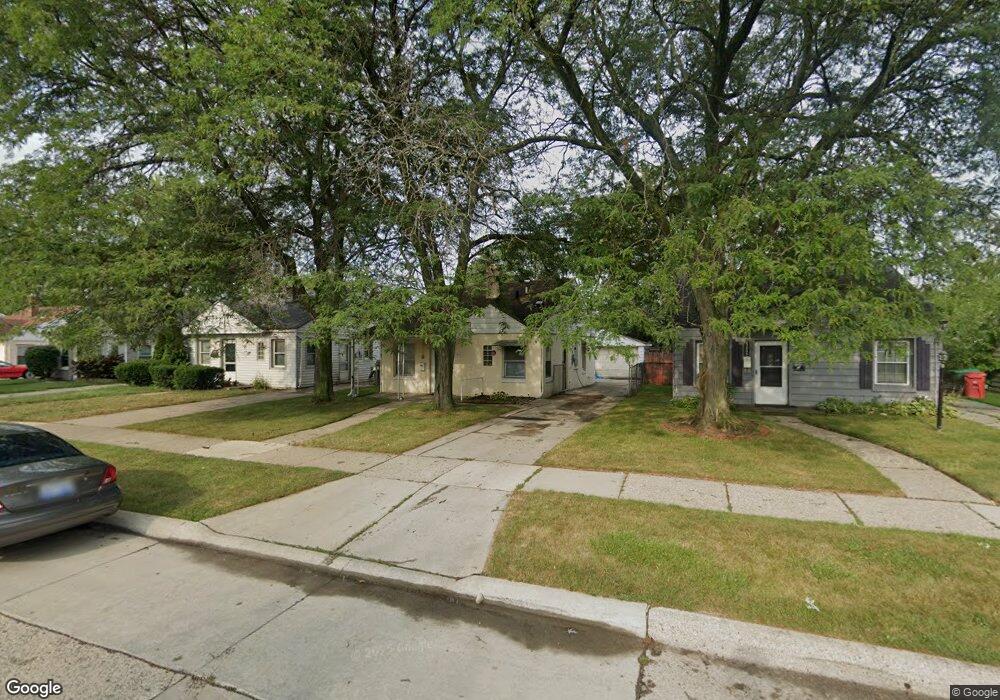
22797 Rosalind Ave Eastpointe, MI 48021
Estimated Value: $121,000 - $148,000
3
Beds
1
Bath
1,152
Sq Ft
$114/Sq Ft
Est. Value
About This Home
This home is located at 22797 Rosalind Ave, Eastpointe, MI 48021 and is currently estimated at $131,881, approximately $114 per square foot. 22797 Rosalind Ave is a home located in Macomb County with nearby schools including Forest Park Elementary School, Eastpointe Middle School, and Reach Charter Academy.
Ownership History
Date
Name
Owned For
Owner Type
Purchase Details
Closed on
Jul 17, 2009
Sold by
Stockoski Kori L
Bought by
Federal Home Loan Mortgage Corp
Current Estimated Value
Purchase Details
Closed on
Nov 18, 2004
Sold by
Stockoski Kori
Bought by
Griffin Home Improvement Llc
Purchase Details
Closed on
Apr 12, 2004
Sold by
Hud
Bought by
Stockoski Kori L
Purchase Details
Closed on
Jun 20, 2003
Sold by
Countrywide Home Loans Inc
Bought by
Hud
Purchase Details
Closed on
Oct 28, 1999
Sold by
Johnson Gerald M
Bought by
Nowka Christopher L
Create a Home Valuation Report for This Property
The Home Valuation Report is an in-depth analysis detailing your home's value as well as a comparison with similar homes in the area
Home Values in the Area
Average Home Value in this Area
Purchase History
| Date | Buyer | Sale Price | Title Company |
|---|---|---|---|
| Federal Home Loan Mortgage Corp | $16,000 | None Available | |
| Griffin Home Improvement Llc | -- | -- | |
| Stockoski Kori L | $75,000 | -- | |
| Hud | -- | -- | |
| Nowka Christopher L | $75,000 | -- |
Source: Public Records
Tax History Compared to Growth
Tax History
| Year | Tax Paid | Tax Assessment Tax Assessment Total Assessment is a certain percentage of the fair market value that is determined by local assessors to be the total taxable value of land and additions on the property. | Land | Improvement |
|---|---|---|---|---|
| 2025 | $1,731 | $57,100 | $0 | $0 |
| 2024 | $1,636 | $54,100 | $0 | $0 |
| 2023 | $1,589 | $46,800 | $0 | $0 |
| 2022 | $1,630 | $39,200 | $0 | $0 |
| 2021 | $1,605 | $34,400 | $0 | $0 |
| 2020 | $1,547 | $30,300 | $0 | $0 |
| 2019 | $1,534 | $27,700 | $0 | $0 |
| 2018 | $1,574 | $20,260 | $0 | $0 |
| 2017 | $1,473 | $18,460 | $3,220 | $15,240 |
| 2016 | $1,757 | $18,460 | $0 | $0 |
| 2015 | $1,228 | $17,610 | $0 | $0 |
| 2013 | $1,632 | $17,690 | $0 | $0 |
Source: Public Records
Map
Nearby Homes
- 22765 Rosalind Ave
- 22780 Rosalind Ave
- 23038 Rosalind Ave
- 22839 Almond Ave
- 22779 Almond Ave
- 23329 Roxana Ave
- 22797 Normandy Ave
- 23373 Wilmot Ave
- 22741 Normandy Ave
- 23311 Courtland Ave
- 22825 Brittany Ave
- 22760 Tuscany Ave
- 23785 Wilmot Ave
- 23082 Tuscany Ave
- 23785 Schroeder Ave
- 22444 Kelly Rd Unit 11
- 23018 Lambrecht Ave
- 22095 Wilmot Ave
- 22139 Normandy Ave
- 23772 Brittany Ave
- 22789 Rosalind Ave
- 22805 Rosalind Ave
- 22781 Rosalind Ave
- 22813 Rosalind Ave
- 22804 Lexington Ave
- 22773 Rosalind Ave
- 22821 Rosalind Ave
- 22788 Lexington Ave
- 22780 Lexington Ave
- 22812 Lexington Ave
- 22796 Lexington Ave
- 22829 Rosalind Ave
- 564 Shrewsbury Dr Rosalind Ave
- 22820 Lexington Ave
- 22796 Rosalind Ave
- 22772 Lexington Ave
- 22788 Rosalind Ave
- 22804 Rosalind Ave
- 22757 Rosalind Ave
- 22837 Rosalind Ave