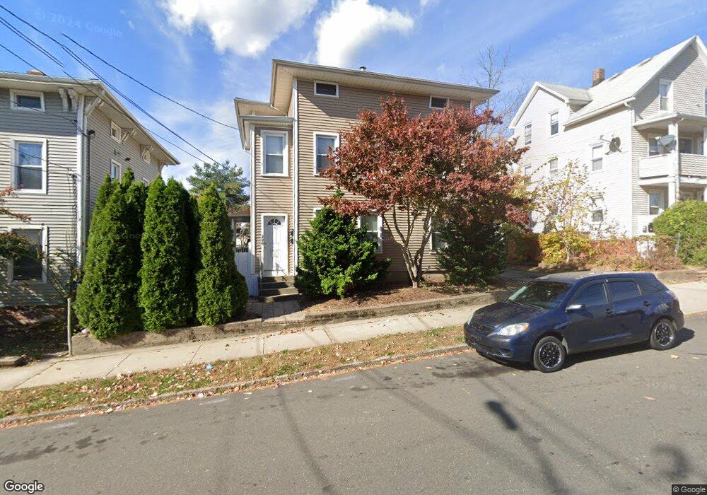
228 Curtis St New Britain, CT 06053
Estimated Value: $307,646 - $373,000
4
Beds
2
Baths
1,816
Sq Ft
$192/Sq Ft
Est. Value
About This Home
This home is located at 228 Curtis St, New Britain, CT 06053 and is currently estimated at $348,412, approximately $191 per square foot. 228 Curtis St is a home located in Hartford County with nearby schools including Lincoln School, Pulaski Middle School, and Mountain Laurel Sudbury School.
Ownership History
Date
Name
Owned For
Owner Type
Purchase Details
Closed on
Jun 24, 2014
Sold by
Hyjek Patrick
Bought by
Hyjeck Realty Llc
Current Estimated Value
Purchase Details
Closed on
Mar 10, 2009
Sold by
Hybner Helen
Bought by
Hyjek Patrick
Home Financials for this Owner
Home Financials are based on the most recent Mortgage that was taken out on this home.
Original Mortgage
$25,000
Interest Rate
4.86%
Create a Home Valuation Report for This Property
The Home Valuation Report is an in-depth analysis detailing your home's value as well as a comparison with similar homes in the area
Home Values in the Area
Average Home Value in this Area
Purchase History
| Date | Buyer | Sale Price | Title Company |
|---|---|---|---|
| Hyjeck Realty Llc | -- | -- | |
| Hyjek Patrick | $165,000 | -- |
Source: Public Records
Mortgage History
| Date | Status | Borrower | Loan Amount |
|---|---|---|---|
| Previous Owner | Hyjek Patrick | $90,000 | |
| Previous Owner | Hyjek Patrick | $25,000 | |
| Previous Owner | Hyjek Patrick | $165,000 |
Source: Public Records
Tax History
| Year | Tax Paid | Tax Assessment Tax Assessment Total Assessment is a certain percentage of the fair market value that is determined by local assessors to be the total taxable value of land and additions on the property. | Land | Improvement |
|---|---|---|---|---|
| 2025 | $5,762 | $147,070 | $38,290 | $108,780 |
| 2024 | $5,823 | $147,070 | $38,290 | $108,780 |
| 2023 | $5,630 | $147,070 | $38,290 | $108,780 |
| 2022 | $4,407 | $89,040 | $12,670 | $76,370 |
| 2021 | $4,407 | $89,040 | $12,670 | $76,370 |
| 2020 | $4,497 | $89,040 | $12,670 | $76,370 |
| 2019 | $4,497 | $89,040 | $12,670 | $76,370 |
| 2018 | $4,497 | $89,040 | $12,670 | $76,370 |
| 2017 | $4,408 | $87,290 | $13,230 | $74,060 |
| 2016 | $4,408 | $87,290 | $13,230 | $74,060 |
| 2015 | $4,277 | $87,290 | $13,230 | $74,060 |
| 2014 | $4,277 | $87,290 | $13,230 | $74,060 |
Source: Public Records
Map
Nearby Homes
- 164 Curtis St
- 77 Booth St
- 272 Burritt St
- 25 Clinton St
- 80 Gold St
- 70 Grove Hill St Unit 2
- 181 Gold St
- 37 Richard St
- 266 Grove St
- 14 Park Place Unit 4
- 527 Burritt St
- 18 Woodruff Ct
- 370 Washington St
- 112 Lincoln St
- 19 Wakefield Ct
- 32 Garden St
- 50 Curtin Ave
- 139 Lincoln St
- 134 Black Rock Ave
- 75 Clark St
- 274 Broad St
- 210 Curtis St
- 270 Broad St Unit 3W
- 270 Broad St
- 270 Broad St Unit 1W
- 270 Broad St Unit 2W
- 270 Broad St Unit 2E
- 270 Broad St Unit 3W
- 278 Broad St
- 61 Smith St Unit 1
- 59 Smith St
- 69 Smith St
- 69 Smith St Unit 2
- 208 Curtis St
- 225 Curtis St
- 53 Smith St
- 215 Curtis St
- 232 Curtis St Unit 3
- 232 Curtis St Unit 1
- 232 Curtis St Unit Floor 1
Your Personal Tour Guide
Ask me questions while you tour the home.