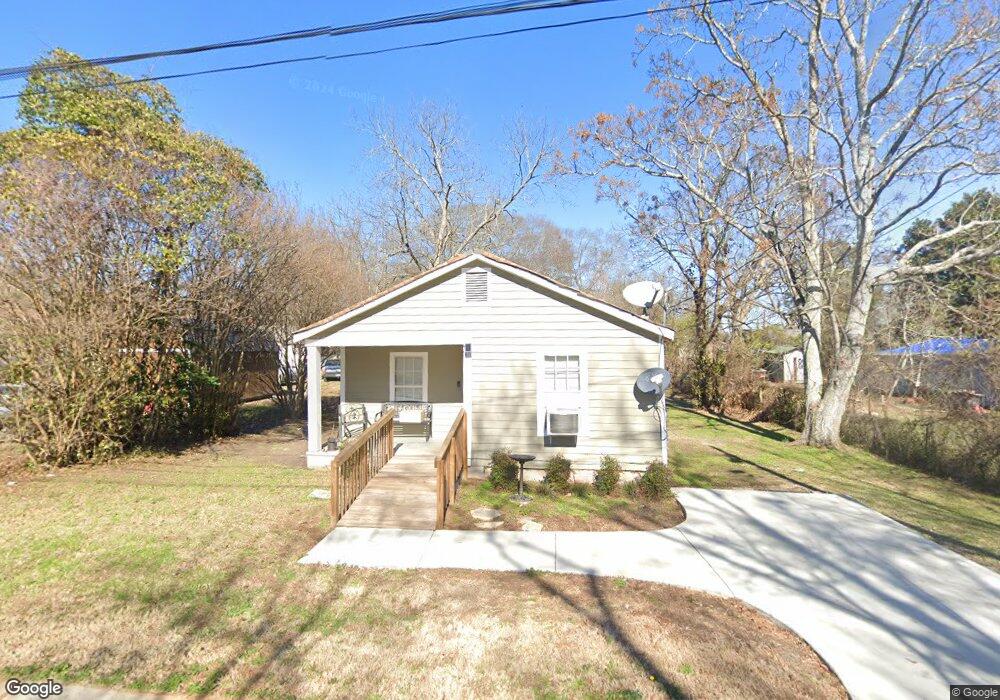
228 King St Social Circle, GA 30025
Estimated Value: $113,000 - $252,000
2
Beds
1
Bath
1,025
Sq Ft
$170/Sq Ft
Est. Value
About This Home
This home is located at 228 King St, Social Circle, GA 30025 and is currently estimated at $173,812, approximately $169 per square foot. 228 King St is a home located in Walton County with nearby schools including Social Circle Primary School, Social Circle Elementary School, and Social Circle Middle School.
Ownership History
Date
Name
Owned For
Owner Type
Purchase Details
Closed on
Feb 4, 2022
Sold by
Barrett Arthur L
Bought by
Connell Freddie L
Current Estimated Value
Home Financials for this Owner
Home Financials are based on the most recent Mortgage that was taken out on this home.
Original Mortgage
$67,663
Outstanding Balance
$62,830
Interest Rate
3.55%
Mortgage Type
FHA
Estimated Equity
$110,982
Purchase Details
Closed on
Sep 15, 2019
Sold by
Barrett Arthur
Bought by
Barrett Arthur L and Hall Penny L
Purchase Details
Closed on
Mar 28, 2008
Sold by
Williams Roy L
Bought by
Barrett Arthur
Create a Home Valuation Report for This Property
The Home Valuation Report is an in-depth analysis detailing your home's value as well as a comparison with similar homes in the area
Home Values in the Area
Average Home Value in this Area
Purchase History
| Date | Buyer | Sale Price | Title Company |
|---|---|---|---|
| Connell Freddie L | $70,000 | -- | |
| Barrett Arthur L | -- | -- | |
| Barrett Arthur | $16,000 | -- |
Source: Public Records
Mortgage History
| Date | Status | Borrower | Loan Amount |
|---|---|---|---|
| Open | Connell Freddie L | $67,663 |
Source: Public Records
Tax History Compared to Growth
Tax History
| Year | Tax Paid | Tax Assessment Tax Assessment Total Assessment is a certain percentage of the fair market value that is determined by local assessors to be the total taxable value of land and additions on the property. | Land | Improvement |
|---|---|---|---|---|
| 2024 | $489 | $32,120 | $10,000 | $22,120 |
| 2023 | $457 | $29,480 | $8,800 | $20,680 |
| 2022 | $277 | $26,600 | $7,200 | $19,400 |
| 2021 | $200 | $19,240 | $7,200 | $12,040 |
| 2020 | $185 | $17,320 | $5,600 | $11,720 |
| 2019 | $104 | $8,720 | $5,600 | $3,120 |
| 2018 | $95 | $8,720 | $5,600 | $3,120 |
| 2017 | $289 | $6,920 | $4,000 | $2,920 |
| 2016 | $76 | $6,680 | $4,000 | $2,680 |
| 2015 | $71 | $6,320 | $4,000 | $2,320 |
| 2014 | $97 | $8,160 | $0 | $0 |
Source: Public Records
Map
Nearby Homes
- 304 Dogwood Ave
- 127 Holly St NE
- 341 Boxwood St
- 135 N Dogwood Ave
- 207 E Hightower Trail
- 487 N Cherokee Rd
- 381 Crossroads Dr
- 432 Chestnut St
- 413 Crossroads Dr
- 690 Park Place Way
- 684 N Cherokee Rd
- 357 W Hightower Trail
- 159 S Forest Ave
- Adrian Plan at Conner Springs
- Sinclair Plan at Conner Springs
- Shiloh Plan at Conner Springs
- Mira Plan at Conner Springs
- Hemingway Plan at Conner Springs
- Harding Plan at Conner Springs
- 295 Poplar Ave NE
- 237 King St
- 227 King St
- 313 Poplar Ave NE
- 275 Poplar Ave NE
- 217 King St
- 308 N Dogwood Ave
- 272 N Dogwood Ave
- 0 King St NE
- 314 N Dogwood Ave
- 255 Poplar Ave
- 335 Poplar Ave NE
- 335 Poplar Ave NE
- 328 Poplar Ave NE
- 0 Poplar St Unit 3270917
- 334 Poplar Ave NE
- 250 Poplar Ave
- 0 N Dogwood Ave
- 251 Poplar Ave
- 242 N Dogwood Ave