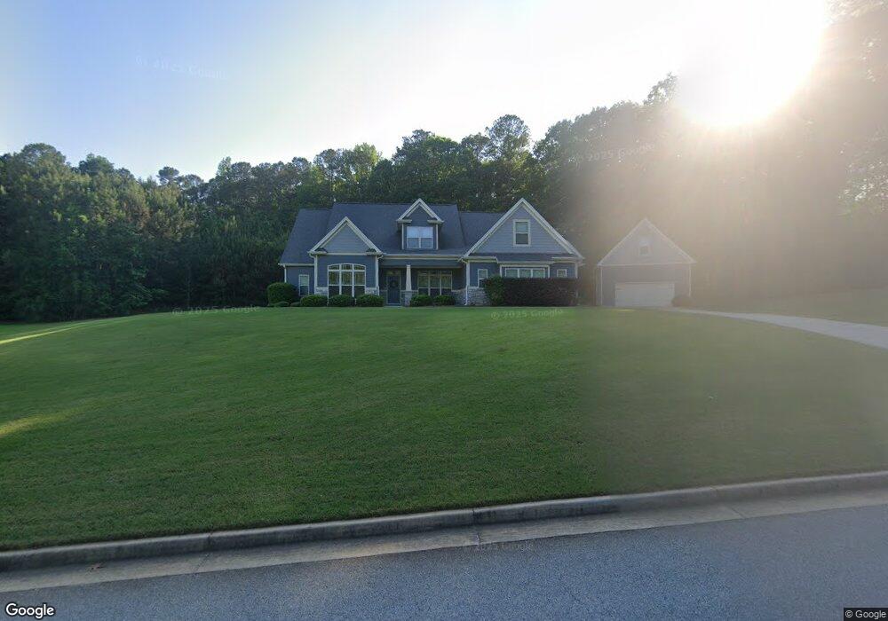
228 Martins Pond Rd Newnan, GA 30263
Estimated Value: $552,000 - $673,000
4
Beds
4
Baths
3,398
Sq Ft
$180/Sq Ft
Est. Value
About This Home
This home is located at 228 Martins Pond Rd, Newnan, GA 30263 and is currently estimated at $610,551, approximately $179 per square foot. 228 Martins Pond Rd is a home with nearby schools including Northside Elementary School, Madras Middle School, and Newnan High School.
Ownership History
Date
Name
Owned For
Owner Type
Purchase Details
Closed on
Apr 29, 2010
Sold by
Jeff Lindsey Communities Inc
Bought by
Batten Grant S and Batten Jaime M
Current Estimated Value
Home Financials for this Owner
Home Financials are based on the most recent Mortgage that was taken out on this home.
Original Mortgage
$262,861
Outstanding Balance
$180,022
Interest Rate
5.5%
Mortgage Type
FHA
Estimated Equity
$430,529
Purchase Details
Closed on
Dec 1, 2009
Sold by
Night Hawk Grading Inc
Bought by
Jeff Lindsey Communities Inc
Purchase Details
Closed on
Jan 30, 2006
Sold by
Rockwall Developers Inc
Bought by
Night Hawk Grading Inc
Purchase Details
Closed on
Sep 29, 2005
Sold by
Williams Carl E
Bought by
Rockwall Developers Inc
Purchase Details
Closed on
Apr 30, 1967
Bought by
Williams Carl E
Create a Home Valuation Report for This Property
The Home Valuation Report is an in-depth analysis detailing your home's value as well as a comparison with similar homes in the area
Home Values in the Area
Average Home Value in this Area
Purchase History
| Date | Buyer | Sale Price | Title Company |
|---|---|---|---|
| Batten Grant S | $267,900 | -- | |
| Jeff Lindsey Communities Inc | $42,000 | -- | |
| Night Hawk Grading Inc | $1,387,000 | -- | |
| Rockwall Developers Inc | $1,000,000 | -- | |
| Williams Carl E | -- | -- |
Source: Public Records
Mortgage History
| Date | Status | Borrower | Loan Amount |
|---|---|---|---|
| Open | Batten Grant S | $262,861 |
Source: Public Records
Tax History Compared to Growth
Tax History
| Year | Tax Paid | Tax Assessment Tax Assessment Total Assessment is a certain percentage of the fair market value that is determined by local assessors to be the total taxable value of land and additions on the property. | Land | Improvement |
|---|---|---|---|---|
| 2024 | $5,235 | $230,121 | $28,000 | $202,121 |
| 2023 | $5,235 | $208,986 | $28,000 | $180,986 |
| 2022 | $4,353 | $181,404 | $28,000 | $153,404 |
| 2021 | $3,610 | $141,793 | $20,000 | $121,793 |
| 2020 | $3,633 | $141,793 | $20,000 | $121,793 |
| 2019 | $3,587 | $127,343 | $14,000 | $113,343 |
| 2018 | $3,594 | $127,343 | $14,000 | $113,343 |
| 2017 | $3,440 | $122,134 | $14,000 | $108,134 |
| 2016 | $3,174 | $114,320 | $14,000 | $100,320 |
| 2015 | $2,876 | $105,638 | $14,000 | $91,638 |
| 2014 | $2,856 | $105,638 | $14,000 | $91,638 |
Source: Public Records
Map
Nearby Homes
- 264 Kendall St
- 894 Happy Valley Cir
- 237 Kory Dr
- 34 Maggie Place
- 64 Redwine Overlook
- 252 Happy Valley Cir
- 440 Kory Dr
- 7 Harris Ct
- 72 W Cove Dr
- 90 Westwind Dr
- 44 Fendley Trace
- 571 Kory Dr
- 285 Peninsula Cir
- 50 Peninsula Cir
- 14 W Shore Ct
- 25 The Terrace
- 212 Westwind Dr
- 10 Cove Dr
- 132 Haven Ridge
- 62 N Shore at Redwine Dr
- 214 Martins Pond Rd
- 215 Martins Pond Rd
- 204 Martins Pond Rd
- 268 Martins Pond Rd
- 265 Martins Pond Rd
- 160 Kates Bridge
- 273 Martins Pond Rd
- 150 Kates Bridge
- 284 Martins Pond Rd
- 140 Kates Bridge
- 174 Martins Pond Rd
- 291 Martins Pond Rd
- 131 Martins Pond Rd
- 180 Kates Bridge
- 300 Martins Pond Rd
- 0 Turtle Track Unit LOT 32 02906212
- 0 Turtle Track Unit 7316531
- 0 Turtle Track Unit 8472051
- 0 Turtle Track Unit 8551686
- 168 Martins Pond Rd