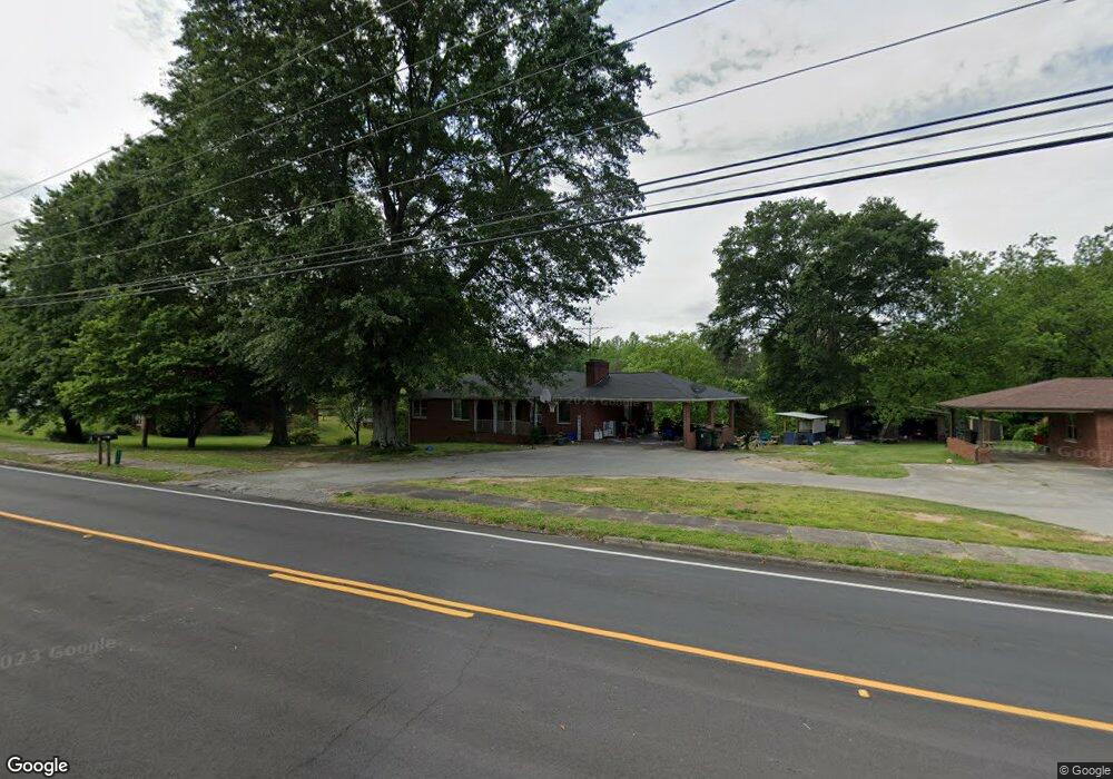
228 Mize Rd Toccoa, GA 30577
Estimated Value: $236,000 - $308,000
6
Beds
3
Baths
3,104
Sq Ft
$88/Sq Ft
Est. Value
About This Home
This home is located at 228 Mize Rd, Toccoa, GA 30577 and is currently estimated at $272,431, approximately $87 per square foot. 228 Mize Rd is a home located in Stephens County with nearby schools including Stephens County High School.
Ownership History
Date
Name
Owned For
Owner Type
Purchase Details
Closed on
Apr 10, 2019
Sold by
Lukyura Llc
Bought by
Murray Samuel Clinton and Murray Kathy
Current Estimated Value
Home Financials for this Owner
Home Financials are based on the most recent Mortgage that was taken out on this home.
Original Mortgage
$134,000
Interest Rate
4.3%
Mortgage Type
New Conventional
Purchase Details
Closed on
Sep 2, 2016
Sold by
Jp Morgan Chase Bk Na
Bought by
Lukyura Llc
Purchase Details
Closed on
Apr 5, 2016
Sold by
Major Terry D
Bought by
Jpmorgan Chase Bank National A
Purchase Details
Closed on
Jul 29, 2011
Sold by
Thomas Deborah B
Bought by
Major Terry D
Home Financials for this Owner
Home Financials are based on the most recent Mortgage that was taken out on this home.
Original Mortgage
$96,839
Interest Rate
4.53%
Mortgage Type
New Conventional
Purchase Details
Closed on
Sep 30, 1999
Bought by
Bertie Thomas E and Bertie Thomas O
Create a Home Valuation Report for This Property
The Home Valuation Report is an in-depth analysis detailing your home's value as well as a comparison with similar homes in the area
Purchase History
| Date | Buyer | Sale Price | Title Company |
|---|---|---|---|
| Murray Samuel Clinton | $140,000 | -- | |
| Lukyura Llc | $65,625 | -- | |
| Jpmorgan Chase Bank National A | -- | -- | |
| Major Terry D | $89,500 | -- | |
| Bertie Thomas E | -- | -- |
Source: Public Records
Mortgage History
| Date | Status | Borrower | Loan Amount |
|---|---|---|---|
| Closed | Murray Samuel Clinton | $134,000 | |
| Previous Owner | Major Terry D | $96,839 |
Source: Public Records
Tax History
| Year | Tax Paid | Tax Assessment Tax Assessment Total Assessment is a certain percentage of the fair market value that is determined by local assessors to be the total taxable value of land and additions on the property. | Land | Improvement |
|---|---|---|---|---|
| 2025 | $2,713 | $91,373 | $1,443 | $89,930 |
| 2024 | $2,242 | $62,884 | $1,443 | $61,441 |
| 2023 | $2,093 | $59,159 | $1,443 | $57,716 |
| 2022 | $1,683 | $56,528 | $1,443 | $55,085 |
| 2021 | $1,646 | $52,627 | $1,443 | $51,184 |
| 2020 | $1,661 | $52,599 | $1,443 | $51,156 |
| 2019 | $1,668 | $52,599 | $1,443 | $51,156 |
| 2018 | $1,678 | $52,925 | $1,443 | $51,482 |
| 2017 | $1,232 | $52,925 | $1,443 | $51,482 |
| 2016 | $1,422 | $46,836 | $1,443 | $45,392 |
| 2015 | $1,500 | $47,175 | $1,443 | $45,732 |
| 2014 | $1,525 | $47,175 | $1,443 | $45,732 |
| 2013 | -- | $47,061 | $1,443 | $45,618 |
Source: Public Records
Map
Nearby Homes
- 1037 S Pond St
- 943 S Pond St
- 574 S Sage St
- 168 Yearwood St
- 98 Wood St
- 500 S Pond St
- 478 S Pond St
- 48 Owen St
- 151 Richardson St
- 526 Poplar St
- 128 Branch St
- 614 616 S Pond St
- 258 Persimmon St
- 320 S Pond St
- 0 Valley Dr Unit 10600268
- 9 Poplar St
- 53 Cole Manor Dr
- 288 S Broad St
- 253 Stancil Dr
- 229 Hilltop Ln
Your Personal Tour Guide
Ask me questions while you tour the home.