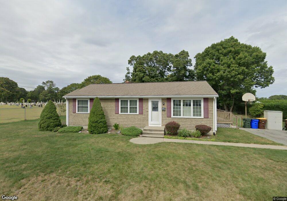
228 Newhall St Fall River, MA 02721
Maplewood NeighborhoodEstimated Value: $457,079 - $488,000
3
Beds
1
Bath
1,512
Sq Ft
$312/Sq Ft
Est. Value
About This Home
This home is located at 228 Newhall St, Fall River, MA 02721 and is currently estimated at $472,020, approximately $312 per square foot. 228 Newhall St is a home located in Bristol County with nearby schools including Letourneau Elementary School, Matthew J. Kuss Middle School, and B M C Durfee High School.
Ownership History
Date
Name
Owned For
Owner Type
Purchase Details
Closed on
Sep 17, 1981
Bought by
Moreira Antonio A and Moreira Barbara A
Current Estimated Value
Create a Home Valuation Report for This Property
The Home Valuation Report is an in-depth analysis detailing your home's value as well as a comparison with similar homes in the area
Home Values in the Area
Average Home Value in this Area
Purchase History
| Date | Buyer | Sale Price | Title Company |
|---|---|---|---|
| Moreira Antonio A | $46,000 | -- |
Source: Public Records
Mortgage History
| Date | Status | Borrower | Loan Amount |
|---|---|---|---|
| Closed | Moreira Antonio A | $27,700 | |
| Closed | Moreira Antonio A | $37,500 | |
| Closed | Moreira Antonio A | $29,865 |
Source: Public Records
Tax History
| Year | Tax Paid | Tax Assessment Tax Assessment Total Assessment is a certain percentage of the fair market value that is determined by local assessors to be the total taxable value of land and additions on the property. | Land | Improvement |
|---|---|---|---|---|
| 2025 | $4,666 | $407,500 | $140,600 | $266,900 |
| 2024 | $4,351 | $378,700 | $135,300 | $243,400 |
| 2023 | $4,239 | $345,500 | $128,700 | $216,800 |
| 2022 | $3,742 | $296,500 | $119,200 | $177,300 |
| 2021 | $3,294 | $238,200 | $119,000 | $119,200 |
| 2020 | $3,166 | $219,100 | $112,400 | $106,700 |
| 2019 | $3,062 | $210,000 | $110,300 | $99,700 |
| 2018 | $3,067 | $209,800 | $110,300 | $99,500 |
| 2017 | $2,869 | $204,900 | $107,100 | $97,800 |
| 2016 | $2,727 | $200,100 | $107,100 | $93,000 |
| 2015 | $2,692 | $205,800 | $107,100 | $98,700 |
| 2014 | $2,589 | $205,800 | $107,100 | $98,700 |
Source: Public Records
Map
Nearby Homes
- 186 Spencer St
- 0 Stafford Rd Unit 1393774
- 0 Stafford Rd Unit 73431501
- 0 Hancock St
- 664 Norman St
- 21 Nightingale Ln
- 38 Hummingbird Ln
- 18 Mockingbird Ln
- 0 Sheldon St
- 95 Hiatt St
- 185 Stafford Rd
- 206 Songbird Ln
- 84 Lark Ln
- 37 Bluejay St
- 3 Blackbird St
- 495 Chicago St
- 93 Lawton St
- 125 Carl St
- 1082 Hancock St
- 71 Blackbird St
Your Personal Tour Guide
Ask me questions while you tour the home.