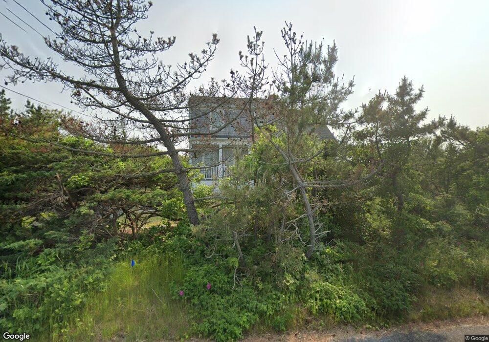
228 Phillips Rd Sandwich, MA 2563
Estimated Value: $957,000 - $1,643,000
4
Beds
3
Baths
1,874
Sq Ft
$663/Sq Ft
Est. Value
About This Home
This home is located at 228 Phillips Rd, Sandwich, MA 2563 and is currently estimated at $1,241,612, approximately $662 per square foot. 228 Phillips Rd is a home located in Barnstable County with nearby schools including Sandwich Middle High School, Sandwich Montessori School, and Riverview School.
Ownership History
Date
Name
Owned For
Owner Type
Purchase Details
Closed on
Jun 20, 2017
Sold by
Gull Cottage Rt and Gallitano
Bought by
Gallitano Joshua
Current Estimated Value
Home Financials for this Owner
Home Financials are based on the most recent Mortgage that was taken out on this home.
Original Mortgage
$440,000
Outstanding Balance
$349,571
Interest Rate
3.25%
Mortgage Type
Purchase Money Mortgage
Estimated Equity
$892,041
Purchase Details
Closed on
Sep 29, 2004
Sold by
Gallitano Joseph R
Bought by
Gull Cottage Rt and Gallitano
Create a Home Valuation Report for This Property
The Home Valuation Report is an in-depth analysis detailing your home's value as well as a comparison with similar homes in the area
Purchase History
| Date | Buyer | Sale Price | Title Company |
|---|---|---|---|
| Gallitano Joshua | $550,000 | -- | |
| Gull Cottage Rt | -- | -- | |
| Gull Cottage Rt | -- | -- | |
| Gallitano Joshua | $550,000 | -- |
Source: Public Records
Mortgage History
| Date | Status | Borrower | Loan Amount |
|---|---|---|---|
| Open | Gallitano Joshua | $440,000 | |
| Closed | Gull Cottage Rt | $440,000 |
Source: Public Records
Tax History
| Year | Tax Paid | Tax Assessment Tax Assessment Total Assessment is a certain percentage of the fair market value that is determined by local assessors to be the total taxable value of land and additions on the property. | Land | Improvement |
|---|---|---|---|---|
| 2025 | $9,802 | $927,300 | $535,400 | $391,900 |
| 2024 | $8,337 | $771,900 | $400,400 | $371,500 |
| 2023 | $8,128 | $706,800 | $364,000 | $342,800 |
| 2022 | $7,914 | $601,400 | $325,000 | $276,400 |
| 2021 | $7,185 | $521,800 | $275,700 | $246,100 |
| 2020 | $8,174 | $571,200 | $341,100 | $230,100 |
| 2019 | $7,887 | $550,800 | $334,800 | $216,000 |
| 2018 | $8,528 | $596,800 | $395,700 | $201,100 |
| 2017 | $2,812 | $566,100 | $378,800 | $187,300 |
| 2016 | $7,943 | $548,900 | $366,900 | $182,000 |
| 2015 | $7,892 | $532,500 | $356,100 | $176,400 |
Source: Public Records
Map
Nearby Homes
- 17 Kensington Dr
- 46 Kensington Dr
- 6 Granite Cir
- 5 Bluestone Terrace
- 33 Easterly Dr
- 363 Service Rd
- 24 Surrey Ln
- 28 Spinnaker St
- 7 Horseshoe Cir
- 86 Greenville Dr
- 2 Marie Ln
- 185 Cotuit Rd Unit JP1
- 185 Cotuit Rd Unit C5 Aspen
- 12 Crowell Rd
- 113 Farmersville Rd
- 7 Mary Leal Ln
- 2 Rockhill Rd
- 306 Route 6a
- 306 Route 6a
- 58 Southpoint Dr Unit J
- 245 Phillips Rd
- 212 Phillips Rd
- 233 Phillips Rd
- 225 Phillips Rd
- 211 Phillips Rd
- 214 Phillips Rd
- 275 Phillips Rd
- 271 Phillips Rd
- 269 Phillips Rd
- 260 Phillips Rd
- 231 Phillips Rd
- 234 Phillips Rd
- 278 Phillips Rd
- 232 Phillips Rd
- 262 Phillips Rd
- 227 Phillips Rd
- 287-R Phillips Rd
- 267 Phillips Rd
- 261 Phillips Rd
- 247 Phillips Rd
Your Personal Tour Guide
Ask me questions while you tour the home.