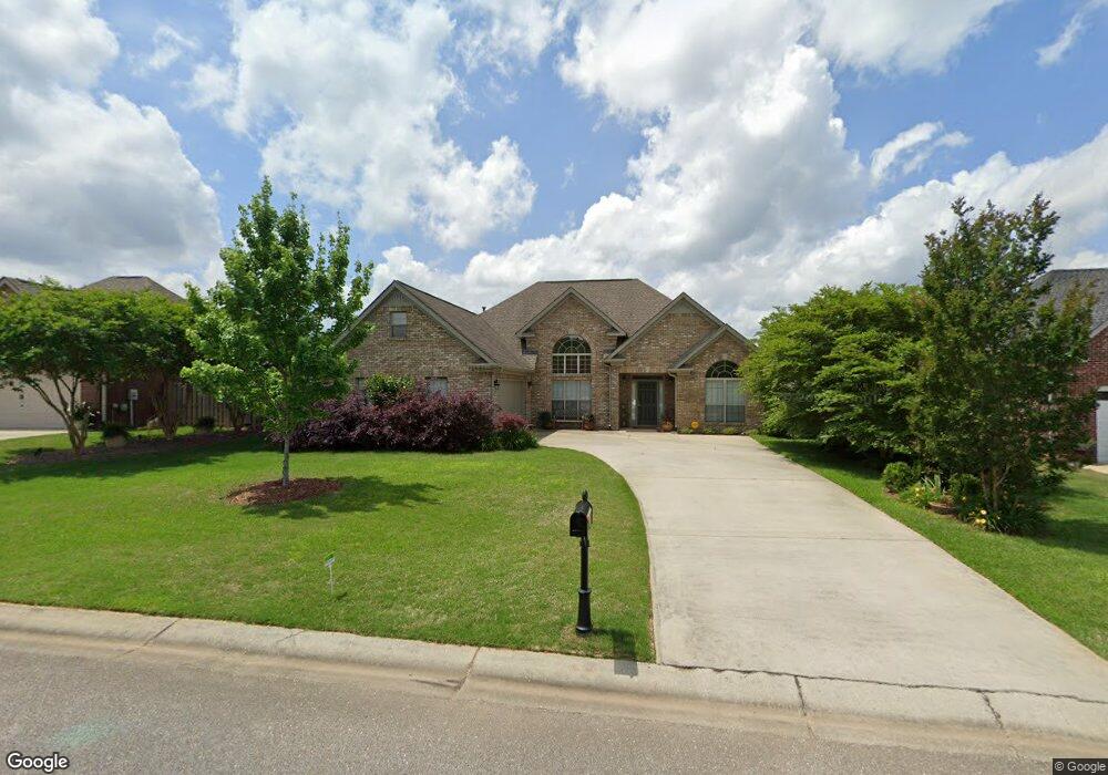
228 Queens Gate Maylene, AL 35114
Estimated Value: $294,000 - $330,000
Studio
1
Bath
1,971
Sq Ft
$158/Sq Ft
Est. Value
About This Home
This home is located at 228 Queens Gate, Maylene, AL 35114 and is currently estimated at $311,221, approximately $157 per square foot. 228 Queens Gate is a home located in Shelby County with nearby schools including Thompson Intermediate School, Thompson Middle School, and Thompson High School.
Ownership History
Date
Name
Owned For
Owner Type
Purchase Details
Closed on
Jun 15, 2007
Sold by
Beanblossom Shannon Ashley Finn
Bought by
Evans Edward D and Evans Frankie J
Current Estimated Value
Home Financials for this Owner
Home Financials are based on the most recent Mortgage that was taken out on this home.
Original Mortgage
$172,572
Outstanding Balance
$105,080
Interest Rate
6.1%
Mortgage Type
Purchase Money Mortgage
Estimated Equity
$206,141
Purchase Details
Closed on
Jan 17, 2007
Sold by
Beanblossom James Kurt
Bought by
Beanblossom Shannon Ashley Finn
Purchase Details
Closed on
Aug 12, 2003
Sold by
Professional Homebuilders Inc
Bought by
Beanblossom James K and Finn Shannon A
Home Financials for this Owner
Home Financials are based on the most recent Mortgage that was taken out on this home.
Original Mortgage
$130,750
Interest Rate
5.42%
Mortgage Type
Unknown
Create a Home Valuation Report for This Property
The Home Valuation Report is an in-depth analysis detailing your home's value as well as a comparison with similar homes in the area
Home Values in the Area
Average Home Value in this Area
Purchase History
| Date | Buyer | Sale Price | Title Company |
|---|---|---|---|
| Evans Edward D | $180,000 | None Available | |
| Beanblossom Shannon Ashley Finn | -- | None Available | |
| Beanblossom James K | $163,446 | -- |
Source: Public Records
Mortgage History
| Date | Status | Borrower | Loan Amount |
|---|---|---|---|
| Open | Evans Edward D | $172,572 | |
| Previous Owner | Beanblossom James K | $130,750 | |
| Closed | Beanblossom James K | $32,680 |
Source: Public Records
Tax History
| Year | Tax Paid | Tax Assessment Tax Assessment Total Assessment is a certain percentage of the fair market value that is determined by local assessors to be the total taxable value of land and additions on the property. | Land | Improvement |
|---|---|---|---|---|
| 2024 | $1,554 | $28,780 | $0 | $0 |
| 2023 | $1,275 | $27,160 | $0 | $0 |
| 2022 | $1,175 | $25,060 | $0 | $0 |
| 2021 | $1,020 | $21,780 | $0 | $0 |
| 2020 | $948 | $20,280 | $0 | $0 |
| 2019 | $906 | $19,380 | $0 | $0 |
| 2017 | $0 | $17,680 | $0 | $0 |
| 2015 | -- | $16,740 | $0 | $0 |
| 2014 | $780 | $16,740 | $0 | $0 |
Source: Public Records
Map
Nearby Homes
- 208 Queens Gate
- 501 Ramsgate Dr
- 236 Queens Gate
- 174 Cedar Grove Pkwy
- 120 Mayfair Park
- 105 Abington Cir
- 132 Victoria Station
- 306 Mayfair Cir
- 544 Ramsgate Dr
- 413 Cornwall Dr
- 545 Ramsgate Dr
- 549 Ramsgate Dr
- 305 Cedar Grove Ct
- 537 Ramsgate Dr
- 309 Cedar Grove Ct
- 109 Kingsley Cir
- 124 Kingsley Rd
- 280 Cedar Grove Pkwy
- 316 Sterling Manor Cir
- 125 Mountain Pkwy
- 232 Queens Gate
- 224 Queens Gate
- 132 Churchill Dr
- 128 Churchill Dr
- 234 Queens Gate
- 220 Queens Gate
- 124 Churchill Dr
- 229 Queens Gate
- 136 Churchill Dr
- 225 Queens Gate
- 216 Queens Gate
- 221 Queens Gate
- 140 Churchill Dr
- 237 Queens Gate
- 104 Churchill Dr
- 117 Churchill Dr
- 129 Churchill Dr
- 125 Churchill Dr
- 240 Queens Gate
- 217 Queens Gate
Your Personal Tour Guide
Ask me questions while you tour the home.