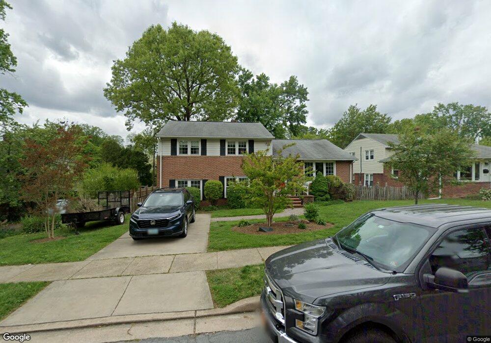
228 Rollingbrook Way Catonsville, MD 21228
Estimated Value: $492,702 - $538,000
Studio
3
Baths
2,030
Sq Ft
$253/Sq Ft
Est. Value
About This Home
This home is located at 228 Rollingbrook Way, Catonsville, MD 21228 and is currently estimated at $514,176, approximately $253 per square foot. 228 Rollingbrook Way is a home located in Baltimore County with nearby schools including Westchester Elementary School, Catonsville Middle School, and Catonsville High School.
Ownership History
Date
Name
Owned For
Owner Type
Purchase Details
Closed on
Jun 22, 2004
Sold by
Ellison Kenneth
Bought by
Stauffer Andrew L and Stauffer Jennifer W
Current Estimated Value
Purchase Details
Closed on
Jun 11, 2004
Sold by
Ellison Kenneth
Bought by
Stauffer Andrew L and Stauffer Jennifer W
Purchase Details
Closed on
Sep 13, 2002
Sold by
Ellison Kenneth G
Bought by
Ellison Kenneth
Create a Home Valuation Report for This Property
The Home Valuation Report is an in-depth analysis detailing your home's value as well as a comparison with similar homes in the area
Home Values in the Area
Average Home Value in this Area
Purchase History
| Date | Buyer | Sale Price | Title Company |
|---|---|---|---|
| Stauffer Andrew L | $270,000 | -- | |
| Stauffer Andrew L | $270,000 | -- | |
| Stauffer Andrew L | $270,000 | -- | |
| Stauffer Andrew L | $270,000 | -- | |
| Ellison Kenneth | -- | -- |
Source: Public Records
Tax History
| Year | Tax Paid | Tax Assessment Tax Assessment Total Assessment is a certain percentage of the fair market value that is determined by local assessors to be the total taxable value of land and additions on the property. | Land | Improvement |
|---|---|---|---|---|
| 2025 | $4,903 | $362,600 | -- | -- |
| 2024 | $4,903 | $341,500 | $127,000 | $214,500 |
| 2023 | $2,295 | $332,600 | $0 | $0 |
| 2022 | $4,402 | $323,700 | $0 | $0 |
| 2021 | $4,090 | $314,800 | $127,000 | $187,800 |
| 2020 | $4,090 | $303,000 | $0 | $0 |
| 2019 | $4,005 | $291,200 | $0 | $0 |
| 2018 | $3,865 | $279,400 | $91,000 | $188,400 |
| 2017 | $3,549 | $262,367 | $0 | $0 |
| 2016 | $3,109 | $245,333 | $0 | $0 |
| 2015 | $3,109 | $228,300 | $0 | $0 |
| 2014 | $3,109 | $228,300 | $0 | $0 |
Source: Public Records
Map
Nearby Homes
- 1900 Lismore Ln
- 7 Overhill Rd
- 124 Oakdale Ave
- 608 Meyers Dr
- 2029 Norhurst Way S
- 29 Upman Ct
- 627 Meyers Dr
- 627 Meyers Dr Unit PARCEL 108
- 122 Wyndcrest Ave
- 343 N Beaumont Ave
- 201 Suter Rd
- 0 Melvin Ave
- 2 Park Dr
- 6040 Old Frederick Rd
- 206 Winters Ln
- 15 Shipley Ave
- 2004 Westchester Ave
- 1104 Lisadale Cir Unit 1D
- 28 Bryans Mill Way
- 1111 Cummings Ave
- 230 Rollingbrook Way
- 226 Rollingbrook Way
- 203 Elpin Dr E
- 205 Elpin Dr E
- 2002 Clifden Rd
- 232 Rollingbrook Way
- 1922 Clifden Rd
- 229 Rollingbrook Way
- 207 Elpin Dr E
- 231 Rollingbrook Way
- 234 Rollingbrook Way
- 2001 Clifden Rd
- 2003 Clifden Rd
- 209 Elpin Dr E
- 1920 Clifden Rd
- 233 Rollingbrook Way
- 1923 Clifden Rd
- 2005 Clifden Rd
- 236 Rollingbrook Way
- 235 Rollingbrook Way
Your Personal Tour Guide
Ask me questions while you tour the home.