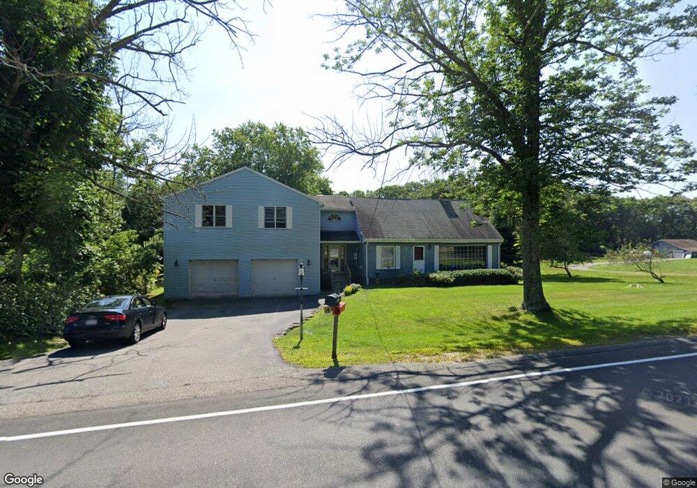
228 S Ashburnham Rd Westminster, MA 01473
Estimated Value: $561,868 - $706,000
3
Beds
2
Baths
2,975
Sq Ft
$211/Sq Ft
Est. Value
About This Home
This home is located at 228 S Ashburnham Rd, Westminster, MA 01473 and is currently estimated at $627,467, approximately $210 per square foot. 228 S Ashburnham Rd is a home located in Worcester County with nearby schools including Oakmont Regional High School.
Ownership History
Date
Name
Owned For
Owner Type
Purchase Details
Closed on
Jun 6, 2024
Sold by
Hay Joan V
Bought by
Hay Alison J and Perciballi Michael J
Current Estimated Value
Purchase Details
Closed on
May 28, 1976
Bought by
Hay James R and Hay Joan
Create a Home Valuation Report for This Property
The Home Valuation Report is an in-depth analysis detailing your home's value as well as a comparison with similar homes in the area
Home Values in the Area
Average Home Value in this Area
Purchase History
| Date | Buyer | Sale Price | Title Company |
|---|---|---|---|
| Hay Alison J | -- | None Available | |
| Hay Alison J | -- | None Available | |
| Hay James R | -- | -- |
Source: Public Records
Mortgage History
| Date | Status | Borrower | Loan Amount |
|---|---|---|---|
| Previous Owner | Hay James R | $81,900 | |
| Previous Owner | Hay James R | $102,000 | |
| Previous Owner | Hay James R | $10,336 |
Source: Public Records
Tax History
| Year | Tax Paid | Tax Assessment Tax Assessment Total Assessment is a certain percentage of the fair market value that is determined by local assessors to be the total taxable value of land and additions on the property. | Land | Improvement |
|---|---|---|---|---|
| 2025 | $6,077 | $494,100 | $131,800 | $362,300 |
| 2024 | $5,814 | $474,200 | $131,800 | $342,400 |
| 2023 | $5,750 | $440,300 | $123,100 | $317,200 |
| 2022 | $5,614 | $355,300 | $107,000 | $248,300 |
| 2021 | $5,507 | $328,600 | $93,700 | $234,900 |
| 2020 | $5,379 | $306,500 | $85,000 | $221,500 |
| 2019 | $5,316 | $291,300 | $69,800 | $221,500 |
| 2018 | $5,116 | $275,800 | $69,800 | $206,000 |
| 2017 | $4,935 | $271,300 | $69,800 | $201,500 |
| 2016 | $5,095 | $271,300 | $58,000 | $213,300 |
| 2015 | $5,141 | $271,300 | $58,000 | $213,300 |
| 2014 | $5,149 | $271,300 | $58,000 | $213,300 |
Source: Public Records
Map
Nearby Homes
- 2 Taymax Rd
- 0 Syd Smith Rd (Rear)
- 0 Syd Smith Rd Map 71 Lot 4-2
- 0
- 0 Syd Smith Rd Unit 73395578
- 0-1 Bean Porridge Hill Rd
- 149 Bragg Hill Rd
- 15 Kirali Ct
- 46 N Common Rd
- 2 Roberts Way
- 77 Barrel Rd
- 441 S Ashburnham Rd
- 261 Bean Porridge Hill Rd
- 100 Platts Rd
- 64 Loiselle Ave
- 20 Battles Rd
- 100A W Main St
- Lot 25 Ashburnham St
- 18 Downy Cir
- 2 Seaver St
- 224 S Ashburnham Rd
- 222 S Ashburnham Rd
- 222 S Ashburnham Rd
- 223 S Ashburnham Rd
- 230 S Ashburnham Rd
- 219 S Ashburnham Rd
- B-1 S Ashburnham Rd
- 214 S Ashburnham Rd
- 217 S Ashburnham Rd
- 233 S Ashburnham Rd Unit 235
- 1 Cudak Ct
- L-11 B Cudak Ct
- Lot 2 Cudak Ct
- 210 S Ashburnham Rd
- 39 Tommy Francis Rd
- 209 S Ashburnham Rd
- 3 Cudak Ct
- 33 Tommy Francis Rd
- 206 S Ashburnham Rd
- 38 Tommy Francis Rd
Your Personal Tour Guide
Ask me questions while you tour the home.