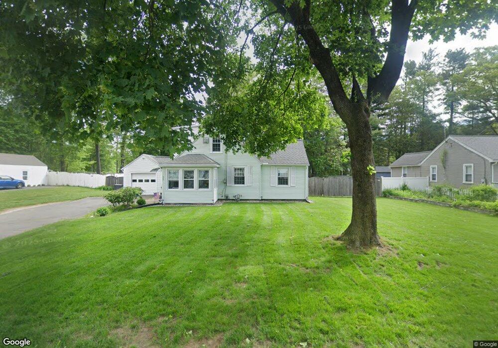
228 Springdale Rd Westfield, MA 01085
Estimated Value: $272,000 - $355,000
2
Beds
2
Baths
948
Sq Ft
$330/Sq Ft
Est. Value
About This Home
This home is located at 228 Springdale Rd, Westfield, MA 01085 and is currently estimated at $313,269, approximately $330 per square foot. 228 Springdale Rd is a home located in Hampden County with nearby schools including Westfield High School and Saint Mary High School.
Ownership History
Date
Name
Owned For
Owner Type
Purchase Details
Closed on
Jun 27, 2017
Sold by
Cavanaugh Lynda M
Bought by
Dalton Daniel P
Current Estimated Value
Home Financials for this Owner
Home Financials are based on the most recent Mortgage that was taken out on this home.
Original Mortgage
$153,664
Outstanding Balance
$129,318
Interest Rate
4.37%
Mortgage Type
FHA
Estimated Equity
$183,951
Purchase Details
Closed on
Jun 29, 1984
Bought by
Regan Kevin J and Cavanaugh Lynda M
Create a Home Valuation Report for This Property
The Home Valuation Report is an in-depth analysis detailing your home's value as well as a comparison with similar homes in the area
Home Values in the Area
Average Home Value in this Area
Purchase History
| Date | Buyer | Sale Price | Title Company |
|---|---|---|---|
| Dalton Daniel P | $156,500 | -- | |
| Regan Kevin J | -- | -- |
Source: Public Records
Mortgage History
| Date | Status | Borrower | Loan Amount |
|---|---|---|---|
| Open | Dalton Daniel P | $153,664 | |
| Previous Owner | Regan Kevin J | $50,000 | |
| Previous Owner | Regan Kevin J | $23,000 | |
| Previous Owner | Regan Kevin J | $15,000 |
Source: Public Records
Tax History Compared to Growth
Tax History
| Year | Tax Paid | Tax Assessment Tax Assessment Total Assessment is a certain percentage of the fair market value that is determined by local assessors to be the total taxable value of land and additions on the property. | Land | Improvement |
|---|---|---|---|---|
| 2025 | $4,003 | $263,700 | $99,500 | $164,200 |
| 2024 | $3,997 | $250,300 | $90,500 | $159,800 |
| 2023 | $3,729 | $227,100 | $86,100 | $141,000 |
| 2022 | $3,729 | $201,700 | $76,700 | $125,000 |
| 2021 | $3,619 | $191,700 | $72,500 | $119,200 |
| 2020 | $3,523 | $183,000 | $72,500 | $110,500 |
| 2019 | $3,444 | $175,100 | $69,000 | $106,100 |
| 2018 | $3,390 | $175,100 | $69,000 | $106,100 |
| 2017 | $3,216 | $165,600 | $69,900 | $95,700 |
| 2016 | $3,219 | $165,600 | $69,900 | $95,700 |
| 2015 | $3,070 | $165,600 | $69,900 | $95,700 |
| 2014 | $2,294 | $165,600 | $69,900 | $95,700 |
Source: Public Records
Map
Nearby Homes
- 14 Lynnwood Dr
- 0 Holyoke Rd
- 26 Deepwoods Dr
- 119 Union St Unit 4
- 111 Union St Unit 6
- 99 Woodmont St
- 351 N Elm St
- 19 Arch Rd
- 72-74 Notre Dame St
- 120 Woodcliff Dr
- 9 Crown St
- 10 Ethan Ave
- Lot 3 Montgomery
- 3 Norton St
- 53 Bristol St
- 13 William St
- 13 Furrow St
- 97 Mechanic St
- 48 Murray Ave
- 40 Prospect St Unit 2F
- 220 Springdale Rd
- 238 Springdale Rd
- 223 Springdale Rd
- 231 Springdale Rd
- 27 Lynnwood Dr
- 246 Springdale Rd
- 33 Lynnwood Dr
- 215 Springdale Rd
- 239 Springdale Rd
- 23 Lynnwood Dr
- 204 Springdale Rd
- 207 Springdale Rd
- 247 Springdale Rd
- 19 Lynnwood Dr
- 12 Denise Dr
- 16 Denise Dr
- 252 Springdale Rd
- 10 Denise Dr
- 20 Denise Dr
- 196 Springdale Rd