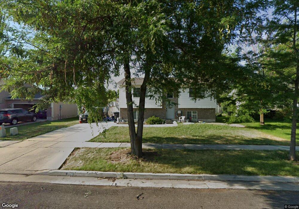
228 Sunstone Cir Logan, UT 84321
Woodruff NeighborhoodEstimated Value: $362,000 - $402,000
4
Beds
2
Baths
1,829
Sq Ft
$209/Sq Ft
Est. Value
About This Home
This home is located at 228 Sunstone Cir, Logan, UT 84321 and is currently estimated at $381,510, approximately $208 per square foot. 228 Sunstone Cir is a home located in Cache County with nearby schools including Woodruff School, Mount Logan Middle School, and Logan High School.
Ownership History
Date
Name
Owned For
Owner Type
Purchase Details
Closed on
Mar 30, 2016
Sold by
Olson Ryan Paul and Olson Kelli Anne Marie
Bought by
Lagasse Sharlene C
Current Estimated Value
Home Financials for this Owner
Home Financials are based on the most recent Mortgage that was taken out on this home.
Original Mortgage
$155,138
Outstanding Balance
$120,786
Interest Rate
3.25%
Mortgage Type
FHA
Estimated Equity
$260,724
Purchase Details
Closed on
Mar 21, 2002
Sold by
Sierra Homes Llc
Bought by
Anderson William E and Anderson Leslie S
Home Financials for this Owner
Home Financials are based on the most recent Mortgage that was taken out on this home.
Original Mortgage
$104,362
Interest Rate
6.78%
Purchase Details
Closed on
Nov 5, 2001
Sold by
Paramount Land Llc
Bought by
Sierra Homes Llc
Create a Home Valuation Report for This Property
The Home Valuation Report is an in-depth analysis detailing your home's value as well as a comparison with similar homes in the area
Home Values in the Area
Average Home Value in this Area
Purchase History
| Date | Buyer | Sale Price | Title Company |
|---|---|---|---|
| Lagasse Sharlene C | -- | American Secure Title Logan | |
| Anderson William E | -- | Advanced Title Co | |
| Sierra Homes Llc | -- | American Secure Title |
Source: Public Records
Mortgage History
| Date | Status | Borrower | Loan Amount |
|---|---|---|---|
| Open | Lagasse Sharlene C | $155,138 | |
| Previous Owner | Anderson William E | $104,362 |
Source: Public Records
Tax History
| Year | Tax Paid | Tax Assessment Tax Assessment Total Assessment is a certain percentage of the fair market value that is determined by local assessors to be the total taxable value of land and additions on the property. | Land | Improvement |
|---|---|---|---|---|
| 2025 | $1,685 | $217,895 | $0 | $0 |
| 2024 | $1,728 | $216,480 | $0 | $0 |
| 2023 | $1,788 | $213,450 | $0 | $0 |
| 2022 | $1,628 | $181,550 | $0 | $0 |
| 2021 | $1,582 | $272,475 | $42,000 | $230,475 |
| 2020 | $1,193 | $184,945 | $42,000 | $142,945 |
| 2019 | $1,247 | $184,945 | $42,000 | $142,945 |
| 2018 | $1,228 | $166,300 | $42,000 | $124,300 |
| 2017 | $1,137 | $81,400 | $0 | $0 |
| 2016 | $1,179 | $81,400 | $0 | $0 |
| 2015 | $1,036 | $71,500 | $0 | $0 |
| 2014 | $937 | $71,500 | $0 | $0 |
| 2013 | -- | $71,500 | $0 | $0 |
Source: Public Records
Map
Nearby Homes
- 1400 S 940 W
- 952 W 330 S
- 1031 W 350 S
- 1099 Three Pointe Ave
- 370 S 1200 W Unit 2
- 501 Southwest St
- 245 S 1280 W
- 553 Center Ave
- 508 S 1215 W Unit 144
- 562 S 1215 W Unit 135
- 539 S 1215 W Unit 129
- 545 S 1215 W
- 658 W 500 S
- 551 S 1215 W Unit 131
- 551 S 1215 W
- 1214 W 575 S
- 226 S 600 W
- 1239 W 575 S
- 1615 Silver Canoe Way
- 320 W 100 S
- 226 Sunstone Cir
- 230 Sunstone Cir
- 967 W 330 S
- 977 W 330 S
- 957 W 330 S
- 224 Sunstone Cir
- 232 Sunstone Cir Unit 28
- 227 Sunstone Cir
- 987 W 330 S
- 947 W 330 S
- 987 W 330 S
- 237 Sunstone Cir
- 229 Sunstone Cir
- 225 Sunstone Cir
- 234 Sunstone Cir
- 222 Sunstone Cir
- 937 W 330 S
- 997 W 330 S
- 223 Sunstone Cir
- 241 Sunstone Cir
Your Personal Tour Guide
Ask me questions while you tour the home.