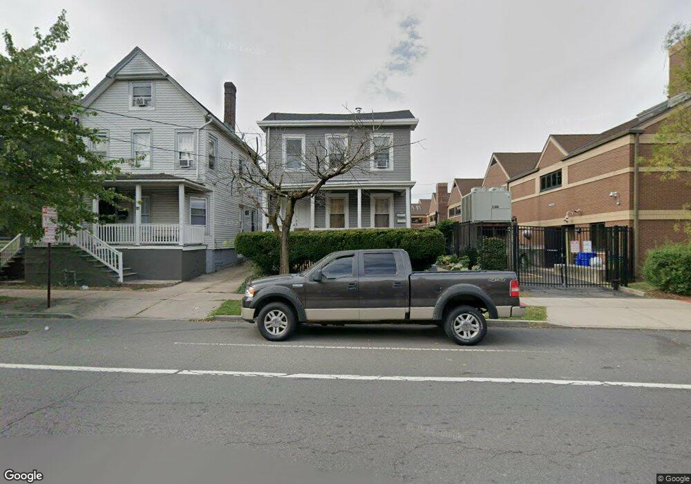
228 Suydam St New Brunswick, NJ 08901
Estimated Value: $354,000 - $501,000
--
Bed
--
Bath
1,996
Sq Ft
$220/Sq Ft
Est. Value
About This Home
This home is located at 228 Suydam St, New Brunswick, NJ 08901 and is currently estimated at $438,414, approximately $219 per square foot. 228 Suydam St is a home located in Middlesex County with nearby schools including New Brunswick High School and Central Jersey College Prep Charter School.
Ownership History
Date
Name
Owned For
Owner Type
Purchase Details
Closed on
Mar 28, 2023
Sold by
Grove Timothy and Grove Ana Maria
Bought by
Grove Living Trust
Current Estimated Value
Purchase Details
Closed on
Jul 6, 2001
Sold by
Hayes Thomas
Bought by
Grove Timothy and Grove Ana Maria
Home Financials for this Owner
Home Financials are based on the most recent Mortgage that was taken out on this home.
Original Mortgage
$104,400
Interest Rate
7.18%
Create a Home Valuation Report for This Property
The Home Valuation Report is an in-depth analysis detailing your home's value as well as a comparison with similar homes in the area
Home Values in the Area
Average Home Value in this Area
Purchase History
| Date | Buyer | Sale Price | Title Company |
|---|---|---|---|
| Grove Living Trust | -- | -- | |
| Grove Living Trust | -- | None Listed On Document | |
| Grove Timothy | $116,000 | -- |
Source: Public Records
Mortgage History
| Date | Status | Borrower | Loan Amount |
|---|---|---|---|
| Previous Owner | Grove Timothy | $104,400 |
Source: Public Records
Tax History Compared to Growth
Tax History
| Year | Tax Paid | Tax Assessment Tax Assessment Total Assessment is a certain percentage of the fair market value that is determined by local assessors to be the total taxable value of land and additions on the property. | Land | Improvement |
|---|---|---|---|---|
| 2025 | $4,879 | $186,300 | $73,600 | $112,700 |
| 2024 | $4,738 | $186,300 | $73,600 | $112,700 |
| 2023 | $4,738 | $186,300 | $73,600 | $112,700 |
| 2022 | $4,637 | $186,300 | $73,600 | $112,700 |
| 2021 | $3,440 | $186,300 | $73,600 | $112,700 |
| 2020 | $4,602 | $186,300 | $73,600 | $112,700 |
| 2019 | $4,514 | $186,300 | $73,600 | $112,700 |
| 2018 | $4,412 | $186,300 | $73,600 | $112,700 |
| 2017 | $4,236 | $186,300 | $73,600 | $112,700 |
| 2016 | $6,347 | $108,200 | $20,700 | $87,500 |
| 2015 | $6,196 | $108,200 | $20,700 | $87,500 |
| 2014 | $6,085 | $108,200 | $20,700 | $87,500 |
Source: Public Records
Map
Nearby Homes
- 34 Lee Ave
- 216 Handy St
- 214 Redmond St
- 163 Livingston Ave
- 264 Seaman St
- 186 Townsend St
- 267 Handy St
- 74 Welton St
- 168 Redmond St
- 68 Welton St
- 114 Joyce Kilmer Ave
- 290 Redmond St
- 122A Remsen Ave Unit A
- 122B Remsen Ave Unit A
- 128 Remsen Ave Unit A
- 128A Remsen Ave
- 130 Joyce Kilmer Ave
- 20 Livingston Ave Unit 601
- 73 Carman St
- 158 Lee Ave
- 226 Suydam St
- 224 Suydam St
- 222 Suydam St
- 218 Suydam St
- 120 Livingston Ave
- 216 Suydam St
- 219 Seaman St
- 214 Suydam St
- 217 Seaman St
- 121 Livingston Ave Unit 3
- 121 Livingston Ave
- 215 Seaman St
- 217 Suydam St
- 212 Suydam St
- 213 Seaman St
- 213 Suydam St
- 210 Suydam St
- 142 Livingston Ave Unit 1-8
- 142 Livingston Ave Unit 8
- 142 Livingston Ave Unit 7