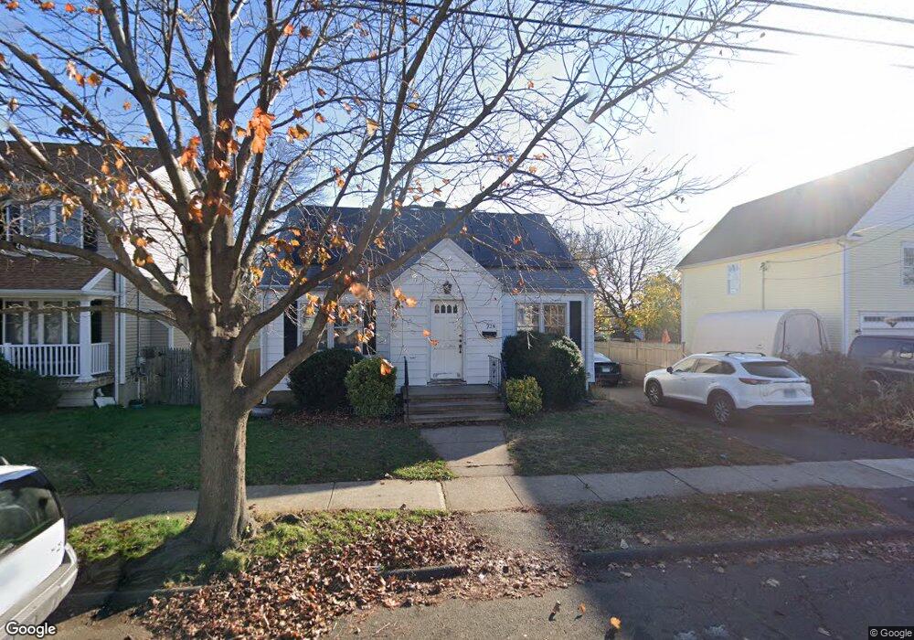
228 Swanson Ave Stratford, CT 06614
Estimated Value: $406,489 - $454,000
3
Beds
2
Baths
1,624
Sq Ft
$265/Sq Ft
Est. Value
About This Home
This home is located at 228 Swanson Ave, Stratford, CT 06614 and is currently estimated at $430,872, approximately $265 per square foot. 228 Swanson Ave is a home located in Fairfield County with nearby schools including Nichols Elementary School, David Wooster Middle School, and Stratford High School.
Ownership History
Date
Name
Owned For
Owner Type
Purchase Details
Closed on
Apr 9, 2007
Sold by
Donald Semanchic Andrew and Donald Semanchic
Bought by
Prime Property Llc
Current Estimated Value
Home Financials for this Owner
Home Financials are based on the most recent Mortgage that was taken out on this home.
Original Mortgage
$285,000
Interest Rate
6.25%
Create a Home Valuation Report for This Property
The Home Valuation Report is an in-depth analysis detailing your home's value as well as a comparison with similar homes in the area
Home Values in the Area
Average Home Value in this Area
Purchase History
| Date | Buyer | Sale Price | Title Company |
|---|---|---|---|
| Prime Property Llc | $49,000 | -- | |
| Filotei Robert | $320,000 | -- |
Source: Public Records
Mortgage History
| Date | Status | Borrower | Loan Amount |
|---|---|---|---|
| Open | Filotei Robert | $284,500 | |
| Closed | Filotei Robert | $285,000 |
Source: Public Records
Tax History Compared to Growth
Tax History
| Year | Tax Paid | Tax Assessment Tax Assessment Total Assessment is a certain percentage of the fair market value that is determined by local assessors to be the total taxable value of land and additions on the property. | Land | Improvement |
|---|---|---|---|---|
| 2025 | $5,687 | $141,470 | $63,560 | $77,910 |
| 2024 | $5,687 | $141,470 | $63,560 | $77,910 |
| 2023 | $5,687 | $141,470 | $63,560 | $77,910 |
| 2022 | $5,582 | $141,470 | $63,560 | $77,910 |
| 2021 | $5,584 | $141,470 | $63,560 | $77,910 |
| 2020 | $5,608 | $141,470 | $63,560 | $77,910 |
| 2019 | $5,612 | $140,770 | $54,390 | $86,380 |
| 2018 | $5,617 | $140,770 | $54,390 | $86,380 |
| 2017 | $5,627 | $140,770 | $54,390 | $86,380 |
| 2016 | $5,489 | $140,770 | $54,390 | $86,380 |
| 2015 | $5,206 | $140,770 | $54,390 | $86,380 |
| 2014 | $5,764 | $161,770 | $68,810 | $92,960 |
Source: Public Records
Map
Nearby Homes
- 271 Swanson Ave
- 172 Swanson Ave
- 210 Wiklund Ave
- 117 Canaan Ct Unit Bld 81, 18
- 127 Canaan Ct Unit 13 Building 82
- 425 Wiklund Ave
- 422 Swanson Ave
- 23 Baird Ct Unit 23
- 424 Light St
- 88 Bdlg 84 Canaan Ct Unit 11
- 152 Stonybrook Rd
- 490 Success Ave Unit 11
- 440 Success Ave Unit BLDG-86, APT-18
- 561 Canaan Rd
- 744 Canaan Rd Unit 23
- 123 Klondike St
- 55 Fisher Ct
- 202 Canaan Rd
- 216 Clover St
- 290 N Bishop Bishop Ave Unit 12
- 240 Swanson Ave
- 250 Swanson Ave
- 231 Swanson Ave
- 245 Swanson Ave
- 255 Wiklund Ave
- 235 Wiklund Ave
- 216 Swanson Ave
- 200 Swanson Ave
- 260 Swanson Ave
- 215 Wiklund Ave
- 221 Swanson Ave
- 251 Swanson Ave
- 265 Wiklund Ave
- 270 Swanson Ave
- 211 Swanson Ave
- 190 Swanson Ave
- 205 Swanson Ave
- 285 Wiklund Ave
- 205 Wiklund Ave
- 270 Wiklund Ave