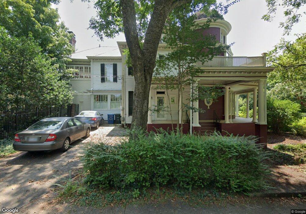
228 W Bank St Salisbury, NC 28144
Estimated Value: $608,000 - $706,324
--
Bed
3
Baths
5,407
Sq Ft
$122/Sq Ft
Est. Value
About This Home
This home is located at 228 W Bank St, Salisbury, NC 28144 and is currently estimated at $658,581, approximately $121 per square foot. 228 W Bank St is a home located in Rowan County with nearby schools including Carroll T Overton Elementary School, Knox Middle School, and North Rowan Middle School.
Ownership History
Date
Name
Owned For
Owner Type
Purchase Details
Closed on
May 20, 2022
Sold by
Huffman Dale P
Bought by
Cernohorsky Randall L and Causby John R
Current Estimated Value
Home Financials for this Owner
Home Financials are based on the most recent Mortgage that was taken out on this home.
Original Mortgage
$309,997
Outstanding Balance
$294,490
Interest Rate
5.25%
Mortgage Type
Balloon
Estimated Equity
$364,091
Purchase Details
Closed on
Apr 27, 1994
Bought by
Huffman Richard L and Huffman Wf
Create a Home Valuation Report for This Property
The Home Valuation Report is an in-depth analysis detailing your home's value as well as a comparison with similar homes in the area
Home Values in the Area
Average Home Value in this Area
Purchase History
| Date | Buyer | Sale Price | Title Company |
|---|---|---|---|
| Cernohorsky Randall L | $630,000 | Law Office Of Jeffrey Grant Ko | |
| Huffman Richard L | $95,500 | -- |
Source: Public Records
Mortgage History
| Date | Status | Borrower | Loan Amount |
|---|---|---|---|
| Open | Cernohorsky Randall L | $309,997 |
Source: Public Records
Tax History Compared to Growth
Tax History
| Year | Tax Paid | Tax Assessment Tax Assessment Total Assessment is a certain percentage of the fair market value that is determined by local assessors to be the total taxable value of land and additions on the property. | Land | Improvement |
|---|---|---|---|---|
| 2025 | $7,443 | $622,285 | $52,250 | $570,035 |
| 2024 | $7,443 | $622,285 | $52,250 | $570,035 |
| 2023 | $7,443 | $622,285 | $52,250 | $570,035 |
| 2022 | $5,860 | $425,553 | $52,250 | $373,303 |
| 2021 | $5,860 | $425,553 | $52,250 | $373,303 |
| 2020 | $5,860 | $425,553 | $52,250 | $373,303 |
| 2019 | $5,860 | $425,553 | $52,250 | $373,303 |
| 2018 | $5,400 | $397,455 | $52,250 | $345,205 |
| 2017 | $5,372 | $397,455 | $52,250 | $345,205 |
| 2016 | $5,224 | $397,455 | $52,250 | $345,205 |
| 2015 | $5,256 | $397,455 | $52,250 | $345,205 |
| 2014 | $5,356 | $409,854 | $52,250 | $357,604 |
Source: Public Records
Map
Nearby Homes
- 321 W Bank St
- 300 W Horah St
- 322 S Church St
- 300 S Main St Unit K
- 1205 Kildare Dr Unit 5
- 1215 Kildare Dr Unit 6
- 1040 Beckham Rd
- 1210 Kildare Dr Unit 80
- 1160 Kildare Dr Unit 76
- 1175 Kildare Dr Unit 3
- 209 S Main St
- 414 S Fulton St
- 418 S Fulton St
- 408 S Ellis St
- 123 N Main St
- 515 W Council St
- 525 W Horah St Unit Lot 9
- 326 S Caldwell St
- 119 S Lee St Unit 3
- 301 N Fulton St
- 226 S Jackson St
- 318 W Bank St
- 229 W Bank St Unit A
- 229 W Bank St
- 229 W Bank St Unit Lot A
- 210 S Jackson St
- 210 S Jackson St
- 223 W Bank St
- 223 W Bank St
- 301 W Fisher St
- 303 W Bank St
- 209 W Bank St
- 326 W Bank St
- 307 W Fisher St
- 313 W Fisher St
- 203 W Bank St
- 219 S Fulton St
- 209 S Fulton St
- 201 S Fulton St
- 218 W Horah St