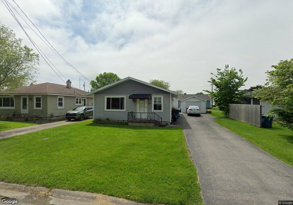
228 Walnut St Port Clinton, OH 43452
Estimated Value: $160,000 - $207,000
3
Beds
1
Bath
1,040
Sq Ft
$173/Sq Ft
Est. Value
About This Home
This home is located at 228 Walnut St, Port Clinton, OH 43452 and is currently estimated at $180,116, approximately $173 per square foot. 228 Walnut St is a home located in Ottawa County with nearby schools including Bataan Memorial Primary School, Bataan Memorial Intermediate School, and Port Clinton Middle School.
Ownership History
Date
Name
Owned For
Owner Type
Purchase Details
Closed on
Jun 17, 2003
Sold by
Bordner Paul E
Bought by
Joseph Steven L
Current Estimated Value
Home Financials for this Owner
Home Financials are based on the most recent Mortgage that was taken out on this home.
Original Mortgage
$83,125
Outstanding Balance
$36,228
Interest Rate
5.71%
Mortgage Type
Purchase Money Mortgage
Estimated Equity
$143,888
Purchase Details
Closed on
Feb 1, 1994
Sold by
Lorensen Eugene and Lorensen Rissa
Bought by
Bordner Paul E
Create a Home Valuation Report for This Property
The Home Valuation Report is an in-depth analysis detailing your home's value as well as a comparison with similar homes in the area
Home Values in the Area
Average Home Value in this Area
Purchase History
| Date | Buyer | Sale Price | Title Company |
|---|---|---|---|
| Joseph Steven L | $87,500 | Hartung | |
| Bordner Paul E | $65,000 | -- |
Source: Public Records
Mortgage History
| Date | Status | Borrower | Loan Amount |
|---|---|---|---|
| Open | Joseph Steven L | $83,125 |
Source: Public Records
Tax History Compared to Growth
Tax History
| Year | Tax Paid | Tax Assessment Tax Assessment Total Assessment is a certain percentage of the fair market value that is determined by local assessors to be the total taxable value of land and additions on the property. | Land | Improvement |
|---|---|---|---|---|
| 2024 | $1,426 | $41,147 | $11,722 | $29,425 |
| 2023 | $1,426 | $31,109 | $6,703 | $24,406 |
| 2022 | $1,207 | $31,109 | $6,703 | $24,406 |
| 2021 | $1,206 | $31,110 | $6,700 | $24,410 |
| 2020 | $934 | $25,220 | $4,360 | $20,860 |
| 2019 | $924 | $25,220 | $4,360 | $20,860 |
| 2018 | $923 | $25,220 | $4,360 | $20,860 |
| 2017 | $888 | $23,890 | $4,360 | $19,530 |
| 2016 | $890 | $23,890 | $4,360 | $19,530 |
| 2015 | $893 | $23,890 | $4,360 | $19,530 |
| 2014 | $432 | $22,930 | $4,360 | $18,570 |
| 2013 | $433 | $22,930 | $4,360 | $18,570 |
Source: Public Records
Map
Nearby Homes
- 1201 E 3rd St
- 35 N Beach St
- 29 N Beach St
- 214 Linden St
- 116 Walnut St
- 218 Elm St
- 801 E 3rd St
- 183 Driftwood Dr
- 188 Driftwood Dr
- 164 Driftwood Dr
- 115 Driftwood Dr
- 168 Morningside Dr
- 199 Morningside Dr
- 525 E 2nd St
- 521 E 2nd St
- 1801 E Perry St Unit 22
- 1807 E Perry St Unit 69
- 423 Fulton St
- 34 Grande Lake Dr Unit C
- 2321 E State Rd