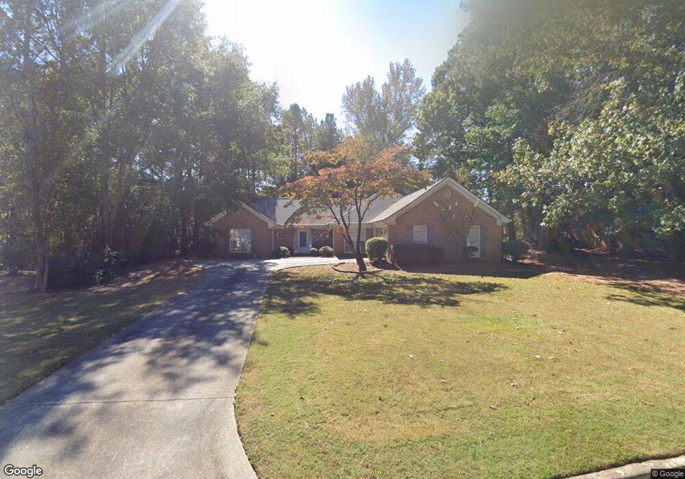
2280 Weatherstone Cir SE Conyers, GA 30094
Estimated Value: $346,476 - $436,000
3
Beds
3
Baths
2,541
Sq Ft
$158/Sq Ft
Est. Value
About This Home
This home is located at 2280 Weatherstone Cir SE, Conyers, GA 30094 and is currently estimated at $400,619, approximately $157 per square foot. 2280 Weatherstone Cir SE is a home located in Rockdale County with nearby schools including Flat Shoals Elementary School, Edwards Middle School, and Rockdale County High School.
Ownership History
Date
Name
Owned For
Owner Type
Purchase Details
Closed on
Sep 3, 2010
Sold by
Scagnelli Mary V
Bought by
Tillison Christopher
Current Estimated Value
Home Financials for this Owner
Home Financials are based on the most recent Mortgage that was taken out on this home.
Original Mortgage
$152,910
Outstanding Balance
$101,023
Interest Rate
4.45%
Mortgage Type
New Conventional
Estimated Equity
$299,597
Create a Home Valuation Report for This Property
The Home Valuation Report is an in-depth analysis detailing your home's value as well as a comparison with similar homes in the area
Home Values in the Area
Average Home Value in this Area
Purchase History
| Date | Buyer | Sale Price | Title Company |
|---|---|---|---|
| Tillison Christopher | $169,900 | -- |
Source: Public Records
Mortgage History
| Date | Status | Borrower | Loan Amount |
|---|---|---|---|
| Open | Tillison Christopher | $152,910 |
Source: Public Records
Tax History Compared to Growth
Tax History
| Year | Tax Paid | Tax Assessment Tax Assessment Total Assessment is a certain percentage of the fair market value that is determined by local assessors to be the total taxable value of land and additions on the property. | Land | Improvement |
|---|---|---|---|---|
| 2024 | $3,776 | $152,080 | $30,920 | $121,160 |
| 2023 | $3,118 | $131,280 | $30,800 | $100,480 |
| 2022 | $2,575 | $110,160 | $24,960 | $85,200 |
| 2021 | $2,268 | $92,480 | $20,800 | $71,680 |
| 2020 | $2,008 | $81,320 | $17,760 | $63,560 |
| 2019 | $1,844 | $74,360 | $10,800 | $63,560 |
| 2018 | $1,620 | $66,720 | $10,800 | $55,920 |
| 2017 | $1,503 | $62,320 | $10,800 | $51,520 |
| 2016 | $1,389 | $62,320 | $10,800 | $51,520 |
| 2015 | $1,175 | $54,840 | $9,320 | $45,520 |
| 2014 | $890 | $48,560 | $8,000 | $40,560 |
| 2013 | -- | $78,840 | $13,600 | $65,240 |
Source: Public Records
Map
Nearby Homes
- Boston Plan at Millers Pointe
- Atlanta Plan at Millers Pointe
- Columbus Plan at Millers Pointe
- 2464 Lennox Rd SE
- 2197 Boxwood Cir
- 2608 Downing Park Dr SE
- Astrid Plan at Alder Park
- Harrison Plan at Alder Park
- Baker Plan at Alder Park
- Oliver Plan at Alder Park
- 784 Stieff Ct SE
- 2537 Lennox Rd SE
- 340 Windsor Walk SE
- 660 Kirkus Dr SE
- 1420 Hillside Place SE
- 2631 Rolling Hills Way SE
- 309 Windsor Walk SE Unit 1
- 1508 Hillside Dr SE
- 1242 Saxony Dr SE
- 1601 Creek Crossing SE
- 2270 Weatherstone Cir SE Unit 2
- 2290 Weatherstone Cir SE
- 3020 Weldon Place SE Unit 5
- 2971 Weatherstone Cir SE Unit 5
- 2291 Weatherstone Cir SE
- 3010 Weldon Place SE
- 2260 Weatherstone Cir SE Unit 2
- 3031 Weldon Place SE
- 2251 Weatherstone Cir SE Unit 2
- 2951 Weatherstone Cir SE
- 2291 Wren Rd SE
- 2250 Weatherstone Cir SE
- 2310 Weatherstone Cir SE
- 3021 Weldon Place SE Unit 5
- 2970 Weatherstone Cir SE
- 2311 Weatherstone Cir SE
- 3000 Weldon Place SE Unit 5
- 2960 Weatherstone Cir SE
- 2241 Weatherstone Cir SE
- 2240 Weatherstone Cir SE Unit 2