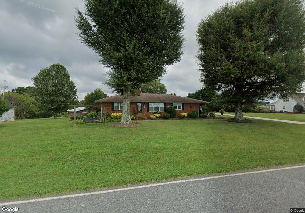
2281 Brevard Place Rd Iron Station, NC 28080
Estimated Value: $319,007 - $493,000
3
Beds
2
Baths
2,010
Sq Ft
$185/Sq Ft
Est. Value
About This Home
This home is located at 2281 Brevard Place Rd, Iron Station, NC 28080 and is currently estimated at $371,502, approximately $184 per square foot. 2281 Brevard Place Rd is a home located in Lincoln County with nearby schools including Iron Station Elementary School, East Lincoln Middle School, and East Lincoln High School.
Ownership History
Date
Name
Owned For
Owner Type
Purchase Details
Closed on
Aug 29, 2007
Sold by
Spaulding William and Spaulding Pamela
Bought by
Edwards Jerry Lamont and Edwards Teresa Carol
Current Estimated Value
Home Financials for this Owner
Home Financials are based on the most recent Mortgage that was taken out on this home.
Original Mortgage
$105,000
Outstanding Balance
$66,920
Interest Rate
6.7%
Mortgage Type
New Conventional
Estimated Equity
$304,582
Purchase Details
Closed on
Sep 27, 2001
Bought by
Spaulding William and Spaulding Pamela
Create a Home Valuation Report for This Property
The Home Valuation Report is an in-depth analysis detailing your home's value as well as a comparison with similar homes in the area
Home Values in the Area
Average Home Value in this Area
Purchase History
| Date | Buyer | Sale Price | Title Company |
|---|---|---|---|
| Edwards Jerry Lamont | $160,000 | None Available | |
| Spaulding William | $111,000 | -- |
Source: Public Records
Mortgage History
| Date | Status | Borrower | Loan Amount |
|---|---|---|---|
| Open | Edwards Jerry Lamont | $105,000 |
Source: Public Records
Tax History Compared to Growth
Tax History
| Year | Tax Paid | Tax Assessment Tax Assessment Total Assessment is a certain percentage of the fair market value that is determined by local assessors to be the total taxable value of land and additions on the property. | Land | Improvement |
|---|---|---|---|---|
| 2025 | $1,469 | $214,752 | $37,964 | $176,788 |
| 2024 | $1,449 | $214,752 | $37,964 | $176,788 |
| 2023 | $1,415 | $214,752 | $37,964 | $176,788 |
| 2022 | $1,281 | $158,519 | $26,976 | $131,543 |
| 2021 | $1,281 | $158,519 | $26,976 | $131,543 |
| 2020 | $1,134 | $158,519 | $26,976 | $131,543 |
| 2019 | $1,134 | $158,519 | $26,976 | $131,543 |
| 2018 | $1,039 | $128,948 | $25,440 | $103,508 |
| 2017 | $938 | $128,948 | $25,440 | $103,508 |
| 2016 | $938 | $128,948 | $25,440 | $103,508 |
| 2015 | $1,005 | $128,948 | $25,440 | $103,508 |
| 2014 | $1,013 | $131,421 | $30,425 | $100,996 |
Source: Public Records
Map
Nearby Homes
- 4394 Mountain Creek Rd
- 4364 Hager Mountain Ln
- 6 Hager Mountain Ln
- 222 Oakhill St
- 4859 Paysour Pond Rd
- 4435 Cornett Dr
- 3960 Orchard Rd
- 5486 E Highway 27
- 1279 Craig Dr
- 3388 Rhyne Forest Rd
- 1713 Oak Park Ct
- 1789 Doe Ct
- 1785 Doe Ct
- 5038 Arden Gate Dr
- 0 Wolf Rd Unit 8
- 5039 Penn Rd
- 1485 Adkin Dr
- 1615 Oak Park Ct
- Lot #42 Sardis Ct
- 713 Alexis Lucia Rd
- 2265 Brevard Place Rd
- 2301 Brevard Place Rd
- 2303 Brevard Place Rd
- 2245 Brevard Place Rd
- 2319 Brevard Place Rd
- 2318 Brevard Place Rd
- 2226 Brevard Place Rd
- 2327 Brevard Place Rd
- 2223 Brevard Place Rd
- 2334 Brevard Place Rd
- 2230 Brevard Place Rd
- 4180 John Ritchie Rd
- 9 & 10 John Ritchie Rd
- 2355 Brevard Place Rd
- 2278 Brevard Place Rd
- 2667 Long Cir
- 4125 John Ritchie Rd
- 4162 John Ritchie Rd
- 2174 Brevard Place Rd
- 2173 Brevard Place Rd