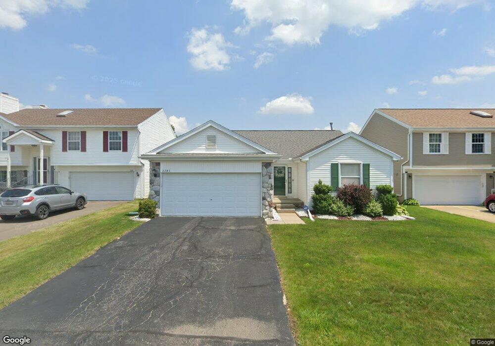
2281 W Miller Cir Unit 68 Westland, MI 48186
Estimated Value: $296,000 - $303,000
3
Beds
3
Baths
1,319
Sq Ft
$226/Sq Ft
Est. Value
About This Home
This home is located at 2281 W Miller Cir Unit 68, Westland, MI 48186 and is currently estimated at $298,675, approximately $226 per square foot. 2281 W Miller Cir Unit 68 is a home located in Wayne County with nearby schools including Adlai Stevenson Middle School, Wayne Memorial High School, and St Michael Lutheran School.
Ownership History
Date
Name
Owned For
Owner Type
Purchase Details
Closed on
Jun 16, 2009
Sold by
Onewest Bank Fsb
Bought by
Deutsche Bank National Trust Company
Current Estimated Value
Purchase Details
Closed on
Jun 3, 2009
Sold by
Labara Leanne
Bought by
Onewest Bank Fsb
Purchase Details
Closed on
Jan 6, 2006
Sold by
Celmo Anthony Larry and Celmo Ellen Lynne
Bought by
Labara Leanne
Purchase Details
Closed on
Jan 7, 2004
Sold by
Celmo Anthony Larry and Celmo Ellen Lynne
Bought by
Wolverine State Investment Fund
Create a Home Valuation Report for This Property
The Home Valuation Report is an in-depth analysis detailing your home's value as well as a comparison with similar homes in the area
Home Values in the Area
Average Home Value in this Area
Purchase History
| Date | Buyer | Sale Price | Title Company |
|---|---|---|---|
| Deutsche Bank National Trust Company | -- | None Available | |
| Onewest Bank Fsb | $81,000 | None Available | |
| Labara Leanne | $194,670 | Metropolitan Title Company | |
| Wolverine State Investment Fund | $100,897 | -- |
Source: Public Records
Tax History Compared to Growth
Tax History
| Year | Tax Paid | Tax Assessment Tax Assessment Total Assessment is a certain percentage of the fair market value that is determined by local assessors to be the total taxable value of land and additions on the property. | Land | Improvement |
|---|---|---|---|---|
| 2025 | $2,656 | $129,800 | $0 | $0 |
| 2024 | $2,656 | $121,400 | $0 | $0 |
| 2023 | $2,717 | $112,300 | $0 | $0 |
| 2022 | $2,879 | $94,400 | $0 | $0 |
| 2021 | $5,767 | $89,100 | $0 | $0 |
| 2020 | $2,778 | $81,900 | $0 | $0 |
| 2019 | $2,677 | $78,000 | $0 | $0 |
| 2018 | $2,086 | $71,500 | $0 | $0 |
| 2017 | $856 | $70,000 | $0 | $0 |
| 2016 | $2,574 | $71,300 | $0 | $0 |
| 2015 | $5,117 | $62,350 | $0 | $0 |
| 2013 | $4,957 | $51,920 | $0 | $0 |
| 2012 | $2,480 | $50,720 | $0 | $0 |
Source: Public Records
Map
Nearby Homes
- 38185 Palmateer Rd
- 2601 Dagner Dr
- 38692 Watson Cir
- 1639 Tulip Ln
- 1786 Daisey Ln Unit 32
- 3020 Rivers Edge Dr
- 3329 S Newburgh Rd
- 2268 Minerva St
- 3018 Rivers Edge Dr N
- 2232 Wilshire St
- 00000 Avondale St
- 2610 Hannan Rd
- 00 S Newburgh Rd
- 0 S Newburgh Rd
- 2618 Hannan Rd
- 36795 Greenbush Rd
- 39258 Avondale St
- 36255 Manila Ave
- 3490 Hannan Rd
- 39288 Nottingham St
- 2301 W Miller Cir
- 2261 W Miller Cir Unit 69
- 2321 W Miller Cir
- 2241 W Miller Cir
- 2280 Stockmeyer Blvd
- 2300 Stockmeyer Blvd
- 2260 Stockmeyer Blvd Unit 81
- 2290 W Miller Cir Unit 61
- 2270 W Miller Cir Unit 60
- 2310 W Miller Cir Unit 62
- 2320 Stockmeyer Blvd Unit 84
- 2341 W Miller Cir
- 2221 W Miller Cir
- 2240 Stockmeyer Blvd
- 2250 W Miller Cir
- 2350 W Miller Cir Unit 63
- 2230 W Miller Cir Unit 58
- 2220 Stockmeyer Blvd
- 2340 Stockmeyer Blvd
- 2201 W Miller Cir