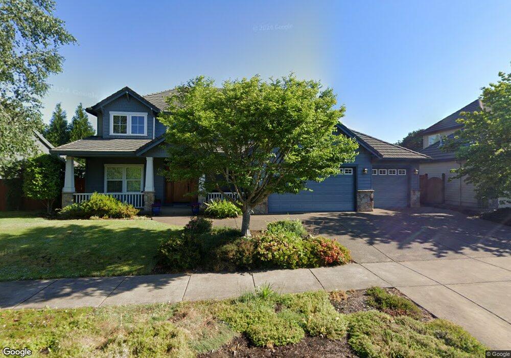
2283 Avengale Dr Eugene, OR 97408
Cal Young NeighborhoodEstimated Value: $836,945 - $1,099,000
4
Beds
3
Baths
2,808
Sq Ft
$351/Sq Ft
Est. Value
About This Home
This home is located at 2283 Avengale Dr, Eugene, OR 97408 and is currently estimated at $986,486, approximately $351 per square foot. 2283 Avengale Dr is a home with nearby schools including Gilham Elementary School, Cal Young Middle School, and Sheldon High School.
Ownership History
Date
Name
Owned For
Owner Type
Purchase Details
Closed on
Oct 20, 2004
Sold by
Character Homes Inc
Bought by
Buchanan Glenn S and Buchanan Renee L
Current Estimated Value
Home Financials for this Owner
Home Financials are based on the most recent Mortgage that was taken out on this home.
Original Mortgage
$333,468
Interest Rate
5.82%
Mortgage Type
Purchase Money Mortgage
Purchase Details
Closed on
May 14, 2004
Sold by
Kersey Daniel J and Kersey Christine
Bought by
Character Homes Inc
Create a Home Valuation Report for This Property
The Home Valuation Report is an in-depth analysis detailing your home's value as well as a comparison with similar homes in the area
Home Values in the Area
Average Home Value in this Area
Purchase History
| Date | Buyer | Sale Price | Title Company |
|---|---|---|---|
| Buchanan Glenn S | $416,836 | Western Pioneer Title Co | |
| Character Homes Inc | $72,900 | Western Pioneer Title Co |
Source: Public Records
Mortgage History
| Date | Status | Borrower | Loan Amount |
|---|---|---|---|
| Closed | Buchanan Glenn S | $333,468 | |
| Closed | Buchanan Glenn S | $83,368 |
Source: Public Records
Tax History
| Year | Tax Paid | Tax Assessment Tax Assessment Total Assessment is a certain percentage of the fair market value that is determined by local assessors to be the total taxable value of land and additions on the property. | Land | Improvement |
|---|---|---|---|---|
| 2025 | $11,356 | $582,839 | -- | -- |
| 2024 | $11,215 | $565,864 | -- | -- |
| 2023 | $11,215 | $549,383 | $0 | $0 |
| 2022 | $10,506 | $533,382 | $0 | $0 |
| 2021 | $9,585 | $517,847 | $0 | $0 |
| 2020 | $9,425 | $502,765 | $0 | $0 |
| 2019 | $9,122 | $488,122 | $0 | $0 |
| 2018 | $8,573 | $460,102 | $0 | $0 |
| 2017 | $8,119 | $460,102 | $0 | $0 |
| 2016 | $7,826 | $446,701 | $0 | $0 |
| 2015 | $7,613 | $433,690 | $0 | $0 |
| 2014 | $7,500 | $421,058 | $0 | $0 |
Source: Public Records
Map
Nearby Homes
- 3689 Marcella Dr
- 3620 Walton Ln
- 3380 Honeywood St
- 2120 Ashbury Dr
- 2138 Country Haven Dr
- 3708 Gilham Rd
- 2063 Lake Wind Dr
- 2099 Lake Shore Dr
- 1923 Sterling Park Place
- 3329 Lake Wood Dr
- 1880 Lake Cove Ave
- 2053 Lakeview Dr
- 3328 Lakemont Dr
- 3858 Mirror Pond Way
- 2461 Mountain Terrace
- 3770 Waterbrook Way
- 3428 River Pointe Dr
- 3435 Meadow View Dr
- 2527 Park View Dr
- 3105 Wolf Meadows Ln
- 2283 Dale Ave
- 2299 Avengale Dr
- 2261 Avengale Dr
- 3719 Norwich Ave
- 2298 Avengale Dr
- 2284 Avengale Dr
- 2307 Avengale Dr
- 3723 Norwich Ave
- 3715 Norwich Ave
- 2262 Avengale Dr
- 3713 Norwich Ave
- 3595 Celeste Way
- 3727 Norwich Ave
- 3520 Celeste Way
- 3630 Marcella Dr
- 2285 Comstock Ave
- 2250 Avengale Dr
- 2273 Comstock Ave
- 3711 Norwich Ave
- 3515 Celeste Way
Your Personal Tour Guide
Ask me questions while you tour the home.