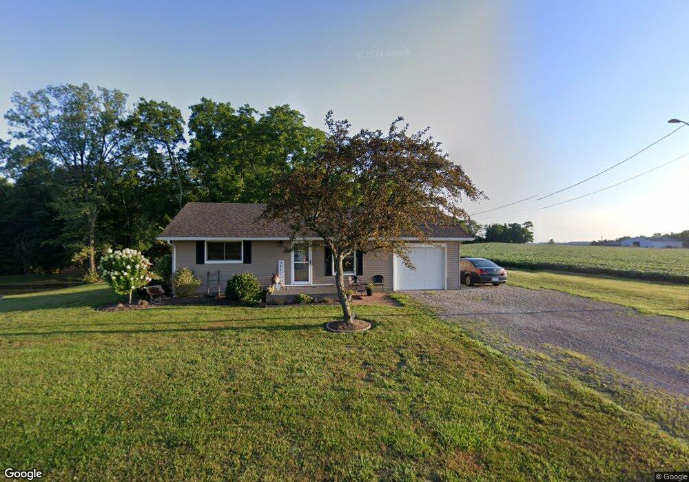
2283 Cattail Rd Chillicothe, OH 45601
Estimated Value: $154,000 - $243,000
2
Beds
1
Bath
768
Sq Ft
$254/Sq Ft
Est. Value
About This Home
This home is located at 2283 Cattail Rd, Chillicothe, OH 45601 and is currently estimated at $195,357, approximately $254 per square foot. 2283 Cattail Rd is a home located in Ross County with nearby schools including Unioto Elementary School, Unioto Middle School, and Unioto High School.
Ownership History
Date
Name
Owned For
Owner Type
Purchase Details
Closed on
Nov 28, 2012
Sold by
Efaw Rachel B and Mizer Rachel B
Bought by
Efaw Rachel B and Efaw Brian M
Current Estimated Value
Home Financials for this Owner
Home Financials are based on the most recent Mortgage that was taken out on this home.
Original Mortgage
$82,000
Interest Rate
3.38%
Mortgage Type
New Conventional
Purchase Details
Closed on
Apr 28, 2008
Sold by
Steinhausser David L and Steinhausser Pamela S
Bought by
Mizer Rachel B
Home Financials for this Owner
Home Financials are based on the most recent Mortgage that was taken out on this home.
Original Mortgage
$65,000
Interest Rate
5.93%
Mortgage Type
Purchase Money Mortgage
Purchase Details
Closed on
Dec 12, 2005
Sold by
Steinhausser David L and Steinhausser Apmela S
Bought by
Steinhausser David L and Steinhausser Pamela S
Create a Home Valuation Report for This Property
The Home Valuation Report is an in-depth analysis detailing your home's value as well as a comparison with similar homes in the area
Home Values in the Area
Average Home Value in this Area
Purchase History
| Date | Buyer | Sale Price | Title Company |
|---|---|---|---|
| Efaw Rachel B | -- | Technetitle Agency Inc | |
| Mizer Rachel B | $65,000 | Hostetler Title | |
| Steinhausser David L | -- | None Available |
Source: Public Records
Mortgage History
| Date | Status | Borrower | Loan Amount |
|---|---|---|---|
| Previous Owner | Efaw Rachel B | $82,000 | |
| Previous Owner | Mizer Rachel B | $65,000 |
Source: Public Records
Tax History Compared to Growth
Tax History
| Year | Tax Paid | Tax Assessment Tax Assessment Total Assessment is a certain percentage of the fair market value that is determined by local assessors to be the total taxable value of land and additions on the property. | Land | Improvement |
|---|---|---|---|---|
| 2024 | $1,461 | $42,120 | $6,000 | $36,120 |
| 2023 | $1,461 | $42,120 | $6,000 | $36,120 |
| 2022 | $1,494 | $42,120 | $6,000 | $36,120 |
| 2021 | $1,135 | $30,000 | $4,630 | $25,370 |
| 2020 | $1,141 | $30,000 | $4,630 | $25,370 |
| 2019 | $1,141 | $30,000 | $4,630 | $25,370 |
| 2018 | $985 | $25,380 | $4,300 | $21,080 |
| 2017 | $987 | $20,470 | $4,300 | $16,170 |
| 2016 | $772 | $20,470 | $4,300 | $16,170 |
| 2015 | $729 | $19,150 | $4,300 | $14,850 |
| 2014 | $711 | $19,150 | $4,300 | $14,850 |
| 2013 | $715 | $19,150 | $4,300 | $14,850 |
Source: Public Records
Map
Nearby Homes
- 11303 County Road 550
- 10217 County Road 550
- 500 Old Elm Rd
- 1667 Stone Rd Unit Lot 59
- 435 Mount Carmel Rd
- 265 Brookside Dr
- 12690 Pleasant Valley Rd
- 25 Woodland Way
- 2153 Egypt Pike
- 559 Golfview Dr
- 365 Golfview Dr
- 2391 Simmons Rd
- 13223 Pleasant Valley Rd
- 45 Custer Dr
- 1036 Clinton Rd
- 18 Sarah Ct
- 54 Moccasin Dr
- 313 Goodale Dr
- 420 Steiner Rd
- 9942 Egypt Pike
- 2091 Cattail Rd
- 2061 Cattail Rd
- 2061 Cattail Rd
- 2061 Cattail Rd
- 2039 Cattail Rd
- 2039 Cattail Rd
- 5496 Egypt Pike
- 5518 Egypt Pike
- 2033 Cattail Rd
- 2047 Cattail Rd
- 5384 Egypt Pike
- 5378 Egypt Pike
- 5592 Egypt Pike
- 1991 Cattail Rd
- 5739 Egypt Pike
- 5548 Egypt Pike
- 2490 Cattail Rd
- 5795 Egypt Pike
- 5791 Egypt Pike
- 5793 Egypt Pike