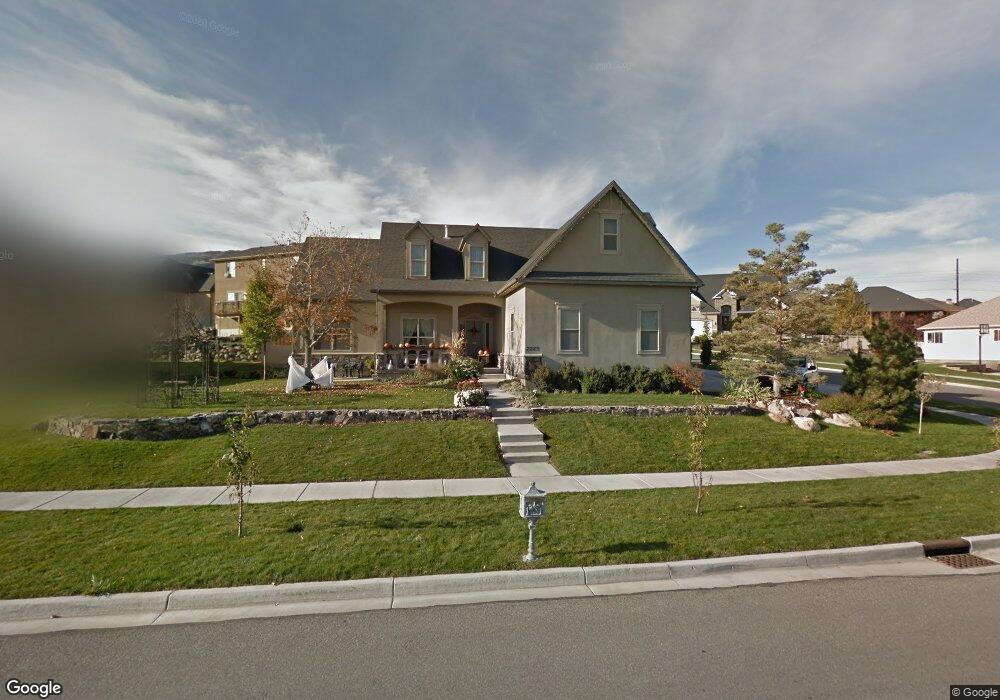
2283 Colt Dr Saratoga Springs, UT 84045
Estimated Value: $638,000 - $714,000
3
Beds
2
Baths
3,476
Sq Ft
$191/Sq Ft
Est. Value
About This Home
This home is located at 2283 Colt Dr, Saratoga Springs, UT 84045 and is currently estimated at $664,736, approximately $191 per square foot. 2283 Colt Dr is a home located in Utah County with nearby schools including Sage Hills Elementary School, Lake Mountain Middle School, and Westlake High School.
Ownership History
Date
Name
Owned For
Owner Type
Purchase Details
Closed on
Feb 21, 2025
Sold by
Taylor Arthur L and Taylor Linda J
Bought by
Arthur Taylor Jr Family Revocable Trust and Taylor
Current Estimated Value
Purchase Details
Closed on
Feb 19, 2021
Sold by
Taylor Arthur and Taylor Linda Jesse
Bought by
Taylor Arthur L and Taylor Linda J
Home Financials for this Owner
Home Financials are based on the most recent Mortgage that was taken out on this home.
Original Mortgage
$282,200
Interest Rate
2.7%
Mortgage Type
New Conventional
Purchase Details
Closed on
May 18, 2015
Sold by
Taylor Arthur
Bought by
Taylor Arthur and Taylor Linda Jesse
Home Financials for this Owner
Home Financials are based on the most recent Mortgage that was taken out on this home.
Original Mortgage
$307,515
Interest Rate
3.71%
Mortgage Type
New Conventional
Purchase Details
Closed on
Mar 19, 2015
Sold by
Kuykendall Rodney S and Kuykendall Shauna G
Bought by
Taylor Arthur
Home Financials for this Owner
Home Financials are based on the most recent Mortgage that was taken out on this home.
Original Mortgage
$307,515
Interest Rate
3.71%
Mortgage Type
New Conventional
Purchase Details
Closed on
May 28, 2013
Sold by
Kuykendall Rodney S and Kuykendall Shauna G
Bought by
Kuykenall Rodney S and Kuykenall Shauna G
Home Financials for this Owner
Home Financials are based on the most recent Mortgage that was taken out on this home.
Original Mortgage
$310,337
Interest Rate
4.4%
Mortgage Type
FHA
Purchase Details
Closed on
Mar 19, 2007
Sold by
Schwing Nathan and Schwing Mark
Bought by
Kuykendall Rodney S and Kuykendall Shauna G
Home Financials for this Owner
Home Financials are based on the most recent Mortgage that was taken out on this home.
Original Mortgage
$280,000
Interest Rate
6.1%
Mortgage Type
Purchase Money Mortgage
Purchase Details
Closed on
Nov 2, 2004
Sold by
Vision
Bought by
Schwing Nathan and Schwing Mark
Home Financials for this Owner
Home Financials are based on the most recent Mortgage that was taken out on this home.
Original Mortgage
$214,500
Interest Rate
5.69%
Mortgage Type
Purchase Money Mortgage
Purchase Details
Closed on
Oct 21, 2004
Sold by
Land Rock Development Lc
Bought by
Vision
Home Financials for this Owner
Home Financials are based on the most recent Mortgage that was taken out on this home.
Original Mortgage
$214,500
Interest Rate
5.69%
Mortgage Type
Purchase Money Mortgage
Create a Home Valuation Report for This Property
The Home Valuation Report is an in-depth analysis detailing your home's value as well as a comparison with similar homes in the area
Home Values in the Area
Average Home Value in this Area
Purchase History
| Date | Buyer | Sale Price | Title Company |
|---|---|---|---|
| Arthur Taylor Jr Family Revocable Trust | -- | None Listed On Document | |
| Taylor Arthur L | -- | Accommodation | |
| Taylor Arthur | -- | Accommodation | |
| Taylor Arthur | -- | Bay National Title Co | |
| Kuykenall Rodney S | -- | Magellan Title | |
| Kuykendall Rodney S | -- | Equity Title Insurance Agen | |
| Schwing Nathan | -- | 1St National Title Insuranc | |
| Vision | -- | Title West Title Company |
Source: Public Records
Mortgage History
| Date | Status | Borrower | Loan Amount |
|---|---|---|---|
| Previous Owner | Taylor Arthur L | $282,200 | |
| Previous Owner | Taylor Arthur | $307,515 | |
| Previous Owner | Kuykenall Rodney S | $310,337 | |
| Previous Owner | Kuykendall Rodney S | $280,000 | |
| Previous Owner | Schwing Nathan | $214,500 |
Source: Public Records
Tax History Compared to Growth
Tax History
| Year | Tax Paid | Tax Assessment Tax Assessment Total Assessment is a certain percentage of the fair market value that is determined by local assessors to be the total taxable value of land and additions on the property. | Land | Improvement |
|---|---|---|---|---|
| 2025 | $2,721 | $618,400 | $237,900 | $380,500 |
| 2024 | $2,721 | $326,865 | $0 | $0 |
| 2023 | $2,563 | $331,045 | $0 | $0 |
| 2022 | $2,833 | $356,840 | $0 | $0 |
| 2021 | $2,416 | $454,300 | $134,200 | $320,100 |
| 2020 | $2,316 | $427,600 | $119,800 | $307,800 |
| 2019 | $2,043 | $390,700 | $116,100 | $274,600 |
| 2018 | $2,059 | $371,600 | $108,900 | $262,700 |
| 2017 | $2,034 | $196,405 | $0 | $0 |
| 2016 | $1,969 | $176,440 | $0 | $0 |
| 2015 | $1,904 | $161,865 | $0 | $0 |
| 2014 | $1,827 | $153,505 | $0 | $0 |
Source: Public Records
Map
Nearby Homes
- 2274 S Browning Dr
- 2199 S Morgan Rd
- 2237 S Maverick Rd
- 2238 S Western Dr
- 2226 S Maverick Rd
- 153 W Honeysuckle Dr
- 127 W Honeysuckle Dr Unit 221
- 2387 S Maverick Rd W
- 2559 S Colt Dr
- 7323 N Long Dr Unit 607
- 79 E Watson Dr
- 83 E Watson Dr
- 78 Watson Dr
- 89 E Watson Dr
- 103 E Palmer Ln
- 107 E Palmer Ln
- 111 E Palmer Ln
- 2162 S Ruger Dr
- 151 E Cameron Dr
- 107 E Watson Dr
- 2283 S Colt Dr Unit 526
- 2283 S Colt Dr
- 2297 Colt Dr
- 2297 S Colt Dr Unit 527
- 2297 S Colt Dr
- 2298 Wesson Dr
- 2263 S Colt Dr Unit 525
- 2263 S Colt Dr
- 2263 Colt Dr
- 2272 Colt Dr
- 2272 S Colt Dr Unit 518
- 2272 S Colt Dr
- 2318 S Wesson Dr
- 2318 Wesson Dr
- 2262 Colt Dr
- 2262 S Colt Dr Unit 519
- 2262 S Colt Dr
- 2309 Colt Dr
- 2309 S Colt Dr Unit 528
- 168 Palomino Dr