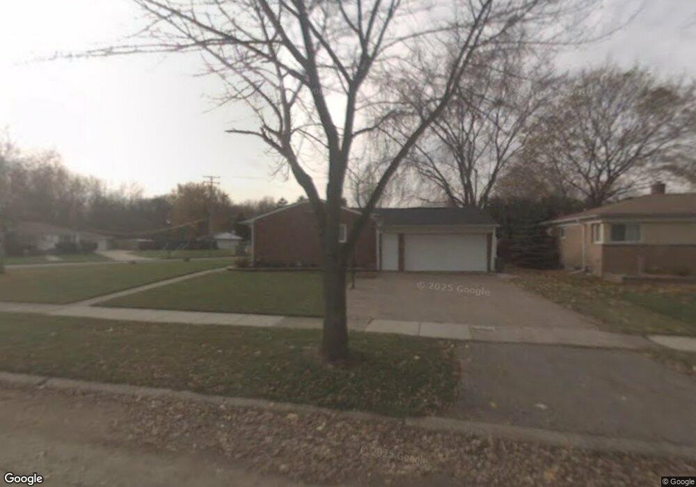
22833 King Dr Clinton Township, MI 48035
Estimated Value: $216,807 - $247,000
3
Beds
1
Bath
975
Sq Ft
$241/Sq Ft
Est. Value
About This Home
This home is located at 22833 King Dr, Clinton Township, MI 48035 and is currently estimated at $234,952, approximately $240 per square foot. 22833 King Dr is a home located in Macomb County with nearby schools including Clintondale High School, Faith Christian School, and St. Thecla Catholic School.
Ownership History
Date
Name
Owned For
Owner Type
Purchase Details
Closed on
Jul 5, 2007
Sold by
Cardillo Josephine M
Bought by
Mistretta Josephine Marie
Current Estimated Value
Purchase Details
Closed on
Nov 14, 2003
Sold by
Laughlin Matthew G and Laughlin Katheryn J
Bought by
Cardillo Antonio V and Cardillo Josephine M
Home Financials for this Owner
Home Financials are based on the most recent Mortgage that was taken out on this home.
Original Mortgage
$113,600
Interest Rate
8.75%
Mortgage Type
Purchase Money Mortgage
Purchase Details
Closed on
Apr 19, 2000
Sold by
Busby Wayne M
Bought by
Laughlin Matthew G
Create a Home Valuation Report for This Property
The Home Valuation Report is an in-depth analysis detailing your home's value as well as a comparison with similar homes in the area
Home Values in the Area
Average Home Value in this Area
Purchase History
| Date | Buyer | Sale Price | Title Company |
|---|---|---|---|
| Mistretta Josephine Marie | -- | None Available | |
| Cardillo Antonio V | $142,000 | Great Lakes Title Of Mi | |
| Laughlin Matthew G | $113,500 | -- |
Source: Public Records
Mortgage History
| Date | Status | Borrower | Loan Amount |
|---|---|---|---|
| Previous Owner | Cardillo Antonio V | $113,600 | |
| Closed | Cardillo Antonio V | $21,300 |
Source: Public Records
Tax History Compared to Growth
Tax History
| Year | Tax Paid | Tax Assessment Tax Assessment Total Assessment is a certain percentage of the fair market value that is determined by local assessors to be the total taxable value of land and additions on the property. | Land | Improvement |
|---|---|---|---|---|
| 2025 | $2,438 | $97,300 | $0 | $0 |
| 2024 | $1,381 | $87,700 | $0 | $0 |
| 2023 | $1,311 | $78,300 | $0 | $0 |
| 2022 | $2,193 | $67,700 | $0 | $0 |
| 2021 | $2,132 | $64,000 | $0 | $0 |
| 2020 | $1,201 | $61,300 | $0 | $0 |
| 2019 | $1,936 | $53,800 | $0 | $0 |
| 2018 | $1,928 | $49,700 | $0 | $0 |
| 2017 | $1,906 | $42,100 | $12,500 | $29,600 |
| 2016 | $1,896 | $42,100 | $0 | $0 |
| 2015 | -- | $37,200 | $0 | $0 |
| 2014 | -- | $35,600 | $0 | $0 |
| 2011 | -- | $49,200 | $24,300 | $24,900 |
Source: Public Records
Map
Nearby Homes
- 23227 Linne St
- 22311 Spitzley St
- 22948 E Schafer St
- 23346 Demley Dr
- 23207 Dale Allen St
- 22252 Dale Allen St
- 22317 E Schafer St
- 22459 Katzman St
- 23571 Demley Dr
- 23528 King Dr
- 23636 Whitley Dr
- 35408 Willis St
- 23614 King Dr
- 22211 Grandy St
- 21903 Elmway St
- 23608 Glenwood St
- 23786 Thornton St
- 21934 S Nunneley Rd
- 23844 Indianwood St
- 22021 15 Mile Rd
- 36231 Nitchun St
- 22815 King Dr
- 36200 Nitchun St
- 36251 Nitchun St
- 36214 Nitchun St
- 22840 King Dr
- 22860 King Dr
- 22929 King Dr
- 36271 Nitchun St
- 36254 Nitchun St
- 36250 N Price Dr
- 22655 E Price Dr
- 22918 King Dr
- 36221 Pamala Dr
- 36203 Pamala Dr
- 36274 Nitchun St
- 36229 N Price Dr
- 36301 Nitchun St
- 36239 Pamala Dr
- 36300 N Price Dr