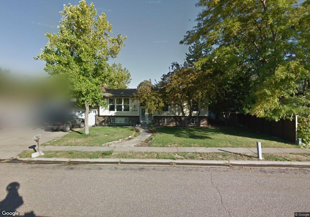
2285 E 1200 N Layton, UT 84040
5
Beds
3
Baths
1,899
Sq Ft
11,326
Sq Ft Lot
About This Home
This home is located at 2285 E 1200 N, Layton, UT 84040. 2285 E 1200 N is a home located in Davis County with nearby schools including East Layton Elementary School, Central Davis Junior High School, and Layton High School.
Create a Home Valuation Report for This Property
The Home Valuation Report is an in-depth analysis detailing your home's value as well as a comparison with similar homes in the area
Home Values in the Area
Average Home Value in this Area
Tax History
| Year | Tax Paid | Tax Assessment Tax Assessment Total Assessment is a certain percentage of the fair market value that is determined by local assessors to be the total taxable value of land and additions on the property. | Land | Improvement |
|---|---|---|---|---|
| 2024 | $2,601 | $275,000 | $154,758 | $120,242 |
| 2023 | $2,393 | $245,300 | $113,115 | $132,184 |
| 2022 | $2,549 | $257,950 | $110,580 | $147,370 |
| 2021 | $2,319 | $350,000 | $168,712 | $181,288 |
| 2020 | $2,051 | $297,000 | $138,287 | $158,713 |
| 2019 | $2,023 | $287,000 | $123,168 | $163,832 |
| 2018 | $1,854 | $264,000 | $97,195 | $166,805 |
| 2016 | $1,610 | $118,250 | $50,882 | $67,368 |
| 2015 | $1,551 | $108,185 | $50,882 | $57,303 |
| 2014 | $1,669 | $118,989 | $50,882 | $68,107 |
| 2013 | -- | $94,319 | $29,198 | $65,121 |
Source: Public Records
Map
Nearby Homes
- 2203 E 1200 N
- 1332 N 2350 E
- 2113 E 1200 N
- 2124 E Cherry Ln
- 1975 E 1425 N
- 2391 Kays Creek Dr
- 2855 E Gentile St Unit 1
- 1843 Hayes Dr
- 1907 N Bridge Ct
- 1752 N Valley View Dr
- 2231 N Valley View Dr
- 1870 N Valley View Dr Unit 201
- 2877 E Gentile St Unit 2
- 2509 E 1900 N
- 2547 E 1900 N
- 1960 N 2150 E
- 717 Woodridge Dr
- 1545 E 975 N
- 1954 N 2600 E
- 378 N Thurston Ln
Your Personal Tour Guide
Ask me questions while you tour the home.