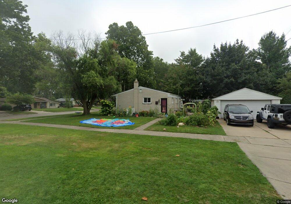
22859 N Brookside Dr Dearborn Heights, MI 48125
Estimated Value: $183,000 - $196,327
3
Beds
2
Baths
999
Sq Ft
$192/Sq Ft
Est. Value
About This Home
This home is located at 22859 N Brookside Dr, Dearborn Heights, MI 48125 and is currently estimated at $191,332, approximately $191 per square foot. 22859 N Brookside Dr is a home located in Wayne County with nearby schools including Polk Elementary School, Bedford School, and Pardee School.
Ownership History
Date
Name
Owned For
Owner Type
Purchase Details
Closed on
Feb 1, 2022
Sold by
Barbara Watkinst
Bought by
Watkins Barbara and Mikalacki James E
Current Estimated Value
Purchase Details
Closed on
Nov 27, 2007
Sold by
Citimortgage Inc
Bought by
Watkins Barbara J
Purchase Details
Closed on
Aug 31, 2006
Sold by
Fountaine Ronald A
Bought by
Citimortgage Inc
Purchase Details
Closed on
Jan 23, 2003
Sold by
Zanger Timothy P and Zanger Amy L
Bought by
Fountaine Ronald A
Purchase Details
Closed on
Jul 5, 1995
Sold by
Greco Arthur L Del
Bought by
Holloway Jon M and Holloway Deborah
Create a Home Valuation Report for This Property
The Home Valuation Report is an in-depth analysis detailing your home's value as well as a comparison with similar homes in the area
Home Values in the Area
Average Home Value in this Area
Purchase History
| Date | Buyer | Sale Price | Title Company |
|---|---|---|---|
| Watkins Barbara | -- | None Listed On Document | |
| Watkins Barbara J | $70,000 | Heritage Title Services Llc | |
| Citimortgage Inc | $119,900 | None Available | |
| Fountaine Ronald A | $135,000 | Metropolitan Title Company | |
| Holloway Jon M | $84,000 | -- |
Source: Public Records
Tax History Compared to Growth
Tax History
| Year | Tax Paid | Tax Assessment Tax Assessment Total Assessment is a certain percentage of the fair market value that is determined by local assessors to be the total taxable value of land and additions on the property. | Land | Improvement |
|---|---|---|---|---|
| 2025 | $1,663 | $87,600 | $0 | $0 |
| 2024 | $1,663 | $84,000 | $0 | $0 |
| 2023 | $1,571 | $74,400 | $0 | $0 |
| 2022 | $2,180 | $66,800 | $0 | $0 |
| 2021 | $2,898 | $62,300 | $0 | $0 |
| 2019 | $2,795 | $49,500 | $0 | $0 |
| 2018 | $1,757 | $43,600 | $0 | $0 |
| 2017 | $1,281 | $41,100 | $0 | $0 |
| 2016 | $2,016 | $39,000 | $0 | $0 |
| 2015 | $3,607 | $36,200 | $0 | $0 |
| 2013 | $3,750 | $38,400 | $0 | $0 |
| 2010 | -- | $42,000 | $0 | $0 |
Source: Public Records
Map
Nearby Homes
- 22453 Pardee Ct
- 000 Hanover St
- 23214 S Brookside Dr
- 4943 Pardee Ave
- 5015 Lincoln Blvd
- 4665 Lincoln Blvd
- 5656 Monroe St
- 4459 Parker St
- 5671 Syracuse St
- 5908 Pine St
- 5614 Katherine St
- 5689 Cornell St
- 4665 Syracuse St
- 4449 Academy St
- 4209 Vassar St
- 5954 Pine St
- 4442 Mckinley St
- 4901 Cornell St
- 4620 Katherine St
- 4456 Monroe St
- 22847 N Brookside Dr
- 22835 N Brookside Dr
- 22883 Brookside Ct
- 22883 Brookside Ct
- 22919 N Brookside Dr
- 22844 S Brookside Dr
- 22895 Brookside Ct
- 22848 N Brookside Dr
- 22862 N Brookside Dr
- 22856 S Brookside Dr
- 22823 N Brookside Dr
- 22907 Brookside Ct
- 22842 N Brookside Dr
- 22874 N Brookside Dr
- 22868 S Brookside Dr
- 22943 N Brookside Dr
- 22928 N Brookside Dr
- 22836 N Brookside Dr
- 22880 S Brookside Dr
- 22940 N Brookside Dr