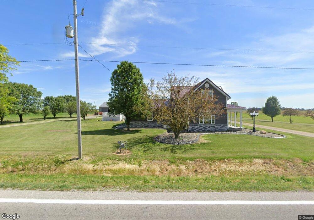
22867 State Route 18 Deshler, OH 43516
Estimated Value: $270,000 - $344,000
5
Beds
2
Baths
2,323
Sq Ft
$137/Sq Ft
Est. Value
About This Home
This home is located at 22867 State Route 18, Deshler, OH 43516 and is currently estimated at $318,667, approximately $137 per square foot. 22867 State Route 18 is a home located in Wood County with nearby schools including McComb Elementary School, McComb Middle School, and Mccomb Local High School.
Ownership History
Date
Name
Owned For
Owner Type
Purchase Details
Closed on
Jan 28, 2021
Sold by
Zernhel Colleen S
Bought by
Zernhel Abby and King Brittany
Current Estimated Value
Purchase Details
Closed on
May 16, 2017
Sold by
Zernhel Colleen S
Bought by
Zernhel Abby and King Brittany
Purchase Details
Closed on
Oct 19, 1983
Bought by
Zernhel Daniel R
Create a Home Valuation Report for This Property
The Home Valuation Report is an in-depth analysis detailing your home's value as well as a comparison with similar homes in the area
Home Values in the Area
Average Home Value in this Area
Purchase History
| Date | Buyer | Sale Price | Title Company |
|---|---|---|---|
| Zernhel Abby | -- | None Available | |
| Zernhel Abby | -- | None Available | |
| Zernhel Daniel R | $16,000 | -- |
Source: Public Records
Tax History Compared to Growth
Tax History
| Year | Tax Paid | Tax Assessment Tax Assessment Total Assessment is a certain percentage of the fair market value that is determined by local assessors to be the total taxable value of land and additions on the property. | Land | Improvement |
|---|---|---|---|---|
| 2024 | $2,951 | $88,795 | $13,265 | $75,530 |
| 2023 | $2,951 | $88,800 | $13,270 | $75,530 |
| 2022 | $2,709 | $71,330 | $10,920 | $60,410 |
| 2021 | $2,830 | $71,330 | $10,920 | $60,410 |
| 2020 | $2,831 | $70,740 | $10,920 | $59,820 |
| 2019 | $2,206 | $55,650 | $10,150 | $45,500 |
| 2018 | $2,142 | $55,650 | $10,150 | $45,500 |
| 2017 | $2,159 | $55,650 | $10,150 | $45,500 |
| 2016 | $1,903 | $53,520 | $7,000 | $46,520 |
| 2015 | $1,088 | $30,070 | $7,000 | $23,070 |
| 2014 | $1,133 | $30,070 | $7,000 | $23,070 |
| 2013 | $570 | $27,340 | $6,370 | $20,970 |
Source: Public Records
Map
Nearby Homes
- 1381 County Road 5
- 1403 County Road D
- 0 N Maple St
- 139 S Lind St
- D273 Co Rd 1
- 429 N Park St
- 126 S Keyser Ave
- 224 S Keyser Ave
- 330 W Elm St
- 320 S Keyser Ave
- 408 W Elm St
- 527 W Maple St
- 114 N Harvest Dr
- 117 Meadow Ln
- 109 N Harvest St
- 106 N Harvest Dr
- 115 Meadow Ln
- 113 N Meadow Ln
- 122 N Harvest St
- 116 Meadow Ln
- 22981 Deshler Rd
- 3010 Custar Rd
- 2999 Custar Rd
- 2997 Custar Rd
- 23371 State Route 18
- 0 Deshler Rd
- 22472 State Route 18
- 3740 Custar Rd
- 3853 Hockenberry Rd
- 22808 Hoytville Rd
- 22604 Hoytville Rd
- 23016 Hoytville Rd
- 22735 Hoytville Rd
- 2945 Milton Rd
- 22025 State Route 18
- 22367 Hoytville Rd
- 22129 Hoytville Rd